Zingel Alp, Engelberg, Obwalden, Switzerlandi
| Regional Level Types | |
|---|---|
| Zingel Alp | Mountain |
| Engelberg | Municipality |
| Obwalden | Canton |
| Switzerland | Country |
This page is currently not sponsored. Click here to sponsor this page.
Latitude & Longitude (WGS84):
46° 50' 11'' North , 8° 21' 38'' East
Latitude & Longitude (decimal):
Type:
Köppen climate type:
Nearest Settlements:
| Place | Population | Distance |
|---|---|---|
| Engelberg | 4,001 (2013) | 3.5km |
| Wolfenschiessen | 2,080 (2013) | 7.9km |
| Kerns | 5,217 (2017) | 9.7km |
| Dallenwil | 1,738 (2013) | 10.0km |
| Sachseln | 4,511 (2013) | 10.2km |
Mindat Locality ID:
191448
Long-form identifier:
mindat:1:2:191448:4
GUID (UUID V4):
fdf7fe21-c572-4f6d-8d61-3631b8d7bd9d
Other/historical names associated with this locality:
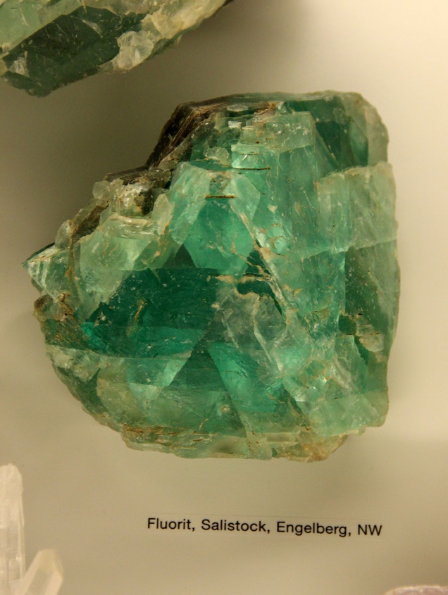
Salistock
Other Languages:
German:
Zingelalp, Engelberg, Kanton Obwalden, Schweiz
Historic fluorite occurrence.
Specimens kept in several museum collections date back to the 19th century; any attempts since to re-locate the deposit were unsuccessful.
Select Mineral List Type
Standard Detailed Gallery Strunz Chemical ElementsDetailed Mineral List:
| ⓘ Fluorite Formula: CaF2 Habit: Octahedrons to 12 cm along the edges Colour: Green |
Gallery:
List of minerals arranged by Strunz 10th Edition classification
| Group 3 - Halides | |||
|---|---|---|---|
| ⓘ | Fluorite | 3.AB.25 | CaF2 |
Other Regions, Features and Areas containing this locality
This page contains all mineral locality references listed on mindat.org. This does not claim to be a complete list. If you know of more minerals from this site, please register so you can add to our database. This locality information is for reference purposes only. You should never attempt to
visit any sites listed in mindat.org without first ensuring that you have the permission of the land and/or mineral rights holders
for access and that you are aware of all safety precautions necessary.


Zingel Alp, Engelberg, Obwalden, Switzerland