GRN grid region: N24W50
A grid 'square' of approximately 160km x 160km, part of the Global Reference Network of 19,833 grid cells covering the Earth.


Northeast Corner:
36 0'0'' N , 84 4'11'' W ( 36,-84.07 )
Southwest Corner:
34 30'0'' N , 85 47'5'' W ( 34.5,-85.785 )
Climate:
Select Mineral List Type
Standard Detailed Gallery Strunz Chemical ElementsCommodity List
This is a list of exploitable or exploited mineral commodities recorded at this locality.Mineral List
101 valid minerals. 2 (TL) - type locality of valid minerals. 1 erroneous literature entry.
Rock Types Recorded
Note: data is currently VERY limited. Please bear with us while we work towards adding this information!
Select Rock List Type
Alphabetical List Tree DiagramLocalities within grid area
- Alabama
- De Kalb County
- Allen Prospect
- Clyde Hulgen Iron Property
- Dek 5 Clay Prospect
- Fort Payne
- J. C. McElroy Prospect
- Jesse Manning Prospect
- L. O. Clark Prospect
- ⭔Ragon Mining Company Battelle Area
- ⭔Suphur Springs Area
- Unnamed Iron (MRDS - 10100503)
- Unnamed Iron (MRDS - 10135484)
- Unnamed Iron Mine (MRDS - 10112330)
- Unnamed Iron Mine (MRDS - 10257727)
- Unnamed Iron Prospect (MRDS - 10112273)
- Unnamed Iron Prospect (MRDS - 10135722)
- Unnamed Iron Prospect (MRDS - 10135816)
- Unnamed Iron Prospect (MRDS - 10135845)
- Unnamed Iron Prospect (MRDS - 10135897)
- Unnamed Iron Prospect (MRDS - 10136197)
- Unnamed Iron Prospect (MRDS - 10136408)
- Unnamed Iron Prospect (MRDS - 10160485)
- Unnamed Iron Prospect (MRDS - 10160675)
- Unnamed Iron Prospect (MRDS - 10184616)
- Unnamed Iron Prospect (MRDS - 10184849)
- Unnamed Iron Prospect (MRDS - 10185171)
- Unnamed Iron Prospect (MRDS - 10185185)
- Unnamed Iron Prospect (MRDS - 10209089)
- Unnamed Iron Prospect (MRDS - 10209100)
- Unnamed Iron Prospect (MRDS - 10209257)
- Unnamed Iron Prospect (MRDS - 10232742)
- Unnamed Iron Prospect (MRDS - 10232958)
- Unnamed Iron Prospect (MRDS - 10233055)
- Unnamed Iron Prospect (MRDS - 10233214)
- Unnamed Iron Prospect (MRDS - 10233411)
- Unnamed Iron Prospect (MRDS - 10255856)
- Unnamed Iron Prospect (MRDS - 10257340)
- Unnamed Iron Prospect (MRDS - 10257951)
- Unnamed Iron Prospect (MRDS - 10281808)
- Unnamed Iron Prospect (MRDS - 10282082)
- Unnamed Iron Prospect (MRDS - 10282371)
- Unnamed Iron Prospects (MRDS - 10209287)
- Unnamed Sulfur - Iron Pyrite Prospect (MRDS - 10209339)
- Woodstock Land & Mineral Mines
- Jackson County
- De Kalb County
- Georgia
- ⭔Catoosa County
- Chattooga County
- ⭔Dade County
- Bibble Mine
- Blake's Mine et al.
- D. Martin's Mine
- Dave L. Brown Quarry
- Halloysite Mine
- Johnson Crook
- Lookout Valley
- New England
- Phoenix Iron & Coal Mines
- Progressive Industries Quarry
- ⭔Rising Fawn Area
- Rising Fawn Area B
- Southern Iron and Steel Company Quarry
- Sutton & Austin Mines
- Trenton
- Unnamed (10083945)
- Unnamed (10100409)
- Unnamed Lot 115; 10th District
- Unnamed Lot 117; 10th District
- Unnamed Lot 251 10th District
- Wills Creek anticline
- Dawson County
- ⭔Fannin County
- Arp Property
- Blue Ridge
- Boardtown Creek
- Bryant Property
- Bryant Prospect
- Chattahoochee National Forest
- Collins Property
- Cutcane Creek
- Deering property
- Dillard & Prince Mine
- Epworth
- Hackney Placer
- Hame String Creek Property
- J. Y. Allen Property
- Jeptha Patterson Prospect
- Kellogg Prospect
- Lebanon School
- Lot 297
- Lots 277; 278; 299; 300; 314
- Margaret Robinson Property
- McCloud Mine
- McKinney Mine
- ⭔McKinney Mine Area
- Mineral Bluff
- Mobile Copper Mine (Shaffer Mine)
- Noontootly Creek
- Owenby Property
- Park Property
- Pisgah Mountain
- Polk Patterson Mine
- Rantze Hill mine
- Rapier Mill Creek Deposit
- Sally Jane Prospect
- Samples Rock Quarry
- Silvey Property
- Union
- W. H. Dodd Property
- Wade Allenis Gold Mine
- Youngstone Creek Property
- ⭔Gilmer County
- A. J. Pinson Property
- Cartecay Iron Property
- Cartecay Mine (Lucky Eight; Craticay Mine - Lucky Eight)
- Cherry Log
- Davis Property
- E. B. Griffin Property
- Ellijay
- Georgia-Tioga Iron Company Mine
- Gilmer County Quarry No. 1
- Gilmer County Quarry No. 2
- Holt Property
- Lacey Property
- Lots 142 & 143
- Marble Bluff (Gartrell property)
- Mine No. 1 (Little Stone Div.)
- Mine Number 2
- Mrs. Will Rolston Property
- T. W. Craigo Property
- Tioga Iron Company Mine
- Tioga Station
- Unknown (10083735)
- Unnamed Marble Mine (10168533)
- W. A. Davis Property
- W. H. Eller Property
- Whitaker Property
- White Path
- White Path Quarry
- Whitestone
- Wishon Talc Mine
- ⭔Gordon County
- Lumpkin County
- ⭔Murray County
- Bramlet Mine and Prospect
- C. C. and J. H. Keith Property
- C. C. Keith Property
- Chatsworth
- Chicken Creek Mine
- Cisco
- Cohutta Talc Mine
- Crandall
- Doogan Mountain
- Doogan Mt. District.
- Eton District-A
- Eton District-B
- Eton Mining District
- F. M. Powell Property
- Farrar Tripoli Prospect
- Fields Prospect
- Fort Mountain Talc Company
- Georgia Talc Mine
- Hammock Prospect
- Hasslers Mill
- Hayes Rock Mine
- Hickey Property Mine-A?
- Holly Creek
- J. F. Love Property
- J. K. Keith Property
- J. W. Coffey Property
- Jessf Jackson Property
- John Johnson Prospect
- Keith Property
- Lafollette Coal and Iron Company Prospect
- Latch Mine
- Lindsey Mine
- Mrs. W. R. Davis Property
- Old Shop Tunnel Talc Mine
- Pickering Mine (King Mine)
- Poteet Property
- Poteet Property (2)
- R. H. O'Neal Property
- Rock Creek Road Prospect (Sandy Gap Prospect)
- Russel Prospect
- Slate Pit
- Southern Talc Company
- Southern Talc Slate Pit
- W. F. Hampton Property
- W. R. Rymer Property
- Pickens County
- Union County
- ⭔Walker County
- Armington Mine (Thurman Bank)
- Boss Tripoli Mine
- Bronco
- ⭔Cassandra Area
- Dave L Brown Quarry
- Dug Gap
- Estelle Mining Company (Kensington Iron And Coal Company Mine; Southern Steel Company)
- General Shale Georgia Pit (Turner Mine)
- Glenn Prospect
- ⭔Hall Ore Bank Area
- Hawkins Mine
- ⭔High Point Area
- ⭔High Point Area (2)
- Horine Development Company Quarry
- J. T. Algoods Property
- Kensington
- Kensington Iron and Coal Company Mine (1)
- Kensington Iron and Coal Company Mine (2)
- Kensington Iron and Coal Company Mine (3)
- Kensington Iron and Coal Company Mine (4)
- Kensington Iron and Coal Company Mine (5)
- Kensington Iron and Coal Company Mine (6)
- Kensington Iron and Coal Company Mine (7)
- Lafayette
- McFarland Mine
- McLamore's Cove Area-A
- McLamore's Cove Area-B
- ⭔Naomi Area
- Patton Quarry
- Road Quarry (1)
- Road Quarry (2)
- Rossville
- Shinbone Ridge-A
- Shinbone Ridge-B
- Shinbone Ridge Area-C
- Southern Steel Company (1)
- Southern Steel Company (2)
- Stoner-Caldwell Property
- Sugar Valley Land Company Mine
- Warrenfel's Mine
- Warthen Prospect
- Wilmer Frye Prospect
- ⭔Whitfield County
- North Carolina
- Cherokee County
- Flaws Farm
- Marble Quarry (MRDS - 10150834)
- Murphy Marble Belt
- Carolina Talc Mine (Kinsey Mine; Bailey Mine; Notla Mine)
- Kinsey Talc Mine
- Mulberry Gap Talc Mine (Davis Mine; Hoffman Mine; Minerals and Metals Talc Mine; Hillyer Mine; Munsford Mine; Old Mill Mine)
- Unnamed Talc Mine (MRDS - 10026132)
- Unnamed Talc Prospect (MRDS - 10026131)
- Unnamed Talc Prospect (MRDS - 10091880)
- Unnamed Talc Prospect (MRDS - 10094999)
- Persimmon Creek meteorite
- T. J. McDonald Prospect
- Valley River Belt
- Cherokee County
- Tennessee
- Bledsoe County
- Blount County
- Blount County Hwy. Dept. Quarry (Blount County Highway Department; Blount County Highway Dept. Quarry)
- East Tennessee Marble Mining District
- Buzzard's Roost Quarry
- Carl Reed Quarry
- Craig Quarry
- Crisp Quarry
- Endsley Quarry (Endsley Marble Company)
- Evans Quarry No. 16
- Evans Quarry No. 17
- Evans Quarry No. 18
- French Pink Quarry (Gray Knox Marble Company)
- John J Craig Quarry No. 19
- John J Craig Quarry No. 20
- Knoxville Quarry Company Quarry No. 22 (Funk Quarry)
- Knoxville Quarry Company Quarry No. 23 (Funk Quarry)
- Knoxville Quarry Company Quarry No. 24 (Funk Quarry)
- Lee Marble Quarry (Finger Marble Quarry)
- Marble Quarry
- Marmor Marble Quarry
- Marthens Quarry
- McMullen Quarry No. 7
- McMullen Quarry No. 8
- McMullen Quarry No. 9
- Quaker Marble Company Quarry No. 13
- Quaker Marble Company Quarry No. 14
- Tennessee Producers Company Prospect
- Tennessee Producers Company Quarry
- Friendsville
- Friendsville Prospect (Griffitts Prospect)
- Greenback
- J. F. Chapman Barite Prospect
- John J Craig Quarry No. 21
- Jones Prospect
- Louisville
- McReynolds Barite Prospect
- Bradley County
- Black Fox Quarry
- Bradley County Highway Dept. Quarry (County Quarry/Pit Number 366)
- Bradley Limestone Quarry (Cleveland Quarry; Dalton Rock Products Company Quarry)
- Brown Prospect
- Charleston Mining District
- Cleveland
- Gee Prospect
- Griffen Barite Mine (Cleveland Barite Mine)
- Hambright Lead Mine
- Hannah Prospect
- Hardwick Lead Mine (Dollie D)
- Home Cantrell Property
- J. N. Havens Property
- Lord Mine (Lord manganese mine)
- M. V. Jones Prospect
- Red Hills Mining District
- Sloan Prospect
- Smallwood Prospect
- Snyder Prospect
- Welch Quarry (Bradley Limestone Company; Inc.)
- White Oak Mountain
- Wolf Prospect
- Campbell County
- Cannon County
- Carter County
- Cumberland County
- Brown Quarry
- Burkhart Quarry (Burkhart Quarry and Supplies; Inc.)
- Crab Orchard District
- Crab Orchard meteorite
- Crossville Limestone Company Pit No. 48
- Crossville Mine
- Cumberland County Highway Department Quarry (Cumberland County Highway Dept.; Crab Orchard Quarry)
- Davis Mine (Kenneth Davis Stone Company)
- Franklin Mine (Franklin Limestone Company; Inc.; Crab Orchard Mine)
- Grassy Cove Cave
- Highway 127 Quarry
- Lantana Building Stone Quarry
- Peck Quarry
- Pit No. 1 (MRDS - 10275421)
- Potter Sandstone Quarry
- Taylor Pit (Taylor Brothers Sand Company)
- Turner Brothers Quarry (Turner Brothers Stone Company; Inc.)
- DeKalb County
- Drill Hole For Uranium; LC-102 Occurrence
- Drill Hole For Uranium; LC-105a Occurrence
- Drill Hole For Uranium; YB-16 Occurrence
- Drill Hole For Uranium; YB-17 Occurrence
- Drill Hole For Uranium; YB-18 Occurrence
- Drill Hole For Uranium; YB-19 Occurrence
- Drill Hole For Uranium; YB-21 Occurrence
- Drill Hole For Uranium; YB-37 Occurrence
- Drill Hole For Uranium; YB-38 Occurrence
- Drill Hole For Uranium; YB-40 Occurrence
- Outcrop Sample For Uranium Occurrence (MRDS - 10026189)
- Outcrop Sample For Uranium Occurrence (MRDS - 10026191)
- Outcrop Sample For Uranium Occurrence (MRDS - 10026222)
- Outcrop Sample For Uranium Occurrence (MRDS - 10026223)
- Outcrop Sample For Uranium Occurrence (MRDS - 10088520)
- Outcrop Sample For Uranium Occurrence (MRDS - 10088522)
- Unnamed Uranium Prospect (MRDS - 10026188)
- Unnamed Uranium Prospect (MRDS - 10091893)
- Tennessee
- DeKalb County
- Young Bend Mining District
- Drill Hole For Uranium; YB-1 Occurrence
- Drill Hole For Uranium; YB-10 Occurrence
- Drill Hole For Uranium; YB-11 Occurrence
- Drill Hole For Uranium; YB-12 Occurrence
- Drill Hole For Uranium; YB-13 Occurrence
- Drill Hole For Uranium; YB-14 Occurrence
- Drill Hole For Uranium; YB-15 Occurrence
- Drill Hole For Uranium; YB-2 Occurrence
- Drill Hole For Uranium; YB-3 Occurrence
- Drill Hole For Uranium; YB-4 Occurrence
- Drill Hole For Uranium; YB-6 Occurrence
- Drill Hole For Uranium; YB-7 Occurrence
- Drill Hole For Uranium; YB-9 Occurrence
- Young Bend Mining District
- Fentress County
- Greene County
- Grundy County
- Hamblen County
- Hamilton County
- Bennett Mine No. 1
- Bennett No. 2 prospect
- Brannan Mine (Brannan - Montague Mine)
- Chattanooga
- Chattanooga Cave (Lookout Cave)
- Chattanooga Mine (Alton Park Tract)
- Chattanooga Quarry (Division; Vulcan Materials Company; Chantanooga)
- Chattanooga Tenn. Bauxite (Missionary Ridge & Summit Knobs)
- Clay Field
- Fred Nixson Prospect
- Hill City-Moccasin Bend
- Hixson Mine
- Hornville Mine
- McCallie tunnel prospect
- Montague Mine
- Perry Mine (Isabella Stewart Mine)
- Shofner Barite Prospect
- Signal Mountain Clay Pit
- Smith prospect
- Tiftonia Plant & Quarry Pit No. 395 (The Stone Man; Inc.; Tiftonia Quarry)
- ⭔White Oak Mt. Area
- ⭔White Oak Mt. Area (2)
- Wilcox prospect
- Willie Moore prospect
- Hawkins County
- Henderson County
- Hickman County
- Knox County
- Chert Pit (MRDS - 10250988)
- Dixie Lee Quarry (Vulcan Materials Company; Midsouth Div.)
- Knox County Caves
- Limestone Quarry (MRDS - 10129129)
- Limestone Quarry (MRDS - 10129157)
- Limestone Quarry (MRDS - 10129174)
- Limestone Quarry (MRDS - 10178753)
- Limestone Quarry (MRDS - 10178846)
- Limestone Quarry (MRDS - 10184358)
- Limestone Quarry (MRDS - 10202464)
- Limestone Quarry (MRDS - 10251542)
- Quarry (MRDS - 10129582)
- Quarry (MRDS - 10153933)
- Quarry (MRDS - 10226509)
- Quarry (MRDS - 10226642)
- Quarry (MRDS - 10276092)
- Lawrence County
- Loudon County
- Alexander Quarry
- Andies Quarry
- Cates Prospect
- Crush Mine
- Fork Creek Knobs
- General Portland Cement Company Mine
- Greenback Rock Quarry Inc.
- Greenway Quarry (Loundon County Road Commission)
- Heaton Barite Prospect
- Locust Bluff Quarry
- Loudon County Plant No. 547
- Loudon Quarry (Loudon County Road Commission)
- Old Hickory Brick Number 1 Pit
- Smith Mine
- Sweetwater Barite Mining District-Central Belt
- Sweetwater Barite Mining District-Western Belt
- Sweetwater Barite Mining District
- Unitia Barite and Lead Prospect
- Marion County
- Bennetts Lake Quarry
- Jasper Job
- Marion County Cave
- Marion Quarry (Marion Quarry/Ketchall Quarry; Vulcan Materials Company; Chantnga Div.)
- Nicajack Cave (Nicojack Cave)
- Nickajack Plant
- Nixon No. 1 Mine (Inman Mines)
- Nixon No. 2 Mine (Inman Mines)
- Patten Entries (Inman Mines)
- Richard City Quarry (Penn-Dixie Cement Corporation)
- Signal Mountain Plant No. 521 (Vulcan Materials Company; Midsouth Div.; Signal Mountain Pit)
- South Pittsburg Quarry
- Tennessee Coal & Iron No. 1 Mine (Inman Mines)
- Tennessee Coal & Iron No. 2 Mine (Inman Mines)
- Tennessee Coal & Iron No. 3 Mine (Inman Mines)
- Thomas and Associates
- McMinn County
- Athens
- Athens Quarry (McMinn County Quarry)
- C. Cate Bank R.G. Patty Bank
- ⭔Calhoun Area
- Charleston Mining District
- Floyd Webb Stone Company Quarry
- Goodsprings-Bethel Iron Mine
- McSpadden Mine
- Mine No. 1
- Nonaburg Iron Mine (1869; Hills Bank Safford; Pit Number 332)
- ⭔Oostanaula Creek Area
- Pierce Prospect
- Reed and Webb Prospects
- Sweetwater Barite Mining District-Central Belt
- Anderson Mine
- Baer Mine
- C. C. Stephens Mine
- Carter Mine
- Dupont Mine (McPhail Mine)
- Garrison Mine
- Hansard Prospect
- Kyle Mine
- Linkenfields Mine
- Mantooth Mine
- McManus Mine
- Mud Creek mine
- New Hope mine
- Richardson Mine
- Riddle Mine
- Smith mine
- Unnamed Barite Mine (MRDS - 10025876)
- Wattenberger Mine (Dillinger Barite Mine)
- Webb Mine
- Wilson Mine
- Sweetwater Barite Mining District-Eastern Belt
- Sweetwater Barite Mining District-Western Belt
- Benton Barite Mine
- Gilman Barite Mine
- Godsey Mine A
- Godsey Mine B
- Green Barite Mines
- Guffy Barite Mine
- H. J. Moore Barite Mine (Wattenberger Mine)
- Holt Mine
- J. M. Godsey Mines
- Jones Mine
- Kyker Mine
- L. A. Wood Barite Mine (Calhoun Barite Mine)
- Potter Barite Mines
- Richesin Barite Mine
- Shelton Barite Mine
- Unnamed Barite Mine (MRDS - 10025861)
- Unnamed Barite Mine (MRDS - 10102286)
- Unnamed Barite Prospect (MRDS - 10025852)
- W. L. Baugh Barite Mines
- U. S. Flourspar Mine
- Unnamed Iron Prospect (MRDS - 10305685)
- Webb Stone Company Quarry Pit No. 332 (Webb Stone Co; Div Dalton Rock Prod; Webb Stone Company Quarry; Pit Number 332)
- Meigs County
- Monroe County
- Ballard Exploration Area Prospect
- Beaty Prospect
- Buck Miller Mine
- Carter Mine
- Coker Creek Mining District
- Alvin Branch Placer Workings
- Annette Placer Workings
- Big Branch Placer Workings
- Big Surface Workings
- Blackjack Ridge Adit Occurrence
- Boyd Mine
- Boyd Placer Workings
- Brannon Prospect
- Calf Yoke Adit Occurrence (Hotwater Workings)
- Calico Trenches Occurrence (Calico Veins)
- Cindy Hole occurrence
- Closman Workings Occurrence (Northeast & Southwest)
- Coker Creek
- Cooper Mine
- Duckett Ridge Adit Occurrence
- El Tigre Mine
- El Tigre Placer
- Gear Placer Workings
- Hollinghead Field Placer Workings (Peels Branch Workings)
- Hotwater Branch Placer Workings
- Johnson Branch Placer Workings
- Johnson Prospect Pit (Johnson adit)
- Johnson Shaft Occurrence
- Lenderman Adit Occurrence
- Lonsdale Adit
- Lonsdale Tunnel
- Lost River Mine (Big Branch Workings; Miles Witt)
- Lower Johnson Adit Occurrence
- Lower Magill Prospect
- Lower Peck Adit Occurrence
- McAllister Branch Placer Workings
- Mill Branch Placer Workings
- Paris Adit Occurrence
- Peck Prospect
- Prospect Pit (MRDS - 10025284)
- Pumphouse Workings Occurrence
- Roberts Branch Adit
- Round Top
- Sixmile Creek Adit Occurrence
- Stripped Area Occurrence (MRDS - 10025358)
- Unnamed Adit Occurrence (MRDS - 10025353)
- Unnamed Adit Occurrence (MRDS - 10025356)
- Unnamed Adit Occurrence (MRDS - 10025360)
- Unnamed Adit Occurrence (MRDS - 10025363)
- Unnamed Adit Occurrence (MRDS - 10025367)
- Unnamed Adit Occurrence (MRDS - 10025370)
- Unnamed Adit Occurrence (MRDS - 10025371)
- Unnamed Adit Occurrence (MRDS - 10025373)
- Unnamed Adit Occurrence (MRDS - 10025384)
- Unnamed Adit Occurrence (MRDS - 10091847)
- Unnamed Adit Occurrence (MRDS - 10091853)
- Unnamed Adit Occurrence (MRDS - 10091857)
- Unnamed Adit Occurrence (MRDS - 10091863)
- Unnamed Adits Occurrence (MRDS - 10025359)
- Unnamed Gold Prospect (MRDS - 10025287)
- Unnamed Gold Prospect (MRDS - 10025288)
- Unnamed Gold Prospect (MRDS - 10025294)
- Unnamed Gold Prospect (MRDS - 10025309)
- Unnamed Gold Prospect (MRDS - 10025362)
- Unnamed Gold Prospect (MRDS - 10025366)
- Unnamed Gold Prospect (MRDS - 10025380)
- Unnamed Gold Prospect (MRDS - 10025382)
- Unnamed Gold Prospect (MRDS - 10025383)
- Unnamed Gold Prospect (MRDS - 10025387)
- Unnamed Gold Prospect (MRDS - 10091845)
- Unnamed Gold Prospect (MRDS - 10091855)
- Unnamed Gold Prospect (MRDS - 10091858)
- Unnamed Gold Prospect (MRDS - 10091859)
- Unnamed Gold Prospect (MRDS - 10091860)
- Unnamed Gold Prospect (MRDS - 10091861)
- Unnamed Gold Prospect (MRDS - 10091862)
- Unnamed Gold Prospects (MRDS - 10091846)
- Unnamed Pit and Shaft (MRDS - 10025295)
- Unnamed Prospect Pit (MRDS - 10025299)
- Unnamed Prospect Pit (MRDS - 10025300)
- Unnamed Prospect Pit (MRDS - 10025308)
- Unnamed Prospect Pit (MRDS - 10025350)
- Unnamed Prospect Pit (MRDS - 10025354)
- Unnamed Prospect Pit (MRDS - 10025355)
- Unnamed Prospect Pit (MRDS - 10025364)
- Unnamed Prospect Pit (MRDS - 10025368)
- Unnamed Prospect Pit (MRDS - 10025369)
- Unnamed Prospect Pit (MRDS - 10091851)
- Unnamed Prospect Pit (MRDS - 10091852)
- Unnamed Prospect Pit (MRDS - 10091856)
- Unnamed Prospect Pit (MRDS - 10098188)
- Unnamed Prospect Pits (MRDS - 10025297)
- Unnamed Prospect Pits (MRDS - 10025298)
- Unnamed Prospect Pits (MRDS - 10025301)
- Unnamed Prospect Pits (MRDS - 10025307)
- Unnamed Prospect Pits (MRDS - 10025361)
- Unnamed Prospect Pits (MRDS - 10091844)
- Unnamed Prospect Trench (MRDS - 10025310)
- Unnamed Shaft Occurrence (MRDS - 10025372)
- Upper Johnson Adit Occurrence
- Upper Magill Prospect
- Upper Peck Adit Occurrence
- Whippoorwill Branch Placer Workings
- Craighead Quarry
- Donnelly Bank
- Eve Mills Prospect
- Ewing Mine
- Fork Creek Knobs
- Fork Creek Prospect
- G. A. Graves Prospect
- Hale Bank (Bill Coppinger Bank)
- Holt Mine
- Latrobe Bank (Queen Bank; Red Hill Bank)
- Linderman Iron Mine
- Madisonville
- Mil Sick Knobs Cave
- Millsap Adit Occurrence
- Monroe County Caves
- Mt. Vernon Quarry (Craighead Limestone Company)
- Nelson Cave
- S. L. Williams Prospect
- Stoner Mine
- Sweetwater Barite Mining District-Central Belt
- Sweetwater Barite Mining District-Eastern Belt
- Barnes Mine
- Beverly Wood Barite Mine
- Blevins Mine
- C. C. Stephens Mine
- Dickey Prospect
- Dixon Mine
- Dunsmore Mine
- F. Thompson Mine
- Forkner Mine
- Goddard Barite Mines
- Gutherie-Jones Mine (Gernt Mine)
- Harmon Mine
- Heiskill Mine
- Howard Mine
- Howard Mine B
- Howell Mine
- Hudson Mine (Bertha Mine)
- J. L. Camp Barite Mine (No. 2)
- Jones Mine
- Kyle Mine (J. J. Kile Mine)
- Kyle Mine B
- L. A. Wood Mine
- L. G. Camp Mine
- L. Thompson Mine (Clyde Mine; Clyne Mine)
- McDonald Prospect
- McGuire Mine (North Vida Mine)
- Monroe (Krebs Mine)
- National Barium Mine
- Notchy Creek Barite Mine
- Preston Prospect
- Roy Mine (Doherty Mine)
- South Vida Mine
- Sweetwater Mine
- W. Harrison Mine - East
- Waltenberger Mine
- Watson Barite Mine (No. 3)
- Sweetwater Barite Mining District
- Tellico Plains
- Wilson Iron Mine (Rocky Springs Iron Mine)
- Polk County
- ⭔Bean Mt. Area
- Burra Burra Mine (Tennessee Copper Company; Copperhill Operations)
- Calloway Mine
- Central Services
- Cherokee Open Pit
- Coker Creek
- Copperhill
- Copperhill (Isabella; McCays; McKay)
- D & S Rock; Inc. Pit No. 413
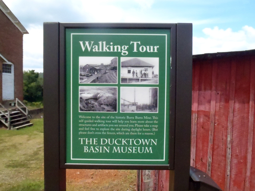
- Ducktown
- East Tennessee Mine (Ducktown Sulphur; Copper & Iron Company)
- Farner
- Gee Creek Prospect
- Gee Prospect
- Hiwassee River
- Isabella
- London Mine (McPherson Mine; Tennessee Copper Company)
- Mary Mine (Mary-Polk County Ore Body; Cities Service Company)
- Meek Prospect (United States Prospect)
- Mill Creek Valley Staurolite locality
- Ocoee mine
- Old Tennessee Mine (School Property Mine)
- Parkwood
- Paul Campbell Isabella Pit No. 393
- Polk County Mine (Mary-Polk County ore body; Tennessee Copper Company; Old Polk County; Cities Service Company)
- ⭔Starr Mt. Area
- Unnamed Iron Prospect (MRDS - 10275595)
- Wetmore Iron Prospect
- Rhea County
- Roane County
- A. B. Long Quarries
- Area-B Chamberlain-Barnardsville deposit
- Emory Gap Plant No. 522
- Euchee
- ⭔Glen Alice Area
- ⭔Harriman Area
- Kingston Saltpeter Cave
- Lambert Brothers Quarry (Rockwood Slag Products Company)
- North Chamberlain-Barnardville Deposit
- ⭔Rockwood-Emory Gap Area
- South Chamberlain-Barnardville Deposit
- Swan Pond Quarry (A. B. Long Quarries; Inc.)
- Sweetwater Barite Mining District-Western Belt
- Unnamed Barite Occurrence (MRDS - 10091868)
- Webster Quarry
- Robertson County
- Sequatchie County
- Sevier County
- Unicoi County
- Van Buren County
- Warren County
- Elkins Estate Celestite Prospect (Ben Lomond Mountain Prospect)
- Limestone Quarry (MRDS - 10251167)
- Limestone Quarry (MRDS - 10251335)
- Limestone Quarry (MRDS - 10276087)
- McMinnville Quarry
- McMinnville Stone Company Quarry
- Outcrop Sample For Uranium Occurrence (MRDS - 10026221)
- Shellford
- Solomon Saltpeter cave
- Steppsville
- Warren Limestone Company Quarry
- Wayne County
- White County
- Braeburn mine
- Carola shaft
- Cave Hill saltpeter pits
- Clifty mines
- Gum Spring Mountain
- M.C Dibrell and County Caves
- Ravenscroft mine
- Sparta quarry (Sparta limestone quarry)
- Walker Mountain saltpeter cave
- Weinman Quarry (Thompson-Weinman and Company)
- White County Quarry (White County Highway Department)
- Williamson County
- DeKalb County


Coker Creek, Coker Creek Mining District, Monroe County, Tennessee, USA