GRN grid region: N11E82
A grid 'square' of approximately 160km x 160km, part of the Global Reference Network of 19,833 grid cells covering the Earth.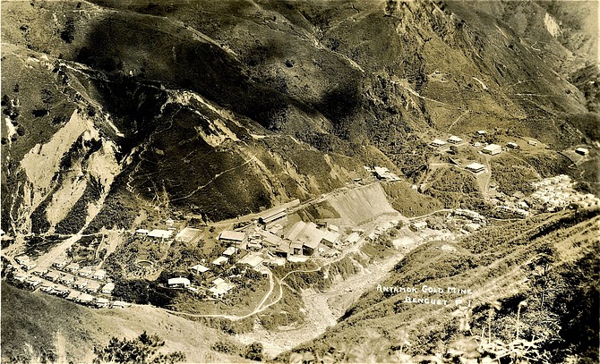


Northeast Corner:
16 30'0'' N , 121 20'34'' E ( 16.5,121.343 )
Southwest Corner:
15 0'0'' N , 119 51'46'' E ( 15,119.863 )
Select Mineral List Type
Standard Detailed Gallery Strunz Chemical ElementsCommodity List
This is a list of exploitable or exploited mineral commodities recorded at this locality.Mineral List
82 valid minerals.
Rock Types Recorded
Note: data is currently VERY limited. Please bear with us while we work towards adding this information!
Select Rock List Type
Alphabetical List Tree DiagramLocalities within grid area
- Luzon
- Cagayan Valley Region
- Nueva Vizcaya Province
- Quirino Province
- ⭔Central Luzon Region
- Cordillera Administrative Region
- Benguet Province
- Cagayan Valley Region
- Luzon
- Cordillera Administrative Region
- Benguet Province
- Baguio
- Bokod
- Itagon
- Itogon
- Tuba
- Benguet Province
- Ilocos Region
- ⭔Pangasinan Province
- Barlo Mine
- Mangatarem
- Subol Mine
- ⭔Pangasinan Province
- Cordillera Administrative Region


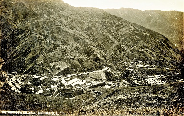
Antamok Mine, Itogon, Benguet Province, Cordillera Administrative Region, Luzon, Philippines