| Locality | Latitude | Longitude | Distance | Bearing |
|---|
| Railway prospect, Deepwater, Gough Co., New South Wales, Australia | 29° 27' 56" S | 151° 50' 12" E | 1.5km (0.9 miles) | |
| Deepwater, Gough Co., New South Wales, Australia | 29° 25' 54" S | 151° 51' 3" E | 5.0km (3.1 miles) | |
| Reid & Sherratts shaft, Deepwater, Gough Co., New South Wales, Australia | 29° 24' 47" S | 151° 47' 39" E | 6.7km (4.2 miles) | |
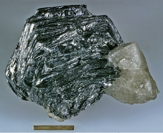
| Allies Mine (Allies Molybdenite and Bismuth Mines; Allies Molybdenite; Allies and Manbundi Mine), Deepwater, Gough Co., New South Wales, Australia | 29° 29' 26" S | 151° 53' 53" E | 7.8km (4.8 miles) | |
| Allies Mo South (Allies Molbdenum South Mine), Deepwater, Gough Co., New South Wales, Australia | 29° 29' 38" S | 151° 53' 52" E | 7.9km (4.9 miles) | |
| Bow Creek Mine, Deepwater, Gough Co., New South Wales, Australia | 29° 28' 27" S | 151° 54' 37" E | 8.6km (5.4 miles) | |
| Cam Creek, Emmaville, Gough Co., New South Wales, Australia | 29° 30' 38" S | 151° 44' 47" E | 8.6km (5.4 miles) | |
| Carneys Hill (Mount Carney), Deepwater, Gough Co., New South Wales, Australia | 29° 24' 7" S | 151° 46' 28" E | 8.7km (5.4 miles) | |
| Bow Creek extended, Deepwater, Gough Co., New South Wales, Australia | 29° 28' 17" S | 151° 54' 42" E | 8.8km (5.4 miles) | |
| Dundee quarry, Dundee, Gough Co., New South Wales, Australia | 29° 33' 11" S | 151° 50' 41" E | 9.6km (6.0 miles) | |
| Davy & Co prospect, Bald Nob, Gough Co., New South Wales, Australia | 29° 29' 32" S | 151° 55' 23" E | 10.2km (6.3 miles) | |
| Rock Abbey molybdenite (Rock Abbey molybdenite deposit), Deepwater, Gough Co., New South Wales, Australia | 29° 28' 21" S | 151° 55' 42" E | 10.4km (6.4 miles) | |
| Kilmaurs alluvials, Tent Hill, Gough Co., New South Wales, Australia | 29° 24' 45" S | 151° 44' 1" E | 10.5km (6.6 miles) | |
| Severn River Sapphires, Dundee, Gough Co., New South Wales, Australia | 29° 33' 42" S | 151° 51' 6" E | 10.7km (6.7 miles) | |
| Dundee, Gough Co., New South Wales, Australia | 29° 33' 54" S | 151° 51' 3" E | 11.1km (6.9 miles) | |
| Rangers Valley lead, Emmaville, Gough Co., New South Wales, Australia | 29° 29' 2" S | 151° 42' 5" E | 11.7km (7.3 miles) | |
| Castle Rag Silver Mine, Stannum district, Clive Co., New South Wales, Australia | 29° 21' 38" S | 151° 49' 49" E | 12.1km (7.5 miles) | |
| Wycliffe deposit, Emmaville, Gough Co., New South Wales, Australia | 29° 27' 38" S | 151° 41' 44" E | 12.2km (7.6 miles) | |
| Castle Hill copper, Stannum district, Clive Co., New South Wales, Australia | 29° 21' 34" S | 151° 50' 28" E | 12.3km (7.6 miles) | |
| Black Sand Gully, Bald Nob, Gough Co., New South Wales, Australia | 29° 27' 52" S | 151° 56' 56" E | 12.3km (7.7 miles) | |
| McDonalds shaft, Deepwater district, Clive Co., New South Wales, Australia | 29° 21' 47" S | 151° 51' 47" E | 12.4km (7.7 miles) | |
| Deepwater Sugarloaf, Deepwater, Gough Co., New South Wales, Australia | 29° 27' 6" S | 151° 56' 53" E | 12.4km (7.7 miles) | |
| Glen Leigh alluvials, Gough Co., New South Wales, Australia | 29° 24' 53" S | 151° 42' 32" E | 12.4km (7.7 miles) | |
| Gilligans prospect, Stannum district, Clive Co., New South Wales, Australia | 29° 21' 23" S | 151° 49' 45" E | 12.5km (7.8 miles) | |
| Watt & Walkers deposit, Stannum district, Clive Co., New South Wales, Australia | 29° 21' 21" S | 151° 49' 50" E | 12.6km (7.8 miles) | |
| Deepwater Sugarloaf west, Deepwater, Gough Co., New South Wales, Australia | 29° 27' 6" S | 151° 57' 5" E | 12.7km (7.9 miles) | |
| Bathursts deposit, Stannum district, Clive Co., New South Wales, Australia | 29° 21' 11" S | 151° 49' 45" E | 12.9km (8.0 miles) | |
| Deepwater Sugarloaf east, Deepwater, Gough Co., New South Wales, Australia | 29° 27' 3" S | 151° 57' 11" E | 12.9km (8.0 miles) | |
| McDonalds, Deepwater, Gough Co., New South Wales, Australia | 29° 29' 9" S | 151° 57' 15" E | 13.0km (8.1 miles) | |
| Southside Hil deposit, Stannum district, Clive Co., New South Wales, Australia | 29° 21' 6" S | 151° 49' 53" E | 13.0km (8.1 miles) | |
Minerals recorded nearby (within 13.0 km)
Rock types recorded nearby (within 13.0 km)
Entries shown in red are rocks recorded for this region.


Allies Mine, Deepwater, Gough Co., New South Wales, Australia