| Locality | Latitude | Longitude | Distance | Bearing |
|---|
| Huta Łabędy, Gliwice, Silesian Voivodeship, Poland | 50° 21' 6" N | 18° 36' 40" E | 7.6km (4.7 miles) | |
| Knurów Mine, Knurów, Gliwice County, Silesian Voivodeship, Poland | 50° 13' 19" N | 18° 40' 17" E | 8.4km (5.2 miles) | |
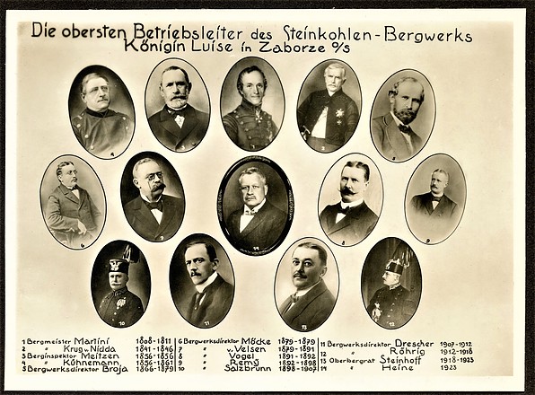
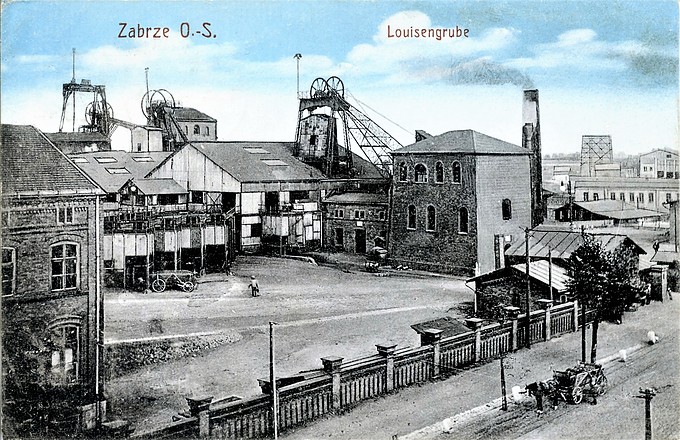
| Królowa Luiza mine (Königin Luise Grube), Zabrze, Silesian Voivodeship, Poland | 50° 17' 47" N | 18° 48' 25" E | 9.3km (5.8 miles) | |
| KWK Zabrze-Bielszowice coal mine, Zabrze, Silesian Voivodeship, Poland | 50° 17' 28" N | 18° 49' 13" E | 10.2km (6.4 miles) | |
| Zabrze-Biskupice coal dump, Zabrze, Silesian Voivodeship, Poland | 50° 18' 57" N | 18° 49' 12" E | 10.4km (6.5 miles) | |
| Szczygłowice Mine, Knurów, Gliwice County, Silesian Voivodeship, Poland | 50° 11' 8" N | 18° 38' 13" E | 12.7km (7.9 miles) | |
| Hugo smelter slag locality, Ruda Śląska, Silesian Voivodeship, Poland | 50° 15' 59" N | 18° 52' 7" E | 14.1km (8.7 miles) | |
| Bobrek heap, Bobrek, Bytom, Silesian Voivodeship, Poland | 50° 20' 9" N | 18° 52' 4" E | 14.2km (8.8 miles) | |
| Budryk coal mine, Gmina Ornontowice, Mikołów County, Silesian Voivodeship, Poland | 50° 10' 29" N | 18° 45' 17" E | 14.7km (9.2 miles) | |
| Dębieńsko Mine heap, Gmina Czerwionka-Leszczyny, Rybnik County, Silesian Voivodeship, Poland | 50° 9' 37" N | 18° 40' 56" E | 15.2km (9.5 miles) | |
| Zinc smelter slag locality, Świętochłowice, Silesian Voivodeship, Poland | 50° 19' 1" N | 18° 54' 19" E | 16.4km (10.2 miles) | |
| Sztolnia Głęboka Fryderyka, Friedrich Mine, Tarnowskie Góry, Tarnowskie Góry County, Silesian Voivodeship, Poland | 50° 25' 45" N | 18° 46' 55" E | 16.5km (10.2 miles) | |
| KWK Śląsk, Chropaczów, Świętochłowice, Silesian Voivodeship, Poland | 50° 18' 56" N | 18° 54' 28" E | 16.5km (10.3 miles) | |
| Neue Viktoria mine, Stroszek-Dąbrowa Miejska, Bytom, Silesian Voivodeship, Poland | 50° 22' 1" N | 18° 53' 5" E | 16.7km (10.4 miles) | |
| Sztolnia Czarnego Pstrąga, Sztolnia Głęboka Fryderyka, Friedrich Mine, Tarnowskie Góry, Tarnowskie Góry County, Silesian Voivodeship, Poland | 50° 25' 36" N | 18° 48' 24" E | 17.1km (10.6 miles) | |
| Bytom Mine, Stroszek-Dąbrowa Miejska, Bytom, Silesian Voivodeship, Poland | 50° 23' 2" N | 18° 52' 46" E | 17.3km (10.8 miles) | |
| "Blachówka" dolomite quarry, Sucha Góra, Bytom, Silesian Voivodeship, Poland | 50° 24' 16" N | 18° 51' 19" E | 17.4km (10.8 miles) | |
| Nowy Dwór Mine, Stroszek-Dąbrowa Miejska, Bytom, Silesian Voivodeship, Poland | 50° 22' 12" N | 18° 54' 12" E | 18.0km (11.2 miles) | |
| Hałda popłuczkowa, Friedrich Mine, Tarnowskie Góry, Tarnowskie Góry County, Silesian Voivodeship, Poland | 50° 24' 56" N | 18° 51' 16" E | 18.2km (11.3 miles) | |
| Szyb Żmija (Viper shaft), Zabytkowa Kopalnia Srebra, Tarnowskie Góry, Tarnowskie Góry County, Silesian Voivodeship, Poland | 50° 25' 30" N | 18° 50' 43" E | 18.6km (11.5 miles) | |
| "Bobrowniki" Dolomite Mine, Tarnowskie Góry, Tarnowskie Góry County, Silesian Voivodeship, Poland | 50° 24' 54" N | 18° 51' 47" E | 18.6km (11.6 miles) | |
| Zabytkowa Kopalnia Srebra, Tarnowskie Góry, Tarnowskie Góry County, Silesian Voivodeship, Poland | 50° 25' 31" N | 18° 50' 57" E | 18.8km (11.7 miles) | |
| Szyb Anioł (Angel shaft), Zabytkowa Kopalnia Srebra, Tarnowskie Góry, Tarnowskie Góry County, Silesian Voivodeship, Poland | 50° 25' 32" N | 18° 50' 59" E | 18.8km (11.7 miles) | |
| Friedrich Mine, Tarnowskie Góry, Tarnowskie Góry County, Silesian Voivodeship, Poland | 50° 25' 34" N | 18° 51' 33" E | 19.3km (12.0 miles) | |
| Fiedlersglück mine, Śródmieście, Bytom, Silesian Voivodeship, Poland | 50° 21' 39" N | 18° 55' 53" E | 19.4km (12.1 miles) | |
| Kościuszko smelter heap, Chorzów II, Chorzów, Silesian Voivodeship, Poland | 50° 18' 39" N | 18° 57' 26" E | 20.0km (12.4 miles) | |
| Deutsch Blei-Scharley/Marchlewski - Nowy Orzeł Biały mine, Rozbark, Bytom, Silesian Voivodeship, Poland | 50° 20' 22" N | 18° 57' 11" E | 20.2km (12.5 miles) | |
| König mine, Centrum, Chorzów, Silesian Voivodeship, Poland | 50° 17' 56" N | 18° 58' 1" E | 20.6km (12.8 miles) | |
| Kleofas coal mine, Załęże, Katowice, Silesian Voivodeship, Poland | 50° 15' 58" N | 18° 57' 59" E | 20.9km (13.0 miles) | |
| Helena mine, Szarlej, Piekary Śląskie, Silesian Voivodeship, Poland | 50° 22' 15" N | 18° 56' 58" E | 21.0km (13.1 miles) | |
Minerals recorded nearby (within 20 km)
Rock types recorded nearby (within 20 km)
Entries shown in red are rocks recorded for this region.


Królowa Luiza mine, Zabrze, Silesian Voivodeship, Poland