| Locality | Latitude | Longitude | Distance | Bearing |
|---|
| Unnamed gneiss quarry, Gmina Strzelin, Strzelin County, Lower Silesian Voivodeship, Poland | 50° 44' 1" N | 17° 4' 10" E | 5.3km (3.3 miles) | |
| Biały Kościół granite quarry II, Gmina Strzelin, Strzelin County, Lower Silesian Voivodeship, Poland | 50° 44' 7" N | 17° 2' 32" E | 5.4km (3.3 miles) | |
| Biały Kościół granite quarry I, Gmina Strzelin, Strzelin County, Lower Silesian Voivodeship, Poland | 50° 43' 50" N | 17° 2' 32" E | 5.9km (3.6 miles) | |
| Granite quarry, Gębczyce, Gmina Strzelin, Strzelin County, Lower Silesian Voivodeship, Poland | 50° 43' 8" N | 17° 3' 55" E | 7.0km (4.3 miles) | |
| Garnczarek gneiss quarry, Gmina Przeworno, Strzelin County, Lower Silesian Voivodeship, Poland | 50° 43' 37" N | 17° 6' 59" E | 7.1km (4.4 miles) | |
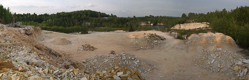
| Gębczyce skarn quarry, Gmina Strzelin, Strzelin County, Lower Silesian Voivodeship, Poland | 50° 42' 51" N | 17° 4' 17" E | 7.5km (4.6 miles) | |
| Górka granite quarry, Górka Sobocka, Gmina Kondratowice, Strzelin County, Lower Silesian Voivodeship, Poland | 50° 44' 38" N | 16° 57' 26" E | 8.6km (5.4 miles) | |
| Rokitki skarn/marble quarries, Gmina Przeworno, Strzelin County, Lower Silesian Voivodeship, Poland | 50° 42' 43" N | 17° 7' 30" E | 8.8km (5.5 miles) | |
| Borowa Góra, Romanów, Gmina Przeworno, Strzelin County, Lower Silesian Voivodeship, Poland | 50° 42' 20" N | 17° 6' 32" E | 9.0km (5.6 miles) | |
| Gromnik Mountain, Samborowiczki, Gmina Przeworno, Strzelin County, Lower Silesian Voivodeship, Poland | 50° 42' 8" N | 17° 6' 36" E | 9.4km (5.8 miles) | |
| Jegłowa quarry, Krzywina, Gmina Przeworno, Strzelin County, Lower Silesian Voivodeship, Poland | 50° 43' 4" N | 17° 9' 15" E | 9.5km (5.9 miles) | |
| Stachów gneiss quarry, Gmina Kondratowice, Strzelin County, Lower Silesian Voivodeship, Poland | 50° 43' 22" N | 16° 57' 50" E | 9.6km (6.0 miles) | |
| Calc-silicate rocks outcrop, Miłocice, Gmina Przeworno, Strzelin County, Lower Silesian Voivodeship, Poland | 50° 41' 40" N | 17° 6' 35" E | 10.2km (6.3 miles) | |
| Pogroda quarry, Gmina Przeworno, Strzelin County, Lower Silesian Voivodeship, Poland | 50° 41' 28" N | 17° 5' 29" E | 10.2km (6.3 miles) | |
| Zarzycka Góra garnet occurrence, Czerwieniec, Gmina Kondratowice, Strzelin County, Lower Silesian Voivodeship, Poland | 50° 42' 51" N | 16° 57' 38" E | 10.5km (6.5 miles) | |
| Janowiczki quarry, Czerwieniec, Gmina Kondratowice, Strzelin County, Lower Silesian Voivodeship, Poland | 50° 43' 46" N | 16° 56' 14" E | 10.7km (6.6 miles) | |
| Kalinka hill, Dobroszów, Gmina Przeworno, Strzelin County, Lower Silesian Voivodeship, Poland | 50° 41' 3" N | 17° 4' 56" E | 10.9km (6.8 miles) | |
| Nieszkowice gneiss and tonalite quarry, Gmina Strzelin, Strzelin County, Lower Silesian Voivodeship, Poland | 50° 42' 17" N | 16° 57' 53" E | 11.1km (6.9 miles) | |
| Kowalskie quarry, Gmina Kondratowice, Strzelin County, Lower Silesian Voivodeship, Poland | 50° 43' 47" N | 16° 55' 22" E | 11.5km (7.1 miles) | |
| Kryształowa, Strużyna, Gmina Przeworno, Strzelin County, Lower Silesian Voivodeship, Poland | 50° 42' 18" N | 17° 10' 38" E | 11.6km (7.2 miles) | |
| Żelowice quarry, Gmina Kondratowice, Strzelin County, Lower Silesian Voivodeship, Poland | 50° 43' 44" N | 16° 54' 47" E | 12.2km (7.6 miles) | |
| Sand Pit Rochowice II, Gmina Borów, Strzelin County, Lower Silesian Voivodeship, Poland | 50° 52' 10" N | 16° 57' 30" E | 12.3km (7.6 miles) | |
| Targowica quarry, Targowica, Gmina Ciepłowody, Ząbkowice Śląskie County, Lower Silesian Voivodeship, Poland | 50° 41' 21" N | 16° 57' 51" E | 12.5km (7.7 miles) | |
| Przeworno marble quarry, Przeworno, Gmina Przeworno, Strzelin County, Lower Silesian Voivodeship, Poland | 50° 41' 34" N | 17° 10' 34" E | 12.6km (7.8 miles) | |
| Brukalice quarry, Gmina Ziębice, Ząbkowice Śląskie County, Lower Silesian Voivodeship, Poland | 50° 39' 45" N | 17° 0' 54" E | 13.7km (8.5 miles) | |
| Manganese-bearing vesuvianite occurrence, Gmina Łagiewniki, Dzierżoniów County, Lower Silesian Voivodeship, Poland | 50° 49' 22" N | 16° 51' 12" E | 15.5km (9.7 miles) | |
| Henryków gneiss quarry, Henryków, Gmina Ziębice, Ząbkowice Śląskie County, Lower Silesian Voivodeship, Poland | 50° 38' 42" N | 16° 59' 51" E | 15.9km (9.9 miles) | |
| Jańska Góra, Piotrówek, Gmina Jordanów Śląski, Wrocław County, Lower Silesian Voivodeship, Poland | 50° 49' 59" N | 16° 49' 59" E | 17.2km (10.7 miles) | |
| Pangelberg, Niemcza, Gmina Niemcza, Dzierżoniów County, Lower Silesian Voivodeship, Poland | 50° 43' 8" N | 16° 50' 20" E | 17.3km (10.8 miles) | |
| Pustków Wilczkowski, Gmina Kobierzyce, Wrocław County, Lower Silesian Voivodeship, Poland | 50° 54' 9" N | 16° 52' 59" E | 18.5km (11.5 miles) | |


Jegłowa quarry, Krzywina, Gmina Przeworno, Strzelin County, Lower Silesian Voivodeship, Poland