| Locality | Latitude | Longitude | Distance | Bearing |
|---|
| Friedrich adit (healing tunnel), Bad Bleiberg, Villach-Land District, Carinthia, Austria | 46° 37' 32" N | 13° 41' 6" E | 0.6km (0.4 miles) | |
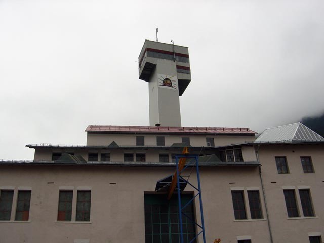
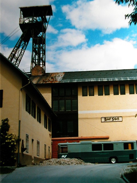
| Rudolf Mine (Rudolf Shaft), Bad Bleiberg, Villach-Land District, Carinthia, Austria | 46° 37' 41" N | 13° 40' 30" E | 1.3km (0.8 miles) | |
| Zwölfernock, Nötsch im Gailtal, Villach-Land District, Carinthia, Austria | 46° 36' 0" N | 13° 40' 59" E | 2.4km (1.5 miles) | |
| Böse Gräben, Nötsch im Gailtal, Villach-Land District, Carinthia, Austria | 46° 35' 54" N | 13° 40' 24" E | 2.8km (1.7 miles) | |
| Antoni Mine (Antoni Shaft), Bleiberg-Kreuth, Bad Bleiberg, Villach-Land District, Carinthia, Austria | 46° 37' 43" N | 13° 38' 54" E | 3.2km (2.0 miles) | |
| Kadutschen, Heiligengeist, Villach, Carinthia, Austria | 46° 37' 39" N | 13° 44' 19" E | 3.9km (2.4 miles) | |
| Rupa, Nötsch im Gailtal, Villach-Land District, Carinthia, Austria | 46° 35' 40" N | 13° 38' 56" E | 4.3km (2.6 miles) | |
| Bleiberg-Kreuth, Bad Bleiberg, Villach-Land District, Carinthia, Austria | 46° 37' 45" N | 13° 37' 54" E | 4.4km (2.8 miles) | |
| Rote Wand, Arnoldstein, Villach-Land District, Carinthia, Austria | 46° 35' 22" N | 13° 43' 43" E | 4.7km (2.9 miles) | |
| Max Mine, Bleiberg-Kreuth, Bad Bleiberg, Villach-Land District, Carinthia, Austria | 46° 37' 55" N | 13° 37' 45" E | 4.7km (2.9 miles) | |
| Heiligengeist, Villach, Carinthia, Austria | 46° 37' 1" N | 13° 45' 2" E | 4.8km (3.0 miles) | |
| A10 Highway tunnel, Kroislerwand, Kellerberg, Paternion, Villach-Land District, Carinthia, Austria | 46° 39' 49" N | 13° 43' 11" E | 5.3km (3.3 miles) | |
| Rubland, Paternion, Villach-Land District, Carinthia, Austria | 46° 39' 48" N | 13° 39' 16" E | 5.4km (3.3 miles) | |
| Feffernitz, Kellerberg, Paternion, Villach-Land District, Carinthia, Austria | 46° 40' 13" N | 13° 40' 29" E | 5.6km (3.5 miles) | |
| Diabase quarry (Jakomini quarry), Bad Bleiberg, Villach-Land District, Carinthia, Austria | 46° 37' 2" N | 13° 36' 42" E | 5.9km (3.7 miles) | |
| Kellerberg, Paternion, Villach-Land District, Carinthia, Austria | 46° 40' 29" N | 13° 42' 27" E | 6.1km (3.8 miles) | |
| Weißenstein, Kellerberg, Paternion, Villach-Land District, Carinthia, Austria | 46° 40' 57" N | 13° 43' 21" E | 7.3km (4.5 miles) | |
| Kabesnock (Kowesnock; Kobesnock), Bleiberg-Kreuth, Bad Bleiberg, Villach-Land District, Carinthia, Austria | 46° 38' 55" N | 13° 36' 2" E | 7.4km (4.6 miles) | |
| Burg, Rubland, Paternion, Villach-Land District, Carinthia, Austria | 46° 40' 0" N | 13° 37' 0" E | 7.5km (4.6 miles) | |
| Weißenstein-Uggowitz area, Weißenstein, Villach-Land District, Carinthia, Austria | 46° 40' 57" N | 13° 44' 23" E | 7.8km (4.9 miles) | |
| Pogöriach, Paternion, Villach-Land District, Carinthia, Austria | 46° 41' 26" N | 13° 39' 27" E | 8.1km (5.0 miles) | |
| Pöllaner Höhe, Pöllan, Paternion, Villach-Land District, Carinthia, Austria | 46° 41' 9" N | 13° 38' 25" E | 8.1km (5.0 miles) | |
| Draschitz, Hohenthurn, Villach-Land District, Carinthia, Austria | 46° 33' 33" N | 13° 37' 57" E | 8.1km (5.1 miles) | |
| Schütt, Villach, Villach-Land District, Carinthia, Austria | 46° 34' 17" N | 13° 46' 19" E | 8.4km (5.2 miles) | |
| Greuth, Arnoldstein, Villach-Land District, Carinthia, Austria | 46° 32' 42" N | 13° 41' 2" E | 8.5km (5.3 miles) | |
| Achomitz, Hohenthurn, Villach-Land District, Carinthia, Austria | 46° 34' 7" N | 13° 36' 25" E | 8.6km (5.3 miles) | |
| Amberg, Fresach, Villach-Land District, Carinthia, Austria | 46° 41' 47" N | 13° 43' 49" E | 8.9km (5.5 miles) | |
| Sagrad, Draschitz, Hohenthurn, Villach-Land District, Carinthia, Austria | 46° 33' 8" N | 13° 37' 21" E | 9.2km (5.7 miles) | |
| Pöllan, Paternion, Villach-Land District, Carinthia, Austria | 46° 41' 46" N | 13° 38' 13" E | 9.2km (5.7 miles) | |
| Feistritz an der Drau, Paternion, Villach-Land District, Carinthia, Austria | 46° 42' 11" N | 13° 39' 44" E | 9.3km (5.8 miles) | |


Antoni Mine, Bleiberg-Kreuth, Bad Bleiberg, Villach-Land District, Carinthia, Austria