| Locality | Latitude | Longitude | Distance | Bearing |
|---|
| Kilroot Mine, Carrickfergus, Co. Antrim, Northern Ireland, UK | 54° 43' 41" N | 5° 44' 56" W | 1.5km (1.0 miles) | |
| Duncrue salt mine, Carrickfergus, Co. Antrim, Northern Ireland, UK | 54° 43' 57" N | 5° 50' 17" W | 4.3km (2.7 miles) | |
| Unnamed quarry No. 2, Whitehead, Co. Antrim, Northern Ireland, UK | 54° 44' 47" N | 5° 42' 43" W | 4.6km (2.8 miles) | |
| Whitehead, Co. Antrim, Northern Ireland, UK | 54° 45' 17" N | 5° 42' 56" W | 4.9km (3.1 miles) | |
| Woodburn Glen, Carrickfergus, Co. Antrim, Northern Ireland, UK | 54° 44' 1" N | 5° 51' 6" W | 5.2km (3.2 miles) | |
| Unnamed quarry No. 1, Whitehead, Co. Antrim, Northern Ireland, UK | 54° 45' 37" N | 5° 41' 55" W | 6.2km (3.8 miles) | |
| Carneal, Glenoe, Larne, Co. Antrim, Northern Ireland, UK | 54° 47' 31" N | 5° 50' 26" W | 8.7km (5.4 miles) | |
| Gobbins, Islandmagee, Co. Antrim, Northern Ireland, UK | 54° 47' 26" N | 5° 41' 46" W | 8.8km (5.5 miles) | |
| Glenoe, Larne, Co. Antrim, Northern Ireland, UK | 54° 47' 56" N | 5° 49' 50" W | 9.1km (5.6 miles) | |
| Basalt quarry, Magheramorne, Glynn (Glynn Hill), Larne, Co. Antrim, Northern Ireland, UK | 54° 48' 39" N | 5° 45' 54" W | 9.6km (6.0 miles) | |
| Hills Port, Gobbins, Islandmagee, Co. Antrim, Northern Ireland, UK | 54° 48' 0" N | 5° 41' 26" W | 9.9km (6.1 miles) | |
| Magheramorne, Glynn (Glynn Hill), Larne, Co. Antrim, Northern Ireland, UK | 54° 48' 59" N | 5° 46' 0" W | 10.2km (6.3 miles) | |
| Limestone quarry, Magheramorne, Glynn (Glynn Hill), Larne, Co. Antrim, Northern Ireland, UK | 54° 49' 0" N | 5° 45' 47" W | 10.2km (6.4 miles) | |
| Heddles Port, Islandmagee, Co. Antrim, Northern Ireland, UK | 54° 49' 6" N | 5° 41' 57" W | 11.4km (7.1 miles) | |
| Craigantlet Quarry, Newtownards, County Down, Northern Ireland, UK | 54° 37' 3" N | 5° 45' 34" W | 12.0km (7.4 miles) | |
| Conlig, County Down, Northern Ireland, UK | 54° 37' 45" N | 5° 40' 39" W | 12.3km (7.6 miles) | |
| Carnmoney, Co. Antrim, Northern Ireland, UK | 54° 41' 4" N | 5° 57' 1" W | 12.3km (7.6 miles) | |
| Bruslee quarry, Ballyclare, Co. Antrim, Northern Ireland, UK | 54° 43' 59" N | 5° 58' 0" W | 12.5km (7.8 miles) | |
| North Down Quarry, Newtownards, County Down, Northern Ireland, UK | 54° 36' 34" N | 5° 43' 45" W | 13.1km (8.2 miles) | |
| Whitespots-Conlig mines (Whitespots-Conlig vein), Conlig, County Down, Northern Ireland, UK | 54° 36' 51" N | 5° 41' 19" W | 13.4km (8.3 miles) | |
| Two Mouthed Cave, Islandmagee, Co. Antrim, Northern Ireland, UK | 54° 50' 31" N | 5° 43' 7" W | 13.5km (8.4 miles) | |
| Green Road Quarry (Ballyclare Old Quarry), Ballyclare, Co. Antrim, Northern Ireland, UK | 54° 44' 41" N | 5° 58' 56" W | 13.7km (8.5 miles) | |
| Skarn, Port Muck, Islandmagee, Co. Antrim, Northern Ireland, UK | 54° 50' 46" N | 5° 43' 28" W | 13.8km (8.6 miles) | |
| Port Muck, Islandmagee, Co. Antrim, Northern Ireland, UK | 54° 50' 51" N | 5° 43' 48" W | 13.9km (8.6 miles) | |
| Larne, Co. Antrim, Northern Ireland, UK | 54° 51' 1" N | 5° 49' 9" W | 14.3km (8.9 miles) | |
| Unnamed quarry, Kilwaughter Castle, Larne, Co. Antrim, Northern Ireland, UK | 54° 50' 18" N | 5° 53' 5" W | 14.5km (9.0 miles) | |
| Mcllroy's Port, Port Muck, Islandmagee, Co. Antrim, Northern Ireland, UK | 54° 51' 21" N | 5° 45' 0" W | 14.7km (9.1 miles) | |
| Cave Hill, Belfast, Co. Antrim, Northern Ireland, UK | 54° 39' 1" N | 5° 57' 44" W | 14.7km (9.2 miles) | |
| Craighill Quarry, Ballyclare, Co. Antrim, Northern Ireland, UK | 54° 45' 37" N | 5° 59' 52" W | 15.0km (9.3 miles) | |
| Kilwaughter Castle, Larne, Co. Antrim, Northern Ireland, UK | 54° 50' 35" N | 5° 53' 20" W | 15.1km (9.4 miles) | |

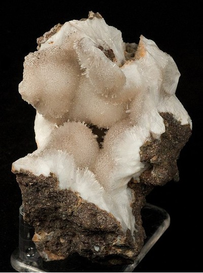

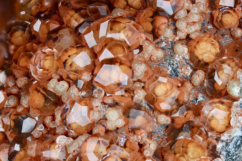


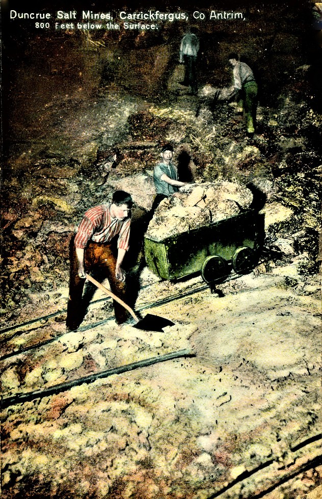


Duncrue salt mine, Carrickfergus, Co. Antrim, Northern Ireland, UK