| Locality | Latitude | Longitude | Distance | Bearing |
|---|
| Vugga Cove, Pentire Point West, Crantock, Cornwall, England, UK | 50° 24' 21" N | 5° 7' 54" W | 0.2km (0.1 miles) | |
| Pentire Point West, Crantock, Cornwall, England, UK | 50° 24' 31" N | 5° 8' 7" W | 0.3km (0.2 miles) | |
| The Gannel Smelter slag locality, Crantock, Cornwall, England, UK | 50° 24' 30" N | 5° 6' 33" W | 1.8km (1.1 miles) | |
| Pigeon Green Mine, Phoenix Mine, Penhale Sands, Perranzabuloe, Cornwall, England, UK | 50° 23' 20" N | 5° 8' 57" W | 2.2km (1.4 miles) | |
| Penhale Point, Perranzabuloe, Cornwall, England, UK | 50° 23' 20" N | 5° 9' 19" W | 2.4km (1.5 miles) | |
| Wheal Golden (Wheal Golding; Golden Consols), Penhale Point, Perranzabuloe, Cornwall, England, UK | 50° 23' 18" N | 5° 9' 15" W | 2.4km (1.5 miles) | |
| Fistral Bay, Newquay, Cornwall, England, UK | 50° 24' 57" N | 5° 6' 4" W | 2.6km (1.6 miles) | |
| Mellingey Mine, Cubert, Cornwall, England, UK | 50° 22' 57" N | 5° 8' 8" W | 2.6km (1.6 miles) | |
| Chiverton Wheal Rose (Trethellan Mine), Newquay, Cornwall, England, UK | 50° 24' 30" N | 5° 5' 41" W | 2.8km (1.7 miles) | |
| Newquay Consols (Fistral Mine; North Wheal Providence; Wheal Providence), Newquay, Cornwall, England, UK | 50° 24' 57" N | 5° 5' 49" W | 2.8km (1.8 miles) | |
| Ellenglaze Mine, Cubert, Cornwall, England, UK | 50° 22' 48" N | 5° 7' 47" W | 2.9km (1.8 miles) | |
| Phoenix Mine, Penhale Sands, Perranzabuloe, Cornwall, England, UK | 50° 22' 43" N | 5° 8' 33" W | 3.1km (1.9 miles) | |
| Penhale Mine, Penhale Sands, Perranzabuloe, Cornwall, England, UK | 50° 22' 41" N | 5° 8' 57" W | 3.3km (2.0 miles) | |
| Gravel Hill Mine (Cliff Iron Mine; Penhale Iron Mine), Perran Iron Lode (Great Perran Iron Lode), Perranzabuloe, Cornwall, England, UK | 50° 22' 27" N | 5° 8' 41" W | 3.6km (2.2 miles) | |
| Newquay Mine (Lehenver Mine), Newquay, Cornwall, England, UK | 50° 24' 35" N | 5° 4' 56" W | 3.7km (2.3 miles) | |
| Penhale Sands, Perranzabuloe, Cornwall, England, UK | 50° 22' 22" N | 5° 8' 7" W | 3.7km (2.3 miles) | |
| Trebisken Mine (Trebisken Green Mine), Cubert, Cornwall, England, UK | 50° 22' 17" N | 5° 6' 55" W | 4.0km (2.5 miles) | |
| Great Western Beach, Newquay, Cornwall, England, UK | 50° 24' 59" N | 5° 4' 43" W | 4.1km (2.5 miles) | |
| Trevemper, Cubert, Cornwall, England, UK | 50° 23' 46" N | 5° 4' 34" W | 4.2km (2.6 miles) | |
| Wheal Mary, Penhale Sands, Perranzabuloe, Cornwall, England, UK | 50° 22' 4" N | 5° 8' 30" W | 4.2km (2.6 miles) | |
| Halwyn pit (Halwyn Mine), Perran Iron Lode (Great Perran Iron Lode), Perranzabuloe, Cornwall, England, UK | 50° 21' 59" N | 5° 7' 44" W | 4.4km (2.7 miles) | |
| Wheal Mexico (Trebellan Mine; incl. Treworthy Mine), Perranzabuloe, Cornwall, England, UK | 50° 22' 6" N | 5° 6' 43" W | 4.4km (2.7 miles) | |
| Tolcarne Beach, Newquay, Cornwall, England, UK | 50° 25' 3" N | 5° 4' 23" W | 4.5km (2.8 miles) | |
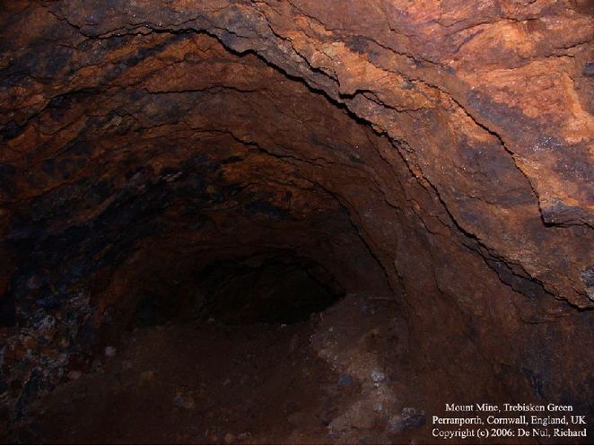
| Mount Mine (Perran Iron Mine; Trebisken and Mount Mine), Perran Iron Lode (Great Perran Iron Lode), Perranzabuloe, Cornwall, England, UK | 50° 21' 57" N | 5° 7' 19" W | 4.5km (2.8 miles) | |
| North Cargoll Mine, Trevemper, Cubert, Cornwall, England, UK | 50° 23' 45" N | 5° 4' 18" W | 4.5km (2.8 miles) | |
| The Criggars, Tolcarne Beach, Newquay, Cornwall, England, UK | 50° 25' 10" N | 5° 4' 18" W | 4.7km (2.9 miles) | |
| Treloggan Mine, Newquay, Cornwall, England, UK | 50° 24' 31" N | 5° 4' 1" W | 4.7km (2.9 miles) | |
| Peru Mine, Perranzabuloe, Cornwall, England, UK | 50° 22' 1" N | 5° 6' 18" W | 4.8km (3.0 miles) | |
| South Mount Mine (Crows-an-Carne Mine), Perran Iron Lode (Great Perran Iron Lode), Perranzabuloe, Cornwall, England, UK | 50° 21' 47" N | 5° 7' 13" W | 4.8km (3.0 miles) | |
| Trerew Mine (Trerew Wheal Rose), Cubert, Cornwall, England, UK | 50° 22' 53" N | 5° 4' 35" W | 4.9km (3.0 miles) | |


Mount Mine, Perran Iron Lode, Perranzabuloe, Cornwall, England, UK