31. Gold Panning at Coker Creek, Tennessee
Last Updated: 7th Sep 2018By Frank Festa
Post Date: Sept., 2018Trip Date: Summer 2017
Gold Panning at Coker Creek, Tennessee
I had always wanted to go on a gold panning trip from the time I became interested in rock and mineral collecting. While leafing through books, magazines and old black and white movies (The Treasure of the Sierra Madre) information filling my youthful mind of wondrous imaginations. The stereo-typed image of a man, with a long beard, high leather boots, hat, sitting on a rock beside a creek, using his cooking skillet as a gold pan was forever silhouetted in my mind.
During the winter of 2017, my imagination finally got the best of me. It’s funny how ones imagination can set so many actions in motion and put one (me) on a course for gold. My home state of Pennsylvania (Western side) geologically speaking, my side is basically sedimentary in nature. Here coal, limestone, shales, sandstones and others are common occurrences, leftovers from eons ago when seas covered this area, ice ages leaving their scars along with huge rounded boulders in their melting retreat , major earth forming erosion, flooding and sedimentation taking place. Native gold is rarely found here. So, where does one go to search for gold in the continental USA? After a long period of study and research, I located my target areas. A number of USGS books, papers, maps, and what-have-you were downloaded from the Internet. Websites fell like dominoes in my search for information. As info was being gathered, a plan was being loosely devised and laid out. A plan for what sites to visit, the amount of time to be used at each site, how far to drive per day to a site, reservations for lodging had to be made, there were hours and hours of planning put into this adventure.
This particular collecting trip would be for two weeks, which was not uncommon for a collecting trip, as I normally spent this amount of time, sometimes more. The trip would cover several different states, cross up and over numerous old mountains and add at least two thousand miles to my vehicle. I had planned to visit several former gold producing creeks, mines and areas where gold was found long ago. And, as a bonus, I located information for a former copper producing area, an archaeological site that to this day can not be fully explain by the experts and finally end in a designated gold belt from days gone by. All this was included in a single trip and two weeks did not seem like enough time to explore everything on the itinerary.
I carried but a single suitcase… as laundromats are easy enough, a large cardboard box containing my “field clothes”, boots, cameras, a few rock collecting tools, hand held GPS, laptop, chargers, pretty much just the bare necessities. It had taken several months to complete all that needed to be done. And when the day finally arrived, I sat in my vehicle and set the GPS for the first of many stops. First stop, seven hours and four hundred fifty miles away, North Carolina.
North Carolina is noted for its gem stones including rubies, sapphires, garnets, and emeralds. All of which I had already attempted to locate on previous rock collecting trip and have written articles about. Please see my article list.There are many websites dealing with North Carolina gold, try this one:
https://deq.nc.gov/about/divisions/energy-mineral-land-resources/north-carolina-geological-survey/geoscience-education/gold-of-nc
The first sites visited in North Carolina, after I arrived and got settled in, were the rubies, sapphires, garnets, and emeralds sites in the Hiddenite area of the Blue Ridge Mountains. The sites here were purely for tourism as these had been explored in earlier rock collecting trips. I did do some gold panning in a few spots recommended by some of the fine folks I talked with while visiting some of the sites. This is a great area for rock collecting and not a place to pass up if you are in this area. You could spend a month exploring here.
A day or two later I moved farther south to Charlotte, N.C. and the old Reed Gold Mine. Story has it that in 1799 a farmer is said to have found a 16 pound yellow colored “rock”. Not knowing the rock was in fact gold, it was used as a doorstop for years. Farther details on the Reed Mine will require independent research. This stop was also a pleasure visit and not intended to be a serious panning site.
From Charlotte, N.C. it was due west to Coker Creek, Tennessee. At this point in the story we must begin to look at the extremely condensed historical events that were occurring in what would later become the eastern part of the USA.
The year was 1492, supposedly Columbus along with a brave group of sailing men, craftsmen and followers sailed the Atlantic Ocean on the foolhardy notion to reach China, the Orient and the riches that lay ahead of them. We all are aware of the ending to the story. They missed their target by thousands of miles and accidently ran into a new world, an uncharted world. A world of enchantment, of native peoples, indigenous peoples, peoples who had lived here for thousands of years, unaware of Europe, or anywhere else other than their own small piece of the Earth. What their expedition probably located was one of the Bahamian islands. Later they located another island which was later named Cuba. This is where Columbus thought Japan had to be. And another island almost as large as Cuba, that Columbus named “Insula Hispana” (in Latin) or later Hispaniola.
The very nature of European history, for that matter the very nature of history itself changed with this single act. By traveling the course Columbus had chosen he and his men had upset the very balance of nature and changed the course of civilizations and the lives of all peoples his world and the world that followed. He had opened the proverbially “Pandora’s Box”, never again to close the lid.
Conquest (for the purpose here) is defined by Wikipedia as “the act of military subjugation of an enemy by force of arms”. Since the beginning of time man has laid conquest, laid seize, on other men. And, you must remember, during a conquest, there are no rules of engagement. Very simply put it is a battle for life or death. You either live or die. The less fortunate, those that survive on the losing side, are taken prisoner, tortured, raped, sacrificed, enslaved, mutilated, worked to death and/or beaten to death. These were truly the living dead. The peoples beaten in battle lost everything they had: land, family, wives, children, homes, huts, jewelry, riches, precious metals. Think of any battle throughout history at any time, any place, in any country. The defeated lose more than their lives.
Europeans were tired of killing each other on their own soil, destroying their own lands, buildings, cities. Now with this new discovery they had just found a new arena for war-like engagement and conquest. Columbus had opened the gates and Europe entered into the “Age of Conquest”. Spain would lead the way. Gold, precious metals, riches became the root of this conquest and the Spanish wanted all they could take. The most important part of the historical record is the slaughter of innocent peoples. What was once an estimated population of one million people in 1493 in the areas of Columbus’s landings, by 1517 a mere fourteen thousand indigenous people remained. The indigenous enslaved peoples dwindled so quickly that the Spanish had to bring in African slaves to the islands to do the physical, manual work of farming, mining. Spain’s dominance, ever growing in the new world, the Aztec Empire would fall to Cortez in 1521, the conquest and plunder of the Inca Civilization lead by Francisco Pizarro with the aid of Hernando de Soto in 1530. The Spanish treatment of the indigenous was horrendous, life had no meaning, death was far better than living. Entire civilizations, were wiped out, massacred, genocide. And, gold was pouring into Spain by the ship full.
Ponce de León was a high level military leader in the government of Hispaniola in the early 1500’s. In 1513, he led the first known expedition to what he named “La Florida”, during his first voyage to the area. The expedition’s purpose was the search for gold and riches. But, the actual discovery of precious metals is open to debate. The English laid claim to this peninsula before the Spanish. But, the Spanish probably searched here for slaves before Leon. In 1521, Ponce was given permission to form a Spanish colony in Florida. Though the plans for the colony were ended when the indigenous peoples resisted the Spanish. Ponce was wounded in battle and died of his wounds. Though locating gold and riches were the basis for this venture very little of it was actually found.
Several years later, Hernando de Soto, in 1539, was given a four year commission for the colonization and exploration of the continental mainland of the new world, but not for serious conquest. Though, the king would gladly accept any “gifts” of gold. De Soto selected 620 men, Spanish, Portuguese and some of mixed-race Africans for the task ahead. And, like Columbus before him, his thoughts were of riches also. De Soto and his men sailed on seven ships carrying provisions, tons of armor, weapons, all sorts of instruments to cause death and destruction, heavy equipment, 237 horses and 200 pigs. The expedition was to begin in Florida, wind its way through Georgia, South Carolina, North Carolina, Tennessee, Alabama, Arkansas, Oklahoma, and Texas.
(as per Wikipedia - Hernando de Soto). Farther independent research is certainly necessary as this is a massive story.
The Spanish and Hernando de Soto encountered indigenous peoples all along their route and though this expedition was not for conquest, their treatment of the indigenous peoples was very familiar with how the Spanish treated innocent peoples from previous encounters. The Spanish made sport of the Indian peoples, forced them into servitude, killed them indiscriminately. The Spanish may not have discovered the masses of gold and riches they hoped for but they did accomplish one very important thing. Indian resentment and hatred for the European. Of the states their expedition route carried them through, Florida, Georgia, South Carolina, North Carolina, Tennessee, Alabama, Arkansas, Oklahoma, and Texas gold was discovered in some. However on this expedition, very little gold was carried out of the country. Independent research is needed to gain a deeper insight into this story.
https://www.nytimes.com/1987/05/19/science/de-soto-s-trail-courage-and-cruelty-come-alive.html
https://owlcation.com/humanities/De-Sotos-Adventure-in-North-America-Holocost-in-the-Sixteenth-Century
https://books.google.com/books?id=A7M_AQAAMAAJ&pg=PA282&lpg=PA282&dq=long+abandoned+spanish+gold+mine+workings+of+de+soto&source=bl&ots=LI32oiR71b&sig=aPH8hbw1PF6hw_KaKPsC8je58aU&hl=en&sa=X&ved=2ahUKEwikjPrtw53dAhUEMt8KHXVHC0MQ6AEwD3oECAIQAQ#v=onepage&q=long%20abandoned%20spanish%20gold%20mine%20workings%20of%20de%20soto&f=false
https://irma.nps.gov/DataStore/DownloadFile/465605
De Soto was to explore the land, make maps, contact locals……..on the side he would also seek gold and treasure. When in contact with local peoples, gold, gem stones and precious metals were sought. Local people, like anywhere in the world, would adorn their bodies with items of beauty. Stories of “yellow stones” in a creek or underground were always sites De Soto and his men would explore. And, at times, de Soto would leave a small contingent of men to work a possible gold vein or travel a great distance to follow up on a report of gold. Old mine workings of Spanish origin have been located throughout the states of De Soto’s expedition.
As more and more settlers came to the new world, foreign governments wanted a larger and larger piece of it. Spain lost its grip to the new world to France and England. Cities would spring up, after a war for independence, states were formed and America was born. Early prospectors in the 1820’s – 1830’s did indeed find abandoned Spanish mine workings.
The first confirmed discoveries of gold in the states in which Hernando de Soto’s expedition traveled through:
Florida – little to no gold
Georgia - 1828
South Carolina – 1827
North Carolina - 1799
Tennessee - 1831
Alabama - 1830
Arkansas – little to no gold
Texas – little to no gold
Oklahoma – little to no gold
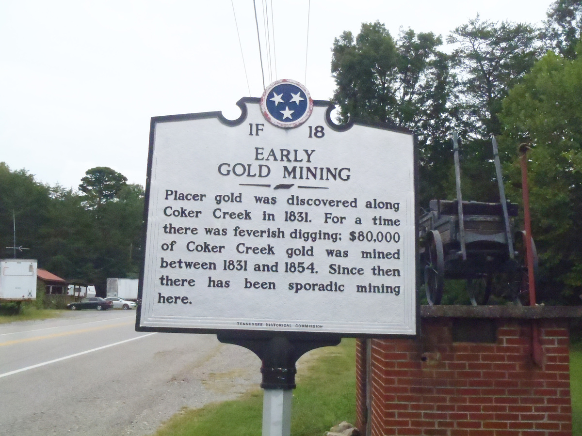
From Charlotte, N.C. I drove into my first area of interest, Tellico Plains and Coker Creek, Tennessee. The famous Coker Creek, where gold was first discovered in 1831. Coker Creek is both the name of the town and the creek flowing through this area.
And again, before we go farther, it is best to look at the early history of this area, in a very condensed form. For thousands of years, since the end of the last ice age indigenous people had lived here. They evolved from primitive hunters seeking food in the form of live prey. Early on small groups would settle the area. In time the hunters grew to be hunter-gathers and eventually farmers. As more and more Europeans arrived in the “new world” they expanded, their boundaries reached father and farther into Indian lands. Seeking new land in which to farm, hunt and trap fur bearing animals for money. This European expansion forced the Indian to either fight for their lands or to move themselves, away from the flood of settlers.
The Cherokee Indian moved into this area early on and thus displaced the original peoples. During the eighteenth century the Indian town of “Talikwa” or the Great Tellico was the largest Cherokee settlement in the area. The former site was on the current town of Tellico Plains, Tenn. From the Great Tellico, the Indians had numerous trails forming a transportation network interconnecting other Indian towns. With the British and the French both claiming these lands war would become inevitable. Specific Indian groups allied themselves with one country or the other. With the outbreak of the French and Indian War (1754), the French were allied “with the Wabanaki Confederacy members Abenaki and Mi'kmaq, and Algonquin, Lenape, Ojibwa, Ottawa, Shawnee, and Wyandot.” “The British colonists were supported at various times by the Iroquois, Catawba, and Cherokee”. Please refer to “Wikipedia, French and Indian War”. We all are aware of the final outcome.
By the time the American Revolution rolled around, the Cherokee Chief, Attakullakulla, wanted no parts of any farther wars and wished to stay neutral. But, due to continual raids on white settlements by young Indian warriors and the fear of Indians by the settlers, the home of the Cherokee Indian, The Great Tellico, was invaded and totally destroyed by the army in 1776. The same year of the Declaration of Independence. It was farther laid to waste in 1779 to end any and all future Indian threats.
http://www.tellico-plains.com/history.html
Just down the road from Tellico Plains lies the village of Coker Creek. Originally made up of Scotch-Irish immigrants from North Carolina, Pennsylvania, and Virginia. And, later in smaller numbers by the English, French, Welch, Swiss, and Germans.
So, just where is Coker Creek? According to “Wikipedia”, Coker Creek is located in Monroe County in the state of Tennessee just above the North Carolina border. The town lies in a mountainous area of the Southern Appalachian Mountains, within the Cherokee National Forest. To the north lies Tellico Mountain, to the south Farner Mountain, Unicoi Mountain to the east and Cataska Mountain to the west. Coker Creek had an official U.S. Post Office from 1841 to 2008.

Coker Creek is the name of the town and the creek which runs past it. About 1827, gold was discovered in Coker Creek. Herein lies a big problem. Coker Creek was then in Cherokee Indian territory.
https://traveltips.usatoday.com/gold-panning-coker-creek-tennessee-59992.html
According to George Ashley in his report for the Geological Survey of Tennessee, titled the Gold Fields of Coker Creek dated 1911, Ashley states the early settlers to this area learned of the gold in the area about Coker Creek from the Cherokee Indian. Ashley continues, sometime in 1827 two men named Jacob F. Peck and Le Grande Henderson entered Indian owned land and began mining for gold. Naturally others followed and in the course of time prospectors were all over forbidden lands. The Cherokee Indian filed complaints with the U.S. government. A company of soldiers were dispatched and stationed near the present day site of the Coker Creek post office with orders to keep trespassers out of Indian Territory.
With gold being discovered in South Carolina and Georgia in 1828/1829 and Alabama in 1830, gold hunters converged in these areas, all Indian owned lands, even with the presence of the military.
As a result……(please research the Treaty of New Echota and the Ocoee Land District. This story is a must read and another black mark against the U.S. governments tactics at stealing Indian lands), the treaty lead to the notorious “Trail of Tears” and the violent forceful removal of the Cherokee Indian from their former homelands.
https://en.wikipedia.org/wiki/Treaty_of_New_Echota
The Cherokee nation, as a whole, were basically stripped of their ownership of lands in the Southeastern U.S. They gave up their rights to large amounts of land to the United States government 1836. Though the treaty was not accepted by the main Cherokee Council and their leader. The treaty had been negotiated by a Cherokee leader named Major Ridge, who falsely claimed to represent the Cherokee Nation when, in fact, he spoke only for a small group within the Cherokee Nation. Later Major Ridge and several others were found assassinated. What a coincidence………………………..Was their deaths to keep them quiet after they realized they and their brethren were lied to, cheated and swindled by Washington, D.C. politicians, or was it in retaliation by members of the Cherokee Nation?????
The treaty was accepted by the U.S. government. I find it hard to believe no one involved with this political scheme was unaware Major Ridge was not speaking for all the Cherokee ! ! ! The land was surveyed and divided into lots. Later sold off to the public in 1839. Certainly individual research is required to dig deeper into this story.
I arrived in Coker Creek in the early afternoon, located what would be my “base camp” (lodging) for the next few days. Like always, I first like to explore my surroundings, get my bearings as to “what is where” so to speak. Tellico Plains and Coker Creek are your everyday small hometown sites with all the amenities a tourist could need. I spotted the Coker Creek Welcome Center and headed there first to locate local info, brochures and talk with the people inside about gold panning. You would be surprised what information can be had by local folks. The lady attending the center was more than knowledgeable concerning gold panning in the area. She was kind enough to show me local maps of where access to creeks was possible to gold pan in, stream locations beside Coker Creek and directions.
We discussed the very popular gold panning spot….Doc Rodgers Field. (lots of info on the Internet) The area is located in the Cherokee National Forest but………………was currently closed to the public for the purpose of creek gold prospecting at the time of my visit. And as always, abuse, abuse, abuse. What is it with people and rules and regulations??? There are posted signs in this area concerning the rules and regulations of gold prospecting here. I guess the rules only pertain to others and not you ! ! !
I would suggest to locals and future visitors to obtain from the state of Tennessee or the Gold Prospectors Association of America (GPAA) a gold panning permit and the rules associated with gold prospecting here at Coker Creek or anywhere else for that matter. Easy to find information on the Internet. I’ll make it even easier for you.
https://www.tn.gov/content/dam/tn/environment/water/documents/water_permit_arap-gp_recreational-prospecting.pdf
https://www.heraldcourier.com/news/local/tennessee-to-regulate-recreational-gold-mining/article_0ef3607a-01ce-11e3-b42d-0019bb30f31a.html
The GPAA also operates a site at Coker Creek. Their site/property be located on the road to Coker Creek.
http://cokercreekgpaa.com/
I walked away from Coker Creek Welcome Center with far more information than the Internet supplied me with. After that it was supper time, maybe one or two “cold ones” than study my information for the following day.
Next morning, using Geological Survey Bulletin 1552, titled Mineral Resources of the Citico Creek Wilderness Study Area, Monroe County, Tennessee, by J.F. Slack and E.R. Force of the U.S. Geological Survey and P.t. Behum and B.B. Williams of the U.S. Bureau of Mines, I drove over to explore Citco Creek and Doublecamp Creek as described in the information with maps. I was able to locate both of the creeks listed and do several hours’ worth of gold panning. I was also able to locate a few smaller creeks at various spots and did pan in these also, though their names elude me. Let me make this perfectly clear, I used only a common plastic gold pan and no other tools, or implements. Yes, I also used my stool in order to sit above the water and stay relatively dry.

Gold panning is a back breaking endeavor in which a relatively small amount of material can be processed (panned) in a lengthy period of time. I had no expectations of “striking it rich” as this area had been explored since the early 1800’s. My goal was simply to apply myself to the task at hand and if luck be with me possibly turn up “some color”.
Gold prospecting equipment abounds far beyond a simple gold pan as the following website demonstrates (there are many gold prospecting supplies sites on the Internet) the possible gear to incorporate in your endeavor.
https://www.goldfeverprospecting.com/goprsu.html
By using a “sluice box” a “high banker or power sluice” or other small or large piece of equipment, one can process a far greater amount of material thus increasing the chances of successfully locating gold. I visited a prospecting shop in Tennessee and I must say the equipment is impressive. For a small investment (several hundred dollars) one can purchase a small battery operated sluice. This equipment is a self-contained unit using batteries to operate a water pump which washes down the material fed onto the rubber grooved belt (riffles). One merely has to do is “feed” material onto the belt. This is my personal favorite. And, if I were to prospect for gold in the future this is the type equipment I would use.
During the course of my first day panning and an uncounted number of handfuls of creek sediment panned, I was ready to call it a day. My back was stiff and sore even though I was sitting but still in a bent over position all day. I was able to locate some color from my endeavor however. Yes…..there it was in my pan. A few tiny flecks of gold sparkling in the sun soaked wet pan. This was recreational gold panning at its best.

I spent the next two days closer to the Coker Creek area locating a number of streams and small feeder waterways and a number of panning sites simply by driving throughout the area. I explored roadside rock outcroppings where possible.
My last day was dedicated solely to Coker Creek. Following the creek by car for a number of miles, I would stop and park when and where possible to dip my pan in either Coker Creek or a feeder stream no matter how small. Hours passed so quickly. My ultimate goal was to reach the spot where Coker Creek flows into the Hiwassee River. This may or may not have been a “good spot” to pan. Who knows? It certainly makes sense that everything eventually ends up at the bottom. I really just wanted to be at that spot. My plans included a preselected GPS point where I would park my vehicle, higher up on the mountain, pack my backpack and head out on foot, down the mountain side following the creek. The creek drops out of the Unicoi Mountains quite a distance through a steep gorge on its way to the river.

So here I was, on the edge of a mountain looking down at a wildly rushing flow of water tumbling down to who knows where. I could only imagine myself back in the early 1800’s, an early explorer, a gold prospector, alone in the forest, alive with Indians possibly hostile. Trespassing on Indian Territory would have been unnerving to say the very least. Here I was, unable to defend myself should a hostile group of Indian appear. What would they do should they discover my presence? Forest sounds amplify themselves and lead the imagination to frightful thoughts. Specter shapes of light and dark add to the feeling of being watched. Land contours, fallen trees, clumps of Earth take on ghostly forms. Alone in Indian Territory.
I explored everything on my way down from uprooted trees, rocky outcrops, quartz exposures, creek bed rocks and sediments. I panned in several spots on the way down. Numerous white quartz exposures were explored for a little color. The day of locating gold nuggets on the surface are probably gone forever. But, this is what keeps prospectors from coming back …..there may be one last nugget to find. It’s the same with playing the lottery or any game of chance. Though the odds are completely against you there is still a tiny possibility. This tiny possibility stirs the emotions and makes you want to try your luck.


I spent hours hiking in a downward direction, using my handheld GPS (with extra batteries) climbing down some very steep locations, though I am always aware of being hurt or disabled. Fortunately, I do carry a medical handbook and am able to perform a few medical procedures should something come up. Most remote spots such as this cellphone service is not available, but it would not matter as I do own a cell phone. I remember watching a film (based in fact) in which a hiker became trapped in a rocky mountainous region. While climbing a rocky hillside his footing gave way and his leg became wedged within a crevice. To make the story short, the hiker after enduring days of pain and anguish, in desperation cut off his leg in order to save his life, managed to travel several miles where he was fortunate enough to be found by other hikers.
With the day more than half gone my personal expedition had reached the Hiwasssee River. I was elated. The trip was successful on several fronts. I survived the trip down the mountain and I located some color in Coker Creek.
Some things I have learned so far….gold panning is not something one would quit their day job for but it is a very interesting recreation. The use of a pan is an extremely slow back breaking process. But a pan is by far the easiest lightest implement to carry and use when gold prospecting. For a prospector who will be in the field more than just once or twice a sluice or better yet a power sluice can process far more material in a far shorter time period and increase ones chances at finding gold. The gold pan is far more authentic and creates the picture of early prospectors.

It is possible to find flecks gold (in very limited amounts) here in the hills of Tennessee. No special talents are needed, no special training necessary. One just needs patience, lots of it. The size of the water source is not important. One can pan in a river or a tiny trickle of flowing water. When panning one only needs a small flow of water. It may even help to stack a few rocks in the flow of water to build a small dam. You only need enough water to swirl the sediments.
Yes, there may be “good spots”…. but if they are so good why doesn’t everyone pan in the same spot? Gold is where you find it. One spot is just as good as the next.

After reading the preceding story you are moved to write me and say, “Frank the gold story was very interesting”. “I too would like to give it a try but, you never explained just how to go about actually operating a pan and processing material”. “All you wrote is that it takes lots of patience, no skill or no training”.
You are perfectly correct to bring up this point. If you will just give me one more minute I’ll give you the basics and you will be hauling in the yellow ore.
Before we can begin however there are a few prerequisites.
1. You need a pan first off. Yes, you can use any frying pan, skillet, deep dinner plate, Chinese wok. You can cut the bottom of a bucket off and use that. This is what‘s great about this activity…you do not need to spend a lot of cash for gear. If you so desire yes you can buy a plastic pan made for panning.
https://www.amazon.com/SE-GP1013G12-Green-Plastic-Riffles/dp/B00IKY42AW
The plastic store bought pans have “riffles” built into them, which is a very good thing to have. Riffles are grooves, slots or depressions. As you use your pan, material will collect or become trapped in these slots.
2. A cheap “snifter and bottle”. Or an eye dropper and a small plastic bottle to store your gold in.
3. The next important item you will need: it really helps if you are in a known gold producing area. Sure, you can try your luck anywhere in the world. But physically being in a known gold producing area will increase your chances of finding gold immensely.
4. Finally you will need a water source. The water can be stagnant or flowing. It can be a large river, lake, pond, stream, creek, even a tiny source will do. Water is necessary in the panning process.
OK, you have the four prerequisites, the pan, storage bottle, the water, the area. Now you are ready. Let’s continue and see if you can swirl out some color. Boots are purely optional, this will be up to you. If you have a plastic stool, like I use, you can sit directly in the water and stay relatively dry. You can “stoop” or sit, this is up to you also. You have to be very close to the water, almost in it.
1. I will leave this next decision up to you. You can either place your pan in the water, under the water or hold it on dry land. I like to place the pan underwater. After making his tough decision, what you want to do is scoop up a handful or two of sediment from the bottom of your water source or from dry land, no matter, and place this sediment into the pan. Leave out the big rocks. You can certainly look the rocks over just in case you may have found a lump of gold. Don’t laugh….it has happened. If you must, dig down a little to get to the sediment.
1a. This step is for those who have a tiny water source. Depending on the size and depth of your water source, you will either have to dig down into the earth to increase the depth of the water and/or expand your operating area. If you have a small flowing source of water you can dam the water up using stones, twigs, soil. The idea is that you need to manipulate your water source to get it deeper than your pan and maybe a channel two foot in length.


2. Your pan and its contents now must be filled with water. This is why it is usually best to start out by placing the pan underwater to begin with. With your panful of sediment and water swirl the material around, shake it, jar it, vibrate it, slosh it around. The whole idea of finding gold with this method relies on the fact of weight or density. Gold is one of the heaviest metals per equal samples. Gold, by weight ranks right up there with Iridium, Osmium, Platinum and Tungsten. Gold is almost four times heavier than iron, per equal sample. This all has to do with its atomic structure. When you shake and swirl your pan, what you are doing is causing the heaviest materials in the pan to sink to or very near the bottom of the pan.

3. There are several ways to perform the next step. You choose. Knowing the heaviest material in your pan is now located at or very near the bottom of the pan, you want to remove the upper layers of sediment. But, and this is very important, not all at once. We will do this in steps. You can gently scrap the upper layer off. You can position your pan at an angle under water and shake the upper material off. You can tip you pan at an angle while under water, shake it gently and while pushing the pan away from you allow the water to pull off the upper layer of sediment. This is where the “riffles” come into play. You want to allow the exiting upper layer of sediment to move across the riffles below. With the entire amount of sediment in motion, the heavy material also moves forward. What will happen is that this heavy material, while in motion, will now become caught or trapped in the riffles and not be allowed to leave the pan.
4. And again, allow the pan to fill with water, shake or swirl the contents. The heaviest material finds its way to the bottom. Shake under water and allow the upper material to flow out of the pan. This process is repeated numerous times. Each time more and more sediment exits the pan leaving the heavier material behind. Also, as larger pebbles become visible, you can hand pick them out and discard after examining them.
5. At some point when the pan is almost emptied of sediment you should arrive at a layer of what’s called “black sand”. This is a critical stage, if you do have gold in your pan it will be lying directly below the black sand. Black sand is pretty much iron material, magnetite and what not. Gold being heavier than iron will, due to weight and density, be found below the iron. It works every time. Again repeat the procedure, allow the black material to exit the pan. If you have gold it will begin to show itself. Repeat the procedure and cross your fingers.
6. If you have gold you will know it immediately. There will be no question in your mind. That golden yellow color can be easily recognized. Get your snifter and bottle. Fill the bottle with water, suck up your gold with the eye dropper, squeeze the rubber bulb and deposit the gold in the bottle. Secure the lid and keep on going. Before you know it you will have more gold than you need, (wishful thinking). There it is………….Good Luck!
Back at my lodgings as the moon was rising, it was time to pack up and continue on to the next destination. My trip would continue on into the Ducktown Mining District of Tennessee and the old Burra Burra Copper mine. I would drive up, over and down the mountains into Eljay, Georgia. This area was home to many many former gold mines. And, for those interested in the old stone iron furnaces, a number of these can be located here in the surrounding area. I stopped and visited "Fort Mountain" a prehistoric site and "Brasstown Bald" the highest point in Georgia. My trip would then continue into the heart of the gold belt at Dahlonga, Georgia, where a U.S. mint was built to handle the vast amount of gold being produced.
****For those interested in the old stone iron furnaces, see my article 22. Iron and The Old Stone Furnaces of Western Pennsylvania
Thank you
Good Luck
Frank
Ashley, G.H., 1911, The Gold Fields of Coker Creek, Monroe County, Tennessee: Geological Survey of Tennessee, The Resources of Tennessee, p. 79 – 107.
Slack, J.F. and Force, E.F., U.S. Geological Survey and Behum, P.T., and Williams, B.B., U.S. Bureau of Mines, 1984, Mineral Resources of the Citico Creek Wilderness Study Area, Monroe County, Tennessee, Geological Survey Bulletin 1552, An evaluation of the mineral potential of the area
***Many thanks to:
Wikipedia for reference materials
Google Earth for the satellite Imagery of the Coker Creek area.
Websites listed in this article
Gold Panning at Coker Creek, Tennessee
Tennessee State Road Marker
I had always wanted to go on a gold panning trip from the time I became interested in rock and mineral collecting. While leafing through books, magazines and old black and white movies (The Treasure of the Sierra Madre) information filling my youthful mind of wondrous imaginations. The stereo-typed image of a man, with a long beard, high leather boots, hat, sitting on a rock beside a creek, using his cooking skillet as a gold pan was forever silhouetted in my mind.
During the winter of 2017, my imagination finally got the best of me. It’s funny how ones imagination can set so many actions in motion and put one (me) on a course for gold. My home state of Pennsylvania (Western side) geologically speaking, my side is basically sedimentary in nature. Here coal, limestone, shales, sandstones and others are common occurrences, leftovers from eons ago when seas covered this area, ice ages leaving their scars along with huge rounded boulders in their melting retreat , major earth forming erosion, flooding and sedimentation taking place. Native gold is rarely found here. So, where does one go to search for gold in the continental USA? After a long period of study and research, I located my target areas. A number of USGS books, papers, maps, and what-have-you were downloaded from the Internet. Websites fell like dominoes in my search for information. As info was being gathered, a plan was being loosely devised and laid out. A plan for what sites to visit, the amount of time to be used at each site, how far to drive per day to a site, reservations for lodging had to be made, there were hours and hours of planning put into this adventure.
This particular collecting trip would be for two weeks, which was not uncommon for a collecting trip, as I normally spent this amount of time, sometimes more. The trip would cover several different states, cross up and over numerous old mountains and add at least two thousand miles to my vehicle. I had planned to visit several former gold producing creeks, mines and areas where gold was found long ago. And, as a bonus, I located information for a former copper producing area, an archaeological site that to this day can not be fully explain by the experts and finally end in a designated gold belt from days gone by. All this was included in a single trip and two weeks did not seem like enough time to explore everything on the itinerary.
I carried but a single suitcase… as laundromats are easy enough, a large cardboard box containing my “field clothes”, boots, cameras, a few rock collecting tools, hand held GPS, laptop, chargers, pretty much just the bare necessities. It had taken several months to complete all that needed to be done. And when the day finally arrived, I sat in my vehicle and set the GPS for the first of many stops. First stop, seven hours and four hundred fifty miles away, North Carolina.
North Carolina is noted for its gem stones including rubies, sapphires, garnets, and emeralds. All of which I had already attempted to locate on previous rock collecting trip and have written articles about. Please see my article list.There are many websites dealing with North Carolina gold, try this one:
https://deq.nc.gov/about/divisions/energy-mineral-land-resources/north-carolina-geological-survey/geoscience-education/gold-of-nc
The first sites visited in North Carolina, after I arrived and got settled in, were the rubies, sapphires, garnets, and emeralds sites in the Hiddenite area of the Blue Ridge Mountains. The sites here were purely for tourism as these had been explored in earlier rock collecting trips. I did do some gold panning in a few spots recommended by some of the fine folks I talked with while visiting some of the sites. This is a great area for rock collecting and not a place to pass up if you are in this area. You could spend a month exploring here.
A day or two later I moved farther south to Charlotte, N.C. and the old Reed Gold Mine. Story has it that in 1799 a farmer is said to have found a 16 pound yellow colored “rock”. Not knowing the rock was in fact gold, it was used as a doorstop for years. Farther details on the Reed Mine will require independent research. This stop was also a pleasure visit and not intended to be a serious panning site.
From Charlotte, N.C. it was due west to Coker Creek, Tennessee. At this point in the story we must begin to look at the extremely condensed historical events that were occurring in what would later become the eastern part of the USA.
The year was 1492, supposedly Columbus along with a brave group of sailing men, craftsmen and followers sailed the Atlantic Ocean on the foolhardy notion to reach China, the Orient and the riches that lay ahead of them. We all are aware of the ending to the story. They missed their target by thousands of miles and accidently ran into a new world, an uncharted world. A world of enchantment, of native peoples, indigenous peoples, peoples who had lived here for thousands of years, unaware of Europe, or anywhere else other than their own small piece of the Earth. What their expedition probably located was one of the Bahamian islands. Later they located another island which was later named Cuba. This is where Columbus thought Japan had to be. And another island almost as large as Cuba, that Columbus named “Insula Hispana” (in Latin) or later Hispaniola.
The very nature of European history, for that matter the very nature of history itself changed with this single act. By traveling the course Columbus had chosen he and his men had upset the very balance of nature and changed the course of civilizations and the lives of all peoples his world and the world that followed. He had opened the proverbially “Pandora’s Box”, never again to close the lid.
Conquest (for the purpose here) is defined by Wikipedia as “the act of military subjugation of an enemy by force of arms”. Since the beginning of time man has laid conquest, laid seize, on other men. And, you must remember, during a conquest, there are no rules of engagement. Very simply put it is a battle for life or death. You either live or die. The less fortunate, those that survive on the losing side, are taken prisoner, tortured, raped, sacrificed, enslaved, mutilated, worked to death and/or beaten to death. These were truly the living dead. The peoples beaten in battle lost everything they had: land, family, wives, children, homes, huts, jewelry, riches, precious metals. Think of any battle throughout history at any time, any place, in any country. The defeated lose more than their lives.
Europeans were tired of killing each other on their own soil, destroying their own lands, buildings, cities. Now with this new discovery they had just found a new arena for war-like engagement and conquest. Columbus had opened the gates and Europe entered into the “Age of Conquest”. Spain would lead the way. Gold, precious metals, riches became the root of this conquest and the Spanish wanted all they could take. The most important part of the historical record is the slaughter of innocent peoples. What was once an estimated population of one million people in 1493 in the areas of Columbus’s landings, by 1517 a mere fourteen thousand indigenous people remained. The indigenous enslaved peoples dwindled so quickly that the Spanish had to bring in African slaves to the islands to do the physical, manual work of farming, mining. Spain’s dominance, ever growing in the new world, the Aztec Empire would fall to Cortez in 1521, the conquest and plunder of the Inca Civilization lead by Francisco Pizarro with the aid of Hernando de Soto in 1530. The Spanish treatment of the indigenous was horrendous, life had no meaning, death was far better than living. Entire civilizations, were wiped out, massacred, genocide. And, gold was pouring into Spain by the ship full.
Ponce de León was a high level military leader in the government of Hispaniola in the early 1500’s. In 1513, he led the first known expedition to what he named “La Florida”, during his first voyage to the area. The expedition’s purpose was the search for gold and riches. But, the actual discovery of precious metals is open to debate. The English laid claim to this peninsula before the Spanish. But, the Spanish probably searched here for slaves before Leon. In 1521, Ponce was given permission to form a Spanish colony in Florida. Though the plans for the colony were ended when the indigenous peoples resisted the Spanish. Ponce was wounded in battle and died of his wounds. Though locating gold and riches were the basis for this venture very little of it was actually found.
Several years later, Hernando de Soto, in 1539, was given a four year commission for the colonization and exploration of the continental mainland of the new world, but not for serious conquest. Though, the king would gladly accept any “gifts” of gold. De Soto selected 620 men, Spanish, Portuguese and some of mixed-race Africans for the task ahead. And, like Columbus before him, his thoughts were of riches also. De Soto and his men sailed on seven ships carrying provisions, tons of armor, weapons, all sorts of instruments to cause death and destruction, heavy equipment, 237 horses and 200 pigs. The expedition was to begin in Florida, wind its way through Georgia, South Carolina, North Carolina, Tennessee, Alabama, Arkansas, Oklahoma, and Texas.
(as per Wikipedia - Hernando de Soto). Farther independent research is certainly necessary as this is a massive story.
The Spanish and Hernando de Soto encountered indigenous peoples all along their route and though this expedition was not for conquest, their treatment of the indigenous peoples was very familiar with how the Spanish treated innocent peoples from previous encounters. The Spanish made sport of the Indian peoples, forced them into servitude, killed them indiscriminately. The Spanish may not have discovered the masses of gold and riches they hoped for but they did accomplish one very important thing. Indian resentment and hatred for the European. Of the states their expedition route carried them through, Florida, Georgia, South Carolina, North Carolina, Tennessee, Alabama, Arkansas, Oklahoma, and Texas gold was discovered in some. However on this expedition, very little gold was carried out of the country. Independent research is needed to gain a deeper insight into this story.
https://www.nytimes.com/1987/05/19/science/de-soto-s-trail-courage-and-cruelty-come-alive.html
https://owlcation.com/humanities/De-Sotos-Adventure-in-North-America-Holocost-in-the-Sixteenth-Century
https://books.google.com/books?id=A7M_AQAAMAAJ&pg=PA282&lpg=PA282&dq=long+abandoned+spanish+gold+mine+workings+of+de+soto&source=bl&ots=LI32oiR71b&sig=aPH8hbw1PF6hw_KaKPsC8je58aU&hl=en&sa=X&ved=2ahUKEwikjPrtw53dAhUEMt8KHXVHC0MQ6AEwD3oECAIQAQ#v=onepage&q=long%20abandoned%20spanish%20gold%20mine%20workings%20of%20de%20soto&f=false
https://irma.nps.gov/DataStore/DownloadFile/465605
De Soto was to explore the land, make maps, contact locals……..on the side he would also seek gold and treasure. When in contact with local peoples, gold, gem stones and precious metals were sought. Local people, like anywhere in the world, would adorn their bodies with items of beauty. Stories of “yellow stones” in a creek or underground were always sites De Soto and his men would explore. And, at times, de Soto would leave a small contingent of men to work a possible gold vein or travel a great distance to follow up on a report of gold. Old mine workings of Spanish origin have been located throughout the states of De Soto’s expedition.
As more and more settlers came to the new world, foreign governments wanted a larger and larger piece of it. Spain lost its grip to the new world to France and England. Cities would spring up, after a war for independence, states were formed and America was born. Early prospectors in the 1820’s – 1830’s did indeed find abandoned Spanish mine workings.
The first confirmed discoveries of gold in the states in which Hernando de Soto’s expedition traveled through:
Florida – little to no gold
Georgia - 1828
South Carolina – 1827
North Carolina - 1799
Tennessee - 1831
Alabama - 1830
Arkansas – little to no gold
Texas – little to no gold
Oklahoma – little to no gold
From Charlotte, N.C. I drove into my first area of interest, Tellico Plains and Coker Creek, Tennessee. The famous Coker Creek, where gold was first discovered in 1831. Coker Creek is both the name of the town and the creek flowing through this area.
And again, before we go farther, it is best to look at the early history of this area, in a very condensed form. For thousands of years, since the end of the last ice age indigenous people had lived here. They evolved from primitive hunters seeking food in the form of live prey. Early on small groups would settle the area. In time the hunters grew to be hunter-gathers and eventually farmers. As more and more Europeans arrived in the “new world” they expanded, their boundaries reached father and farther into Indian lands. Seeking new land in which to farm, hunt and trap fur bearing animals for money. This European expansion forced the Indian to either fight for their lands or to move themselves, away from the flood of settlers.
The Cherokee Indian moved into this area early on and thus displaced the original peoples. During the eighteenth century the Indian town of “Talikwa” or the Great Tellico was the largest Cherokee settlement in the area. The former site was on the current town of Tellico Plains, Tenn. From the Great Tellico, the Indians had numerous trails forming a transportation network interconnecting other Indian towns. With the British and the French both claiming these lands war would become inevitable. Specific Indian groups allied themselves with one country or the other. With the outbreak of the French and Indian War (1754), the French were allied “with the Wabanaki Confederacy members Abenaki and Mi'kmaq, and Algonquin, Lenape, Ojibwa, Ottawa, Shawnee, and Wyandot.” “The British colonists were supported at various times by the Iroquois, Catawba, and Cherokee”. Please refer to “Wikipedia, French and Indian War”. We all are aware of the final outcome.
By the time the American Revolution rolled around, the Cherokee Chief, Attakullakulla, wanted no parts of any farther wars and wished to stay neutral. But, due to continual raids on white settlements by young Indian warriors and the fear of Indians by the settlers, the home of the Cherokee Indian, The Great Tellico, was invaded and totally destroyed by the army in 1776. The same year of the Declaration of Independence. It was farther laid to waste in 1779 to end any and all future Indian threats.
http://www.tellico-plains.com/history.html
Just down the road from Tellico Plains lies the village of Coker Creek. Originally made up of Scotch-Irish immigrants from North Carolina, Pennsylvania, and Virginia. And, later in smaller numbers by the English, French, Welch, Swiss, and Germans.
So, just where is Coker Creek? According to “Wikipedia”, Coker Creek is located in Monroe County in the state of Tennessee just above the North Carolina border. The town lies in a mountainous area of the Southern Appalachian Mountains, within the Cherokee National Forest. To the north lies Tellico Mountain, to the south Farner Mountain, Unicoi Mountain to the east and Cataska Mountain to the west. Coker Creek had an official U.S. Post Office from 1841 to 2008.
Google Earth Satellite View
Coker Creek is the name of the town and the creek which runs past it. About 1827, gold was discovered in Coker Creek. Herein lies a big problem. Coker Creek was then in Cherokee Indian territory.
https://traveltips.usatoday.com/gold-panning-coker-creek-tennessee-59992.html
According to George Ashley in his report for the Geological Survey of Tennessee, titled the Gold Fields of Coker Creek dated 1911, Ashley states the early settlers to this area learned of the gold in the area about Coker Creek from the Cherokee Indian. Ashley continues, sometime in 1827 two men named Jacob F. Peck and Le Grande Henderson entered Indian owned land and began mining for gold. Naturally others followed and in the course of time prospectors were all over forbidden lands. The Cherokee Indian filed complaints with the U.S. government. A company of soldiers were dispatched and stationed near the present day site of the Coker Creek post office with orders to keep trespassers out of Indian Territory.
With gold being discovered in South Carolina and Georgia in 1828/1829 and Alabama in 1830, gold hunters converged in these areas, all Indian owned lands, even with the presence of the military.
As a result……(please research the Treaty of New Echota and the Ocoee Land District. This story is a must read and another black mark against the U.S. governments tactics at stealing Indian lands), the treaty lead to the notorious “Trail of Tears” and the violent forceful removal of the Cherokee Indian from their former homelands.
https://en.wikipedia.org/wiki/Treaty_of_New_Echota
The Cherokee nation, as a whole, were basically stripped of their ownership of lands in the Southeastern U.S. They gave up their rights to large amounts of land to the United States government 1836. Though the treaty was not accepted by the main Cherokee Council and their leader. The treaty had been negotiated by a Cherokee leader named Major Ridge, who falsely claimed to represent the Cherokee Nation when, in fact, he spoke only for a small group within the Cherokee Nation. Later Major Ridge and several others were found assassinated. What a coincidence………………………..Was their deaths to keep them quiet after they realized they and their brethren were lied to, cheated and swindled by Washington, D.C. politicians, or was it in retaliation by members of the Cherokee Nation?????
The treaty was accepted by the U.S. government. I find it hard to believe no one involved with this political scheme was unaware Major Ridge was not speaking for all the Cherokee ! ! ! The land was surveyed and divided into lots. Later sold off to the public in 1839. Certainly individual research is required to dig deeper into this story.
I arrived in Coker Creek in the early afternoon, located what would be my “base camp” (lodging) for the next few days. Like always, I first like to explore my surroundings, get my bearings as to “what is where” so to speak. Tellico Plains and Coker Creek are your everyday small hometown sites with all the amenities a tourist could need. I spotted the Coker Creek Welcome Center and headed there first to locate local info, brochures and talk with the people inside about gold panning. You would be surprised what information can be had by local folks. The lady attending the center was more than knowledgeable concerning gold panning in the area. She was kind enough to show me local maps of where access to creeks was possible to gold pan in, stream locations beside Coker Creek and directions.
We discussed the very popular gold panning spot….Doc Rodgers Field. (lots of info on the Internet) The area is located in the Cherokee National Forest but………………was currently closed to the public for the purpose of creek gold prospecting at the time of my visit. And as always, abuse, abuse, abuse. What is it with people and rules and regulations??? There are posted signs in this area concerning the rules and regulations of gold prospecting here. I guess the rules only pertain to others and not you ! ! !
I would suggest to locals and future visitors to obtain from the state of Tennessee or the Gold Prospectors Association of America (GPAA) a gold panning permit and the rules associated with gold prospecting here at Coker Creek or anywhere else for that matter. Easy to find information on the Internet. I’ll make it even easier for you.
https://www.tn.gov/content/dam/tn/environment/water/documents/water_permit_arap-gp_recreational-prospecting.pdf
https://www.heraldcourier.com/news/local/tennessee-to-regulate-recreational-gold-mining/article_0ef3607a-01ce-11e3-b42d-0019bb30f31a.html
The GPAA also operates a site at Coker Creek. Their site/property be located on the road to Coker Creek.
http://cokercreekgpaa.com/
I walked away from Coker Creek Welcome Center with far more information than the Internet supplied me with. After that it was supper time, maybe one or two “cold ones” than study my information for the following day.
Next morning, using Geological Survey Bulletin 1552, titled Mineral Resources of the Citico Creek Wilderness Study Area, Monroe County, Tennessee, by J.F. Slack and E.R. Force of the U.S. Geological Survey and P.t. Behum and B.B. Williams of the U.S. Bureau of Mines, I drove over to explore Citco Creek and Doublecamp Creek as described in the information with maps. I was able to locate both of the creeks listed and do several hours’ worth of gold panning. I was also able to locate a few smaller creeks at various spots and did pan in these also, though their names elude me. Let me make this perfectly clear, I used only a common plastic gold pan and no other tools, or implements. Yes, I also used my stool in order to sit above the water and stay relatively dry.
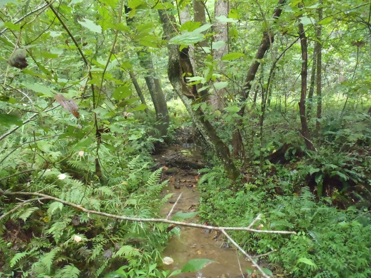
Small Unidentified Stream in District
Exploring Small Stream
Gold panning is a back breaking endeavor in which a relatively small amount of material can be processed (panned) in a lengthy period of time. I had no expectations of “striking it rich” as this area had been explored since the early 1800’s. My goal was simply to apply myself to the task at hand and if luck be with me possibly turn up “some color”.
Gold prospecting equipment abounds far beyond a simple gold pan as the following website demonstrates (there are many gold prospecting supplies sites on the Internet) the possible gear to incorporate in your endeavor.
https://www.goldfeverprospecting.com/goprsu.html
By using a “sluice box” a “high banker or power sluice” or other small or large piece of equipment, one can process a far greater amount of material thus increasing the chances of successfully locating gold. I visited a prospecting shop in Tennessee and I must say the equipment is impressive. For a small investment (several hundred dollars) one can purchase a small battery operated sluice. This equipment is a self-contained unit using batteries to operate a water pump which washes down the material fed onto the rubber grooved belt (riffles). One merely has to do is “feed” material onto the belt. This is my personal favorite. And, if I were to prospect for gold in the future this is the type equipment I would use.
During the course of my first day panning and an uncounted number of handfuls of creek sediment panned, I was ready to call it a day. My back was stiff and sore even though I was sitting but still in a bent over position all day. I was able to locate some color from my endeavor however. Yes…..there it was in my pan. A few tiny flecks of gold sparkling in the sun soaked wet pan. This was recreational gold panning at its best.
Gold
I spent the next two days closer to the Coker Creek area locating a number of streams and small feeder waterways and a number of panning sites simply by driving throughout the area. I explored roadside rock outcroppings where possible.
My last day was dedicated solely to Coker Creek. Following the creek by car for a number of miles, I would stop and park when and where possible to dip my pan in either Coker Creek or a feeder stream no matter how small. Hours passed so quickly. My ultimate goal was to reach the spot where Coker Creek flows into the Hiwassee River. This may or may not have been a “good spot” to pan. Who knows? It certainly makes sense that everything eventually ends up at the bottom. I really just wanted to be at that spot. My plans included a preselected GPS point where I would park my vehicle, higher up on the mountain, pack my backpack and head out on foot, down the mountain side following the creek. The creek drops out of the Unicoi Mountains quite a distance through a steep gorge on its way to the river.
Sand Grain Sized Gold
So here I was, on the edge of a mountain looking down at a wildly rushing flow of water tumbling down to who knows where. I could only imagine myself back in the early 1800’s, an early explorer, a gold prospector, alone in the forest, alive with Indians possibly hostile. Trespassing on Indian Territory would have been unnerving to say the very least. Here I was, unable to defend myself should a hostile group of Indian appear. What would they do should they discover my presence? Forest sounds amplify themselves and lead the imagination to frightful thoughts. Specter shapes of light and dark add to the feeling of being watched. Land contours, fallen trees, clumps of Earth take on ghostly forms. Alone in Indian Territory.
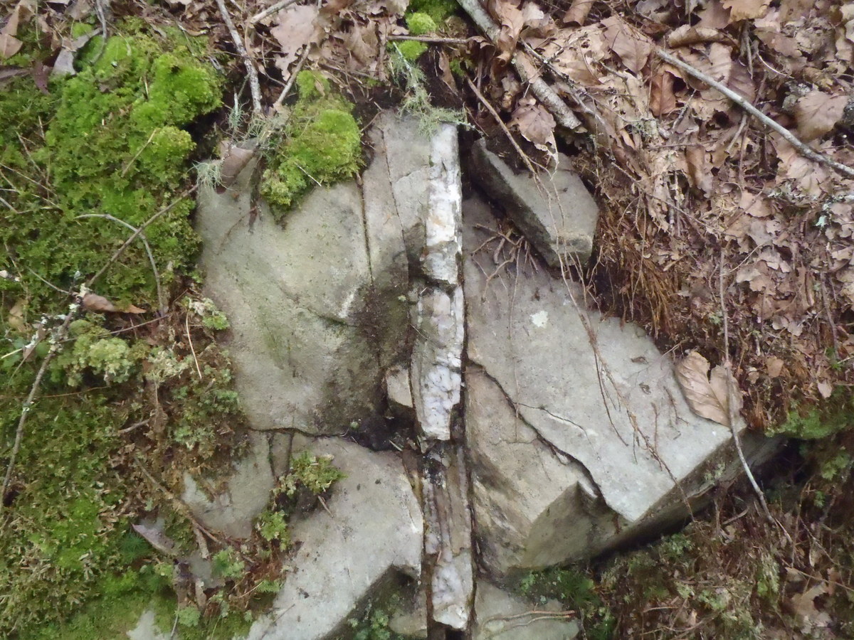
I explored everything on my way down from uprooted trees, rocky outcrops, quartz exposures, creek bed rocks and sediments. I panned in several spots on the way down. Numerous white quartz exposures were explored for a little color. The day of locating gold nuggets on the surface are probably gone forever. But, this is what keeps prospectors from coming back …..there may be one last nugget to find. It’s the same with playing the lottery or any game of chance. Though the odds are completely against you there is still a tiny possibility. This tiny possibility stirs the emotions and makes you want to try your luck.
Quartz Outcrop
Quartz Outcrop
Coker Creek Waterfalls
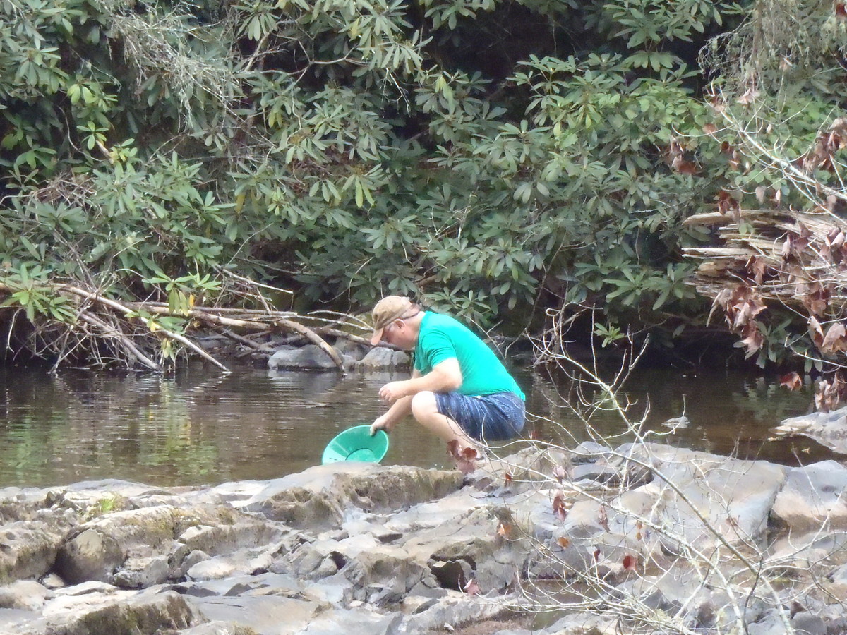
Panning For Gold in Coker Creek
Try Various Spots
I Can Smell the Gold
I spent hours hiking in a downward direction, using my handheld GPS (with extra batteries) climbing down some very steep locations, though I am always aware of being hurt or disabled. Fortunately, I do carry a medical handbook and am able to perform a few medical procedures should something come up. Most remote spots such as this cellphone service is not available, but it would not matter as I do own a cell phone. I remember watching a film (based in fact) in which a hiker became trapped in a rocky mountainous region. While climbing a rocky hillside his footing gave way and his leg became wedged within a crevice. To make the story short, the hiker after enduring days of pain and anguish, in desperation cut off his leg in order to save his life, managed to travel several miles where he was fortunate enough to be found by other hikers.
Sediments Ready to Reveal Gold
With the day more than half gone my personal expedition had reached the Hiwasssee River. I was elated. The trip was successful on several fronts. I survived the trip down the mountain and I located some color in Coker Creek.
Regardless of the Size You Will Recognize Gold
Some things I have learned so far….gold panning is not something one would quit their day job for but it is a very interesting recreation. The use of a pan is an extremely slow back breaking process. But a pan is by far the easiest lightest implement to carry and use when gold prospecting. For a prospector who will be in the field more than just once or twice a sluice or better yet a power sluice can process far more material in a far shorter time period and increase ones chances at finding gold. The gold pan is far more authentic and creates the picture of early prospectors.
Flattened Panned Gold
It is possible to find flecks gold (in very limited amounts) here in the hills of Tennessee. No special talents are needed, no special training necessary. One just needs patience, lots of it. The size of the water source is not important. One can pan in a river or a tiny trickle of flowing water. When panning one only needs a small flow of water. It may even help to stack a few rocks in the flow of water to build a small dam. You only need enough water to swirl the sediments.
Yes, there may be “good spots”…. but if they are so good why doesn’t everyone pan in the same spot? Gold is where you find it. One spot is just as good as the next.
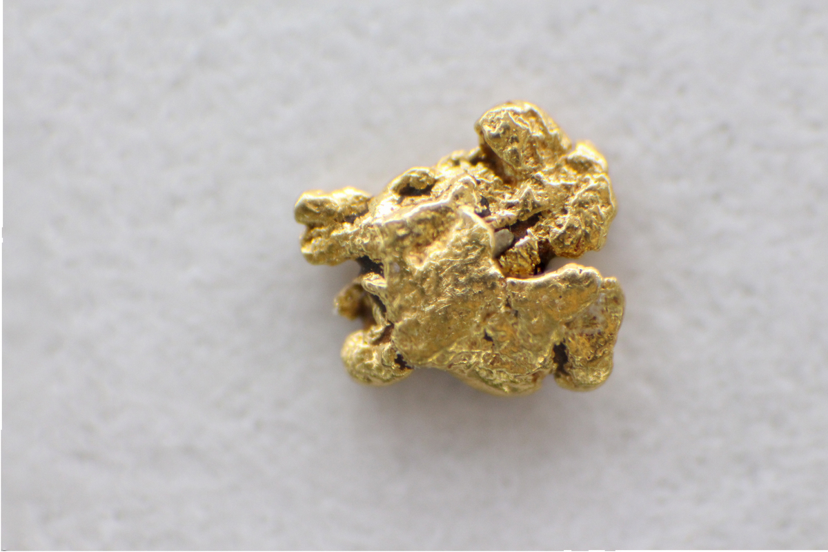
The Face of Gold
After reading the preceding story you are moved to write me and say, “Frank the gold story was very interesting”. “I too would like to give it a try but, you never explained just how to go about actually operating a pan and processing material”. “All you wrote is that it takes lots of patience, no skill or no training”.
You are perfectly correct to bring up this point. If you will just give me one more minute I’ll give you the basics and you will be hauling in the yellow ore.
Before we can begin however there are a few prerequisites.
1. You need a pan first off. Yes, you can use any frying pan, skillet, deep dinner plate, Chinese wok. You can cut the bottom of a bucket off and use that. This is what‘s great about this activity…you do not need to spend a lot of cash for gear. If you so desire yes you can buy a plastic pan made for panning.
https://www.amazon.com/SE-GP1013G12-Green-Plastic-Riffles/dp/B00IKY42AW
The plastic store bought pans have “riffles” built into them, which is a very good thing to have. Riffles are grooves, slots or depressions. As you use your pan, material will collect or become trapped in these slots.
2. A cheap “snifter and bottle”. Or an eye dropper and a small plastic bottle to store your gold in.
3. The next important item you will need: it really helps if you are in a known gold producing area. Sure, you can try your luck anywhere in the world. But physically being in a known gold producing area will increase your chances of finding gold immensely.
4. Finally you will need a water source. The water can be stagnant or flowing. It can be a large river, lake, pond, stream, creek, even a tiny source will do. Water is necessary in the panning process.
OK, you have the four prerequisites, the pan, storage bottle, the water, the area. Now you are ready. Let’s continue and see if you can swirl out some color. Boots are purely optional, this will be up to you. If you have a plastic stool, like I use, you can sit directly in the water and stay relatively dry. You can “stoop” or sit, this is up to you also. You have to be very close to the water, almost in it.
1. I will leave this next decision up to you. You can either place your pan in the water, under the water or hold it on dry land. I like to place the pan underwater. After making his tough decision, what you want to do is scoop up a handful or two of sediment from the bottom of your water source or from dry land, no matter, and place this sediment into the pan. Leave out the big rocks. You can certainly look the rocks over just in case you may have found a lump of gold. Don’t laugh….it has happened. If you must, dig down a little to get to the sediment.
1a. This step is for those who have a tiny water source. Depending on the size and depth of your water source, you will either have to dig down into the earth to increase the depth of the water and/or expand your operating area. If you have a small flowing source of water you can dam the water up using stones, twigs, soil. The idea is that you need to manipulate your water source to get it deeper than your pan and maybe a channel two foot in length.
Build a Dam to Raise Water Level
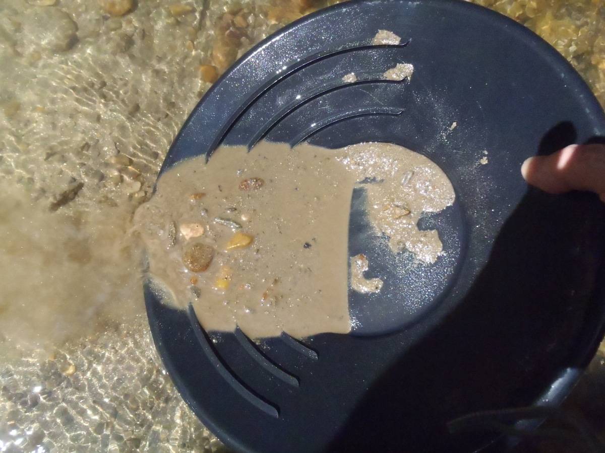
Swirling Off Sediment
2. Your pan and its contents now must be filled with water. This is why it is usually best to start out by placing the pan underwater to begin with. With your panful of sediment and water swirl the material around, shake it, jar it, vibrate it, slosh it around. The whole idea of finding gold with this method relies on the fact of weight or density. Gold is one of the heaviest metals per equal samples. Gold, by weight ranks right up there with Iridium, Osmium, Platinum and Tungsten. Gold is almost four times heavier than iron, per equal sample. This all has to do with its atomic structure. When you shake and swirl your pan, what you are doing is causing the heaviest materials in the pan to sink to or very near the bottom of the pan.
A Handful of Sediment Added to Pan
3. There are several ways to perform the next step. You choose. Knowing the heaviest material in your pan is now located at or very near the bottom of the pan, you want to remove the upper layers of sediment. But, and this is very important, not all at once. We will do this in steps. You can gently scrap the upper layer off. You can position your pan at an angle under water and shake the upper material off. You can tip you pan at an angle while under water, shake it gently and while pushing the pan away from you allow the water to pull off the upper layer of sediment. This is where the “riffles” come into play. You want to allow the exiting upper layer of sediment to move across the riffles below. With the entire amount of sediment in motion, the heavy material also moves forward. What will happen is that this heavy material, while in motion, will now become caught or trapped in the riffles and not be allowed to leave the pan.
4. And again, allow the pan to fill with water, shake or swirl the contents. The heaviest material finds its way to the bottom. Shake under water and allow the upper material to flow out of the pan. This process is repeated numerous times. Each time more and more sediment exits the pan leaving the heavier material behind. Also, as larger pebbles become visible, you can hand pick them out and discard after examining them.
Allow the Water to “Pull” the Sediment Off the Top
5. At some point when the pan is almost emptied of sediment you should arrive at a layer of what’s called “black sand”. This is a critical stage, if you do have gold in your pan it will be lying directly below the black sand. Black sand is pretty much iron material, magnetite and what not. Gold being heavier than iron will, due to weight and density, be found below the iron. It works every time. Again repeat the procedure, allow the black material to exit the pan. If you have gold it will begin to show itself. Repeat the procedure and cross your fingers.
6. If you have gold you will know it immediately. There will be no question in your mind. That golden yellow color can be easily recognized. Get your snifter and bottle. Fill the bottle with water, suck up your gold with the eye dropper, squeeze the rubber bulb and deposit the gold in the bottle. Secure the lid and keep on going. Before you know it you will have more gold than you need, (wishful thinking). There it is………….Good Luck!
No Gold – Keep Trying
Back at my lodgings as the moon was rising, it was time to pack up and continue on to the next destination. My trip would continue on into the Ducktown Mining District of Tennessee and the old Burra Burra Copper mine. I would drive up, over and down the mountains into Eljay, Georgia. This area was home to many many former gold mines. And, for those interested in the old stone iron furnaces, a number of these can be located here in the surrounding area. I stopped and visited "Fort Mountain" a prehistoric site and "Brasstown Bald" the highest point in Georgia. My trip would then continue into the heart of the gold belt at Dahlonga, Georgia, where a U.S. mint was built to handle the vast amount of gold being produced.
****For those interested in the old stone iron furnaces, see my article 22. Iron and The Old Stone Furnaces of Western Pennsylvania
Thank you
Good Luck
Frank
Ashley, G.H., 1911, The Gold Fields of Coker Creek, Monroe County, Tennessee: Geological Survey of Tennessee, The Resources of Tennessee, p. 79 – 107.
Slack, J.F. and Force, E.F., U.S. Geological Survey and Behum, P.T., and Williams, B.B., U.S. Bureau of Mines, 1984, Mineral Resources of the Citico Creek Wilderness Study Area, Monroe County, Tennessee, Geological Survey Bulletin 1552, An evaluation of the mineral potential of the area
***Many thanks to:
Wikipedia for reference materials
Google Earth for the satellite Imagery of the Coker Creek area.
Websites listed in this article
Article has been viewed at least 5197 times.