Tungsten King Mine, Little Dragoon Mts. Arizona
Last Updated: 1st Mar 2018By Rolf Luetcke
Tungsten King Mine, Little Dragoon Mts. Arizona
By Rolf Luetcke
Back in the late 1980's we were exploring the various mines of Cochise County in southeastern Arizona and came across one that was interesting in how it was located. The access we used was from Tres Alamos Wash north of Pomerene Arizona. Driving way up the wash there were dirt side roads that left the wash on both sides on occasion. As one drove up the wash one could see the hills of the Little Dragoon Mountains to the East. They were a set of steep hills that were several miles long and maybe a thousand feet high at the highest point. Driving up a dirt road out of the wash to the south the road wound through the brushy plateau country of the area. Most of the roads here were ranch roads that accessed cattle tanks and salt stations for the cattle the ranchers had in the area. Driving toward the mountains a dirt road ran along the lower slopes of the mountains and one side road headed toward a mine dump we could see high up on the upper part of the mountain. The canyon was very steep and dropped off in several waterfalls when we stopped to view the canyon from below.
At the time I wondered how they had accessed the mine since the canyon looked impassable. As we looked at the direction of the road we could see it left the bottom of the canyon and went steeply up the south side of the hill, next to the canyon and zig-zagged back and forth on the side of the hill . At the time I was driving my VW Bus and using it as an off road vehicle. I started driving up the old mine road and it wound its way along the side of the hill and then went back toward the steep canyon and then became very steep as it kept going toward the mine along the side of the steep hill. Here is where we came to something I had never seen before. The incline was so steep that driving up a dirt road one would just spin ones wheels and we came to a section of the road that was steepest and it was covered by a thick layer of cement. The cement made for good traction but was still extremely steep. Bushes had started growing in the cracks of the cement and grew over the road from both sides but we made it up this steep section of cemented road to the mine.
There was enough, barely enough, room to turn around here and then explore the mine. I could envision having to back down this road but the small spaces at the bottom of the dumps were just enough to turn our vehicle around. A big pickup truck may not have been able to turn around here. The view from here was great and one could see west across the whole San Pedro Valley. The steep canyon started right below the mine dumps and dropped off in several falls and the rocks below the falls held water, a nice thing for the wildlife of the area. One could not climb down this canyon since it was just too steep. Just at the bottom of the canyon we could see there were also a few small mine dumps. Those had not been visible from the road below.
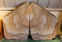
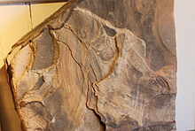
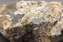
The Tungsten King mine dump went along the north side of the small canyon along a flat space that had been made along the side of the canyon. At the center of the canyon was the mine tunnel of the Tungsten King Mine. The mine had a stream of water running out from the mine and the tunnel had the whole surface of the floor under water. There was a lot of brush that had grown in this canyon and the various parts of the mine had been mostly covered by brush again. I never entered the mine since it was flooded. Looking up the canyon we could see that some digging had also been done where veins of rock were exposed on the surface. We didn't see much in the rock of the dumps, mostly the schist of the host rock that they had left behind. The hosting schist contained mica, pyrite, orthoclase, quartz, garnet and calcite. Not much color to indicate anything besides the iron that colored a lot of the calcite nearly black. The spot below, where we had turned around there were also the remains of an old stone building and on the side a sign that had the name of the mine on it.
We picked up several small bags of material and then headed back down the cement road to the bottom. The host rock here was quite dark and compact and sparkled but had few open pockets to find mineral crystals. When we got to the area of the small dumps we had seen from above we went to have a look. Nothing different than what we had seen above and we didn't pick up any material from here.
In checking out the material after getting home we found about a dozen minerals. One may think this is where the story ends but it is not so. Years later we were driving to Pomerene a few miles north of Benson and the main road made a sharp turn to the north and a small dirt road went west toward the San Pedro River and we took this small dirt road. The road went to a big field and then split in three directions. The one to the left was gated and went onto a large cattle pasture. The same for the other side and a gate here as well and it looked like there may have been a ranch out along this road. This road was the only one that had a sign to keep out on it. The center road didn't have a gate or a sign and was a narrow dirt road that went in between the thick brush toward the river. We drove this road a couple of hundred yards and the area opened up and we saw piles of mine ores lying about. We stopped and explored the area. There were big piles of mineralized material but it was not easy to tell what kind of ore it was and at the time we didn't pick up much since it looked barren of any metallics I often looked for to indicate what had been mined here. I realized it was not from here also and must have been brought in from somewhere else. At this time I didn't connect the ore piles with the Tungsten King since it had been a number of years since we had been up to the mine.
Just over the steep twenty foot drop at the edge of the San Pedro River were old cement structures where ores had been processed. Large cement tanks and other milling remnants were here including an old wooden ore chute. It had been some kind of processing area but at the time I had no idea what it had been used for. It was a number of years later we were talking to a relative who was really interested in the local history and knew about all those out of the way places we had also visited. When we talked to him about the mill site at Pomerene he said it was a tungsten mill from the Tungsten King mine way up on the Little Dragoon Mts. Now the pieces of the puzzle for us fell into place. Our brother in law said that they had used the site by the San Pedro River to process the ores from the mine since there was not a good place at the mine to process the ores and the San Pedro provided the water they needed to crush the ores and get the concentrate to be shipped out.
On later research I discovered that the Tungsten King mine had been discovered in 1913 and the mining had started in 1916 and had been mined for the war effort where they needed tungsten ores. The mine had been intermittently worked until it closed for good in 1954. About 12 tons of material had been mined for the tungsten. The cement had been put in exactly for the reason I had thought for the vehicles to make it to the mine without spinning their wheels. I assume it was also very necessary when trucks filled with the ore drove down the very steep road to get good traction and not lose control on the steep road. I was quite surprised that the cement was still in the good shape it had been in when I drove up to the mine.
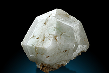
Having now learned the mill site was tungsten ore I drove back to the mill one evening with my black light and found fluorescence in the material on the piles. I filled several bags of the best fluorescing material and then went back a couple more times to collect the better material containing the brightly fluorescing scheelite. Besides the scheelite there was also orange fluorescing calcite in the ore but not much else of interest that I could find.
In the 2000's I wanted to take another trip up to the mine and there is another access road that goes to the area from the freeway East of Benson. The exit here is Sybil road and then under the freeway to the north and along the freeway and then a ranch access road toward the mountains. At the ranch there was a gate at the time and a sign in book at the big gate. One signed in and one could access the area through the ranch. We had taken our ATV this time and left the tow vehicle with the trailer near the place the access road by the freeway went north toward the ranch. We rode the ATV along the dirt roads that skirted the mountains and found the side road that went up to the mine. When we approached the canyon things had totally changed . There was a long locked gate and cable on both sides that blocked off any vehicle traffic and a big sign which was from the State of Arizona noting no vehicle traffic was allowed past this point. The gate had been placed where it was not possible to drive around because of the rock outcroppings that went along both sides beyond the gate. The local hunters have a tendency to go around locked gates but this had not happened here. I parked below and decided I wanted to hike up the hill to the mine to see if things had changed much. The other reason was that on the mineral list was beryl and it was something I had hoped to find at least an example of. Mary stayed below since her asthma made a quick and very steep hike difficult. I could see her from all along the road to the mine as I hiked up. She had settled in under a nice mesquite tree and was relaxing while I worked my way up. The cement was still there but more brush had grown over the road and it would now have been much more difficult to drive if access by vehicle had been allowed.
I made it up to the mine again and this time looked more closely at the dumps but found little to put in my pack to carry back. The people working the mine had been very thorough and left little of the ore material on the dumps. The mine was even more overgrown and there was still water in the mine but it had been dry and water was not in the canyon below on this visit. There were a lot of animal tracks in the mud by the mine, deer, javalina, coyotes, rabbits, squirrels, birds and more could be seen in the mud.
It was a shame that the road had been closed off but since there was not too much at the mine it is not a place we needed to return to. It was just an interesting part of the history of our area and I was happy to have gone here a few times. The area is quite wild and I am sure hikers and hunters still use the area. On the way back out we signed out at the gate by the ranch. The sign in was useful if anyone was lost or injured up in the mountains, the book could show they didn't return and were still out there somewhere.
In the material we collected at the Pomerene mill we did find quite a lot of scheelite in the ores but little in the way of crystals. We had also found out that the mill was used only for the Tungsten King Mine and no other ores had been brought here for processing.
One trip to the mill at Pomerene was a bit more of an adventure than I had wanted. I had an old Jeep station wagon and I had decided to visit the mill site with my dog. It had been a very wet summer rainy season and as I drove the dirt road toward the mill it was hard to see the actual surface of the road since weeds were several feet high. I was driving slowly toward the mill when the front of the Jeep suddenly dropped into a hole in the road with a big bang and my dog fell down onto the floor. I got out and saw that a sink hole had formed and was covered by weeds so was not visible to a driver. The hole was big enough my whole left front wheel fell into the hole. I was lucky to have all the tools necessary to pull the Jeep back out with a come-a-long and using the mesquite trees by the side of the road. I was not able to drive to the mill this time and when I got the Jeep out again to the road surface I saw it leaned on the front left side and when I got out and looked under the Jeep I saw that one of the leaf springs had broken. Well, that was not a very nice trip to walk the dog but I was able to replace the spring with a few hours hard work. I have not been back to the old mill since.
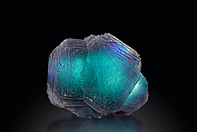
I still have a number of boxes of the scheelite ores from the mill and it all has a very nice fluorescence. The mine has 16 minerals listed and I was able to find enough specimens to be able to get some photos of minerals from there. I added three more minerals that were in the ores I reexamined recently. I never did find any of the beryl I had gone back to look for so that one still eludes me.
By Rolf Luetcke
Back in the late 1980's we were exploring the various mines of Cochise County in southeastern Arizona and came across one that was interesting in how it was located. The access we used was from Tres Alamos Wash north of Pomerene Arizona. Driving way up the wash there were dirt side roads that left the wash on both sides on occasion. As one drove up the wash one could see the hills of the Little Dragoon Mountains to the East. They were a set of steep hills that were several miles long and maybe a thousand feet high at the highest point. Driving up a dirt road out of the wash to the south the road wound through the brushy plateau country of the area. Most of the roads here were ranch roads that accessed cattle tanks and salt stations for the cattle the ranchers had in the area. Driving toward the mountains a dirt road ran along the lower slopes of the mountains and one side road headed toward a mine dump we could see high up on the upper part of the mountain. The canyon was very steep and dropped off in several waterfalls when we stopped to view the canyon from below.
At the time I wondered how they had accessed the mine since the canyon looked impassable. As we looked at the direction of the road we could see it left the bottom of the canyon and went steeply up the south side of the hill, next to the canyon and zig-zagged back and forth on the side of the hill . At the time I was driving my VW Bus and using it as an off road vehicle. I started driving up the old mine road and it wound its way along the side of the hill and then went back toward the steep canyon and then became very steep as it kept going toward the mine along the side of the steep hill. Here is where we came to something I had never seen before. The incline was so steep that driving up a dirt road one would just spin ones wheels and we came to a section of the road that was steepest and it was covered by a thick layer of cement. The cement made for good traction but was still extremely steep. Bushes had started growing in the cracks of the cement and grew over the road from both sides but we made it up this steep section of cemented road to the mine.
There was enough, barely enough, room to turn around here and then explore the mine. I could envision having to back down this road but the small spaces at the bottom of the dumps were just enough to turn our vehicle around. A big pickup truck may not have been able to turn around here. The view from here was great and one could see west across the whole San Pedro Valley. The steep canyon started right below the mine dumps and dropped off in several falls and the rocks below the falls held water, a nice thing for the wildlife of the area. One could not climb down this canyon since it was just too steep. Just at the bottom of the canyon we could see there were also a few small mine dumps. Those had not been visible from the road below.
The Tungsten King mine dump went along the north side of the small canyon along a flat space that had been made along the side of the canyon. At the center of the canyon was the mine tunnel of the Tungsten King Mine. The mine had a stream of water running out from the mine and the tunnel had the whole surface of the floor under water. There was a lot of brush that had grown in this canyon and the various parts of the mine had been mostly covered by brush again. I never entered the mine since it was flooded. Looking up the canyon we could see that some digging had also been done where veins of rock were exposed on the surface. We didn't see much in the rock of the dumps, mostly the schist of the host rock that they had left behind. The hosting schist contained mica, pyrite, orthoclase, quartz, garnet and calcite. Not much color to indicate anything besides the iron that colored a lot of the calcite nearly black. The spot below, where we had turned around there were also the remains of an old stone building and on the side a sign that had the name of the mine on it.
We picked up several small bags of material and then headed back down the cement road to the bottom. The host rock here was quite dark and compact and sparkled but had few open pockets to find mineral crystals. When we got to the area of the small dumps we had seen from above we went to have a look. Nothing different than what we had seen above and we didn't pick up any material from here.
In checking out the material after getting home we found about a dozen minerals. One may think this is where the story ends but it is not so. Years later we were driving to Pomerene a few miles north of Benson and the main road made a sharp turn to the north and a small dirt road went west toward the San Pedro River and we took this small dirt road. The road went to a big field and then split in three directions. The one to the left was gated and went onto a large cattle pasture. The same for the other side and a gate here as well and it looked like there may have been a ranch out along this road. This road was the only one that had a sign to keep out on it. The center road didn't have a gate or a sign and was a narrow dirt road that went in between the thick brush toward the river. We drove this road a couple of hundred yards and the area opened up and we saw piles of mine ores lying about. We stopped and explored the area. There were big piles of mineralized material but it was not easy to tell what kind of ore it was and at the time we didn't pick up much since it looked barren of any metallics I often looked for to indicate what had been mined here. I realized it was not from here also and must have been brought in from somewhere else. At this time I didn't connect the ore piles with the Tungsten King since it had been a number of years since we had been up to the mine.
Just over the steep twenty foot drop at the edge of the San Pedro River were old cement structures where ores had been processed. Large cement tanks and other milling remnants were here including an old wooden ore chute. It had been some kind of processing area but at the time I had no idea what it had been used for. It was a number of years later we were talking to a relative who was really interested in the local history and knew about all those out of the way places we had also visited. When we talked to him about the mill site at Pomerene he said it was a tungsten mill from the Tungsten King mine way up on the Little Dragoon Mts. Now the pieces of the puzzle for us fell into place. Our brother in law said that they had used the site by the San Pedro River to process the ores from the mine since there was not a good place at the mine to process the ores and the San Pedro provided the water they needed to crush the ores and get the concentrate to be shipped out.
On later research I discovered that the Tungsten King mine had been discovered in 1913 and the mining had started in 1916 and had been mined for the war effort where they needed tungsten ores. The mine had been intermittently worked until it closed for good in 1954. About 12 tons of material had been mined for the tungsten. The cement had been put in exactly for the reason I had thought for the vehicles to make it to the mine without spinning their wheels. I assume it was also very necessary when trucks filled with the ore drove down the very steep road to get good traction and not lose control on the steep road. I was quite surprised that the cement was still in the good shape it had been in when I drove up to the mine.
Having now learned the mill site was tungsten ore I drove back to the mill one evening with my black light and found fluorescence in the material on the piles. I filled several bags of the best fluorescing material and then went back a couple more times to collect the better material containing the brightly fluorescing scheelite. Besides the scheelite there was also orange fluorescing calcite in the ore but not much else of interest that I could find.
In the 2000's I wanted to take another trip up to the mine and there is another access road that goes to the area from the freeway East of Benson. The exit here is Sybil road and then under the freeway to the north and along the freeway and then a ranch access road toward the mountains. At the ranch there was a gate at the time and a sign in book at the big gate. One signed in and one could access the area through the ranch. We had taken our ATV this time and left the tow vehicle with the trailer near the place the access road by the freeway went north toward the ranch. We rode the ATV along the dirt roads that skirted the mountains and found the side road that went up to the mine. When we approached the canyon things had totally changed . There was a long locked gate and cable on both sides that blocked off any vehicle traffic and a big sign which was from the State of Arizona noting no vehicle traffic was allowed past this point. The gate had been placed where it was not possible to drive around because of the rock outcroppings that went along both sides beyond the gate. The local hunters have a tendency to go around locked gates but this had not happened here. I parked below and decided I wanted to hike up the hill to the mine to see if things had changed much. The other reason was that on the mineral list was beryl and it was something I had hoped to find at least an example of. Mary stayed below since her asthma made a quick and very steep hike difficult. I could see her from all along the road to the mine as I hiked up. She had settled in under a nice mesquite tree and was relaxing while I worked my way up. The cement was still there but more brush had grown over the road and it would now have been much more difficult to drive if access by vehicle had been allowed.
I made it up to the mine again and this time looked more closely at the dumps but found little to put in my pack to carry back. The people working the mine had been very thorough and left little of the ore material on the dumps. The mine was even more overgrown and there was still water in the mine but it had been dry and water was not in the canyon below on this visit. There were a lot of animal tracks in the mud by the mine, deer, javalina, coyotes, rabbits, squirrels, birds and more could be seen in the mud.
It was a shame that the road had been closed off but since there was not too much at the mine it is not a place we needed to return to. It was just an interesting part of the history of our area and I was happy to have gone here a few times. The area is quite wild and I am sure hikers and hunters still use the area. On the way back out we signed out at the gate by the ranch. The sign in was useful if anyone was lost or injured up in the mountains, the book could show they didn't return and were still out there somewhere.
In the material we collected at the Pomerene mill we did find quite a lot of scheelite in the ores but little in the way of crystals. We had also found out that the mill was used only for the Tungsten King Mine and no other ores had been brought here for processing.
One trip to the mill at Pomerene was a bit more of an adventure than I had wanted. I had an old Jeep station wagon and I had decided to visit the mill site with my dog. It had been a very wet summer rainy season and as I drove the dirt road toward the mill it was hard to see the actual surface of the road since weeds were several feet high. I was driving slowly toward the mill when the front of the Jeep suddenly dropped into a hole in the road with a big bang and my dog fell down onto the floor. I got out and saw that a sink hole had formed and was covered by weeds so was not visible to a driver. The hole was big enough my whole left front wheel fell into the hole. I was lucky to have all the tools necessary to pull the Jeep back out with a come-a-long and using the mesquite trees by the side of the road. I was not able to drive to the mill this time and when I got the Jeep out again to the road surface I saw it leaned on the front left side and when I got out and looked under the Jeep I saw that one of the leaf springs had broken. Well, that was not a very nice trip to walk the dog but I was able to replace the spring with a few hours hard work. I have not been back to the old mill since.
I still have a number of boxes of the scheelite ores from the mill and it all has a very nice fluorescence. The mine has 16 minerals listed and I was able to find enough specimens to be able to get some photos of minerals from there. I added three more minerals that were in the ores I reexamined recently. I never did find any of the beryl I had gone back to look for so that one still eludes me.
Article has been viewed at least 701 times.