Keweenaw (Part 1) Keweenaw Point
Last Updated: 19th Jan 2015By Larry Maltby
Introduction
This is the first in a series of articles about the Michigan Copper Range. In 1950, as a young boy, I traveled here on a family camping trip. We saw for the first time the views of the wilderness from the top of Brockway Mountain. We peered into the crystal clear water along the beaches of Lake Superior. We visited many of the "rock shops" that doted the peninsula and saw the colors and intricate patterns within agates. We stopped at the Seaman Museum which, at that time, was located in Hotchkiss Hall at the Michigan Technical University campus. There we saw the amazing geometry of mineral crystals, including crystals of pure metallic copper that came from the mines in the area. Even the famous landmark, the Quincy No. 6 Shaft House with its "many gabled" architecture, was still standing. I was smitten by all of this!
In later years my wife and I frequently returned to the Keweenaw. These articles will reflect the mineralogy, geology and natural beauty that kept drawing us back.
In later years my wife and I frequently returned to the Keweenaw. These articles will reflect the mineralogy, geology and natural beauty that kept drawing us back.
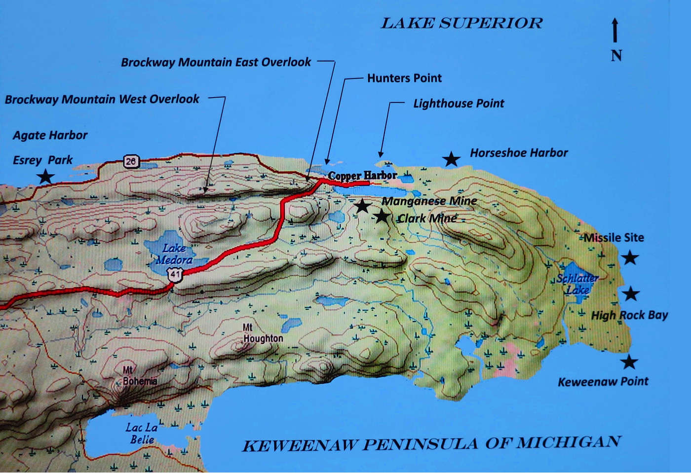
Map, Keweenaw Point
Keweenaw Point
As shown on the map above, the tip of the Keweenaw Peninsula is a north-south shore line about three miles long. Most maps label the southern extremity as Keweenaw Point. The Keweenaw Co. Plat Book also calls out High Rock Bay north of the Point. The Missile Site is almost never mentioned on maps, however, it is a historically interesting location where experimental rockets were fired out over Lake Superior during the 60's. For more information, conduct an internet search on key words, Keweenaw Rocket Range. For many years collectors have used the term "Keweenaw Point" to refer to the entire north-south shore line and the specimens collected there are usually labeled as such.
Going to the point has always been somewhat of an adventure. During the late 50's and through the 60's, we would make the eight mile trip from the end of the pavement to High Rock Bay in the family station wagon. Due to the long rear overhang on the old station wagons the trip would require about one hour of tense driving trying to position the wheels on the deeply rutted road to keep the rear end from dragging.
On another trip to "The Point" we came to the low spot where we usually had to drive through a small stream of water. The beaver had built a large dam right beside the road producing a pond that rose about five feet above the road. We were able to get through by driving on the remains of the road below the dam. Later the County pulled out the dam and installed a culvert. This was a great improvement except that vehicles wore a hole in the top of the culvert large enough for a tire to drop into. The crossing was made by placing a handy piece of plywood over the hole and hoping for the best.
The last time we made the trip, the culvert had been replaced and the crossing was a piece of cake. The only remaining concern was the large water filled holes that covered the road. We checked the depth with a stick and ignored the broken car parts lying beside the road and made it to "The Point" again.
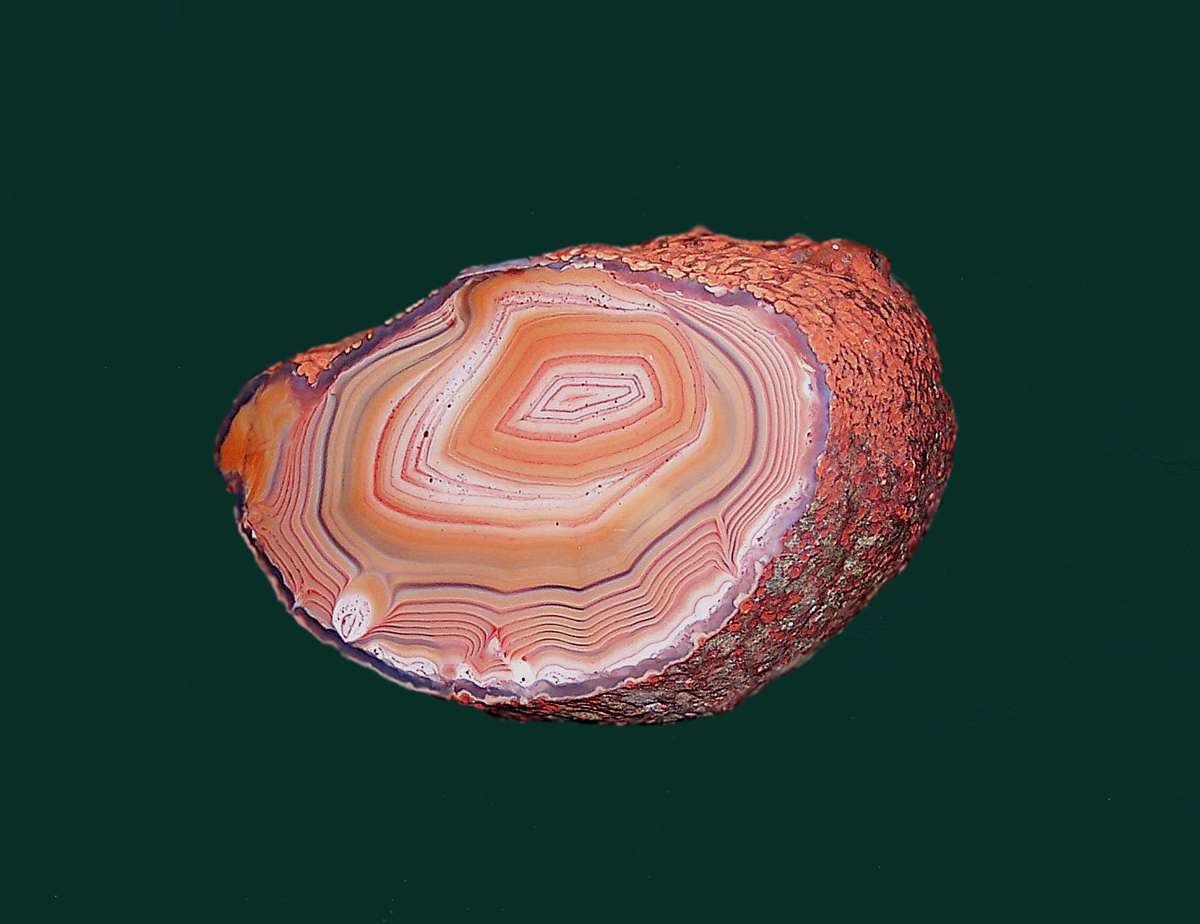
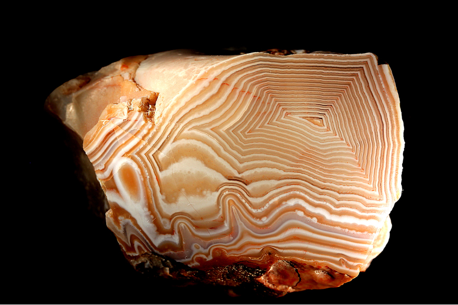
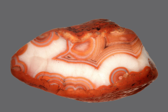
This agate (7.6 x 5.4 cm),is one of the finest ever found at Keweenaw Point. It was collected by Bob Barron in July of 2004. He located the agate while scuba diving near the shore at a depth of about 20 feet and removed it from the submerged weathered basalt of the Lake Shore Traps.
The specimen is currently displayed at the Michigan Technical University,
A. E. Seamon Mineral Museum at Houghton.
The specimen is currently displayed at the Michigan Technical University,
A. E. Seamon Mineral Museum at Houghton.
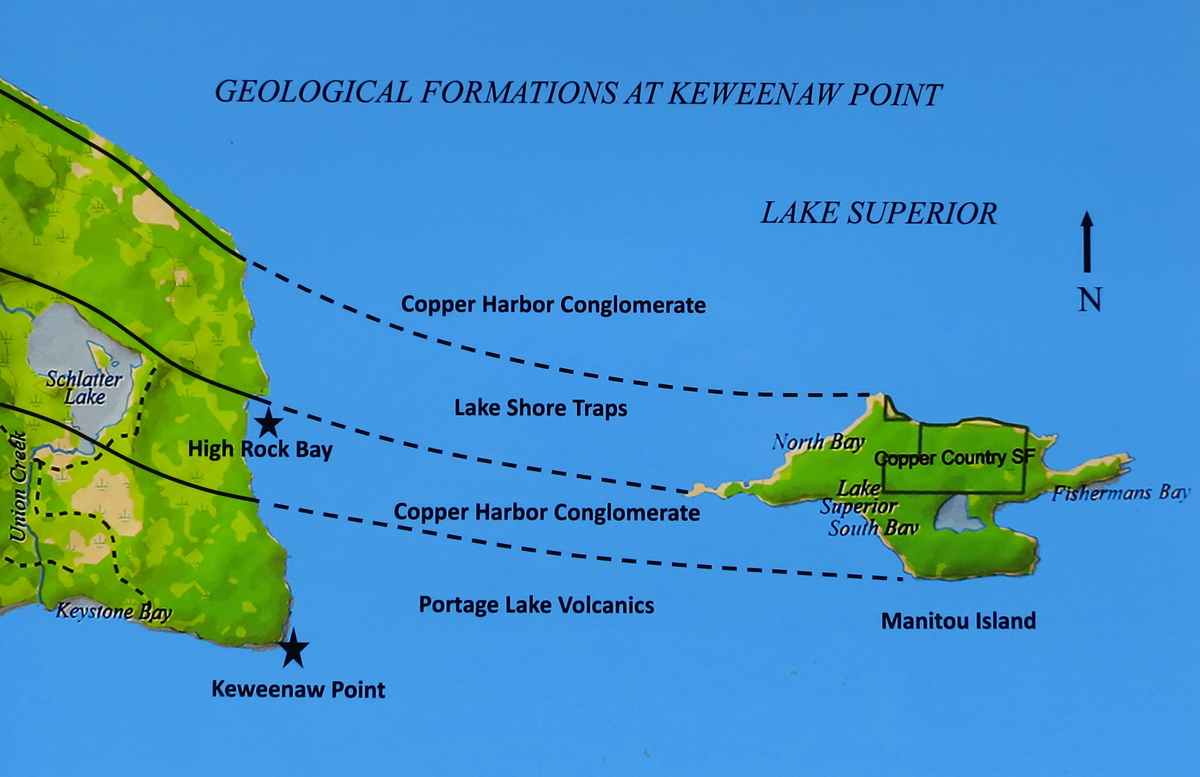
Keweenaw Point, Geology
There are three geological formations that outcrop along the north/south shore of Keweenaw Point. From High Rock Bay north, are the basaltic flows of the Lake Shore Traps. They are an integral part of the encompassing Copper Harbor Conglomerate that extends out into Lake Superior to the north of the point. The traps contain abundant agates, datolite and some interesting minerals in vesicles in the flow tops. South of High Rock Bay, are the outcrops of the Copper Harbor Conglomerate. The southern third of the shoreline has exposures of the Portage Lake Volcanics. All of these formations extend eastward under Lake Superior such that Manitou Island, about three miles off shore, has outcrops of the Lake Shore Traps and the Copper Harbor Conglomerate as shown above.
Accessibility to the outcrops is somewhat limited to the shoreline. Both the peninsula and the island are heavily forested. The area is a wilderness and exposed rocks in the woods are difficult to find.
Accessibility to the outcrops is somewhat limited to the shoreline. Both the peninsula and the island are heavily forested. The area is a wilderness and exposed rocks in the woods are difficult to find.

The end of the road at High Rock Bay is as far as a car can go along the ridge shown to the right.

The Copper Harbor Conglomerate at High Rock Bay rises to about twenty feet above the water giving the bay its name.

Collecting agates at High Rock Bay
The beach agates at Keweenaw Point most likely originated in the flow tops of the Lake Shore Traps. The traps between the Point and Manitou Island were crushed by the glaciers and the rubble has weathered for thousands of years freeing agates into the gravel. But the glaciers have also transported rock debris from Canada onto the beaches of the Keweenaw. Once an agate is eroded from its matrix it is impossible to state with certainty where it was formed, however, for agates found at the Point, the Lake Shore Traps would be a good guess.
Agates

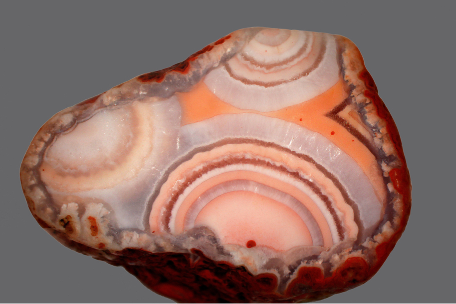
Agate (6.0 x 4.0 cm) Keweenaw Point, extracted from the traps under water.

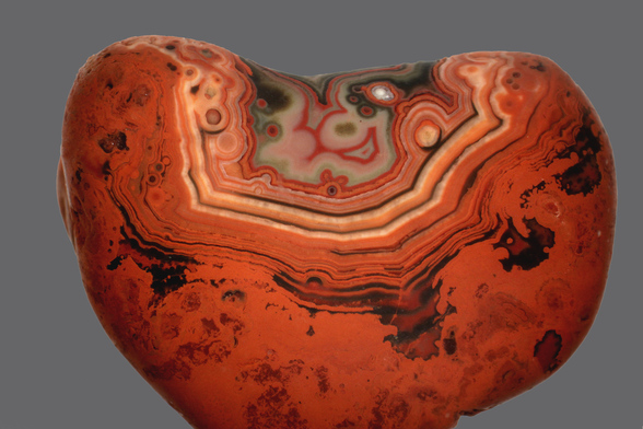
Agate (4.0 x 2.8 cm) Keweenaw Point, found in the wet beach gravel.

Agate (3.8 x 2.6 cm) Keweenaw Point, found in the wet beach gravel.
Agate (5.0 x 3.2 cm) Keweenaw Point, found in the wet beach gravel.

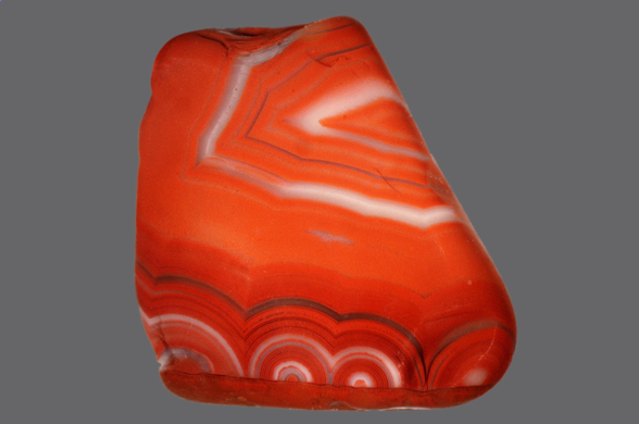
Agate (9.5 cm) Keweenaw Point, collected from a submerged gravel bar by scuba divers.

Agate 12.0 cm) Keweenaw Point, collected from a submerged gravel bar by scuba divers.

Agate rough in basalt (14.5 cm) Keweenaw Point, collected by scuba divers.

Agate rough in basalt (10.0 cm) Keweenaw Point, collected by scuba divers
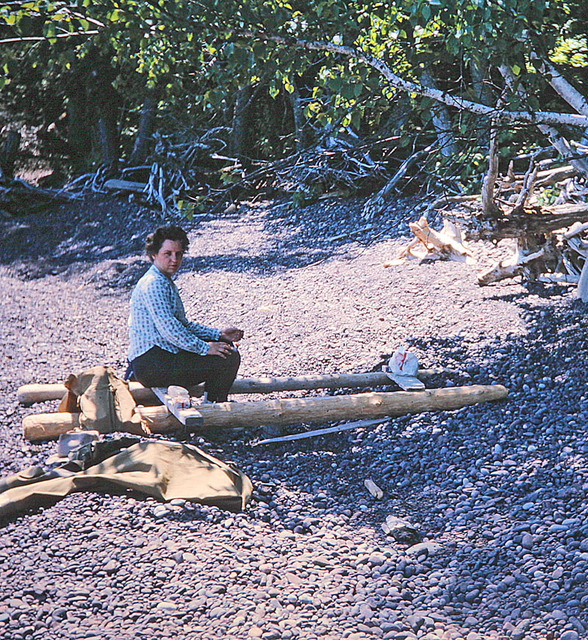
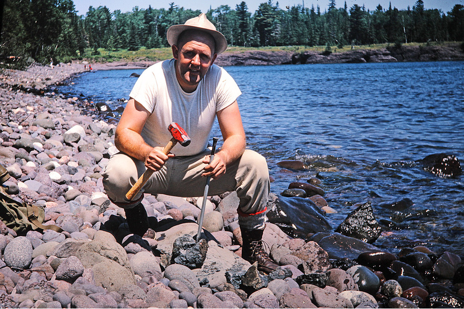
Lunch break at High Rock Bay, August 1965
In the old days, Virginia would always find some driftwood along the beach that she would arrange to make a table of sorts for our lunch. While I would wade along the shore looking in the “wet” gravel for agates, she would paw through the “dry” gravel near her lunch spot. She found many more agates than I did by a ratio of at least 10 to 1. They were all very small and we put them in quart jars of water and forgot about them.
It wasn't until I started doing micro photography that I took another look. We were surprised at how nice they were. The photographic enlargements show their beauty and detail. None of the agates shown in this section have been polished. They were submerged in water and photographed just as they were found on the beach. The refraction of light through the water suppressed the spectral highlights and provided the color saturation needed for the photos.

Agate (1.3 cm) Keweenaw Point
Agate (1.2 cm) Keweenaw Point
Agate (1.2 cm) Keweenaw Point
Agate (1.4 cm) Keweenaw Point
Agate (0.9 cm) Keweenaw Point
Agate (2.0 cm) Keweenaw Point

Agate (2.4 cm) Keweenaw Point

Agate (2.6 cm) Keweenaw Point
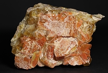
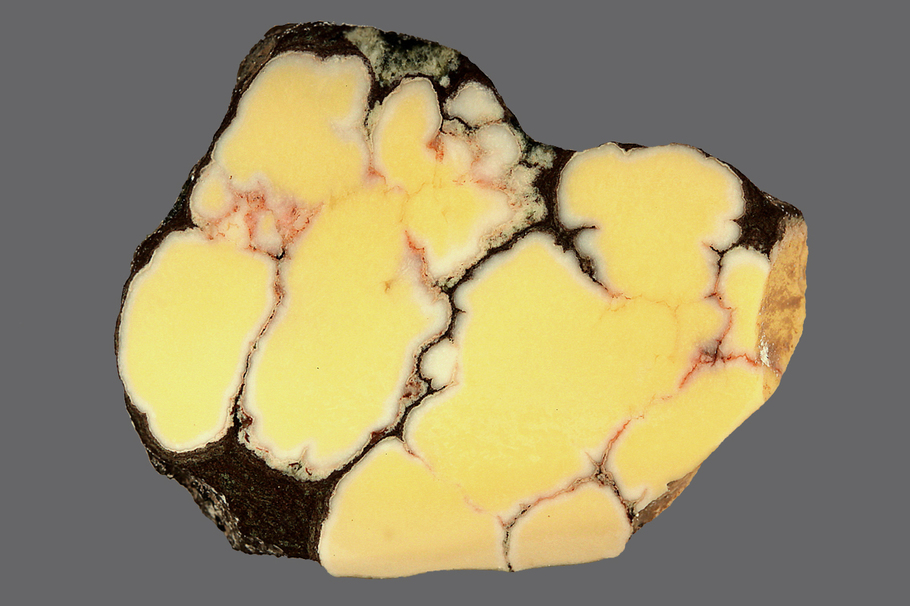
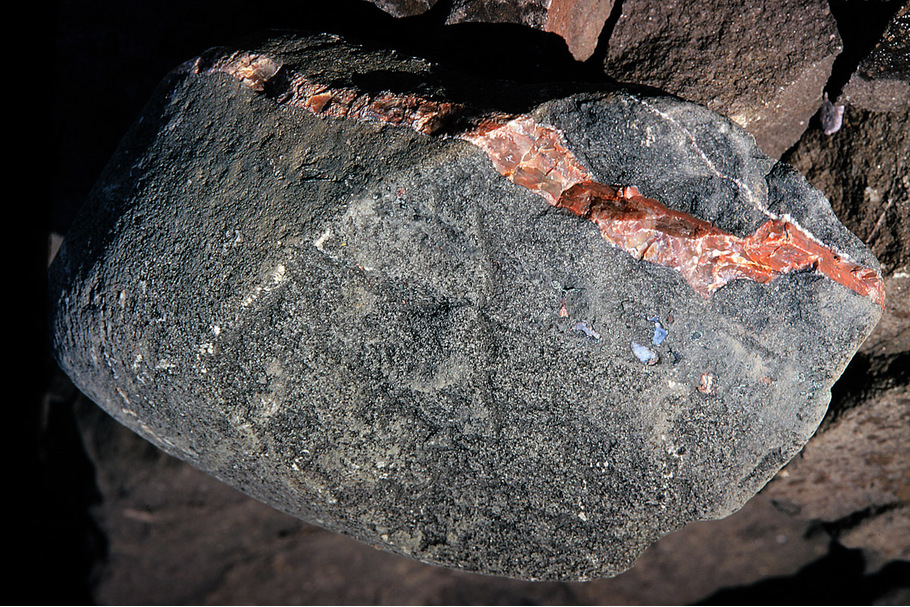
Yellow Datolite
Although it is not well known worldwide, nodular datolite has been sought after by Michigan collectors for many years. High quality datolite is translucent and has porcelain like depth of color that can be very beautiful. The yellow color shown here is at the top of the list for desirability. During the past sixty years or so, the Lake Shore Traps at Keweenaw Point have been the most productive location for these specimens. They have not been plentiful and every summer local collectors have pursued them relentlessly.
The colorful, nodular datolite, found in the Michigan Copper Range is unique and we are not aware of any other source in the world. As we move further down the peninsula with this series of articles, we plan to discuss this subject in more depth.
The colorful, nodular datolite, found in the Michigan Copper Range is unique and we are not aware of any other source in the world. As we move further down the peninsula with this series of articles, we plan to discuss this subject in more depth.

Datolite (3.6 cm) Keweenaw Point

Datolite (2.5 cm) Keweenaw Point
Datolite (2.5 cm) Keweenaw Point

Datolite (4.0 cm) Keweenaw Point
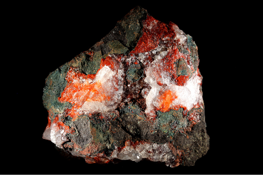
Minerals
Collecting micro minerals at High Rock Bay, August 1965
Most of the collectors that visit the Point are looking for agates on the beach. Some of the local collectors have made the trip in search of the elusive yellow datolite. Over the years there has been some discussion about natrolite crystals being found at the Point, but micro crystals in general, have been largely overlooked. Actually, there are some very nice micro minerals in the Lake Shore Traps and in the large cobbles that line the beach. The cobbles are badly battered and weathered by wave action and do not look like much, but freshly broken material can provide some surprising results.
Agate vein in basalt cobble, High Rock Bay

Agate vein in the cobble shown to the left, (3.5 cm) wide

Agate detail of the vein shown above right (FOV 2.0 cm)
It appears that two tapered crystals have been completely replaced by the agate. Some mineralogists suggest that the original crystals may have been anhydrite. This type of replacement occurs throughout the Lake Shore Traps and the Portage Lake Volcanics.
It appears that two tapered crystals have been completely replaced by the agate. Some mineralogists suggest that the original crystals may have been anhydrite. This type of replacement occurs throughout the Lake Shore Traps and the Portage Lake Volcanics.

This agate (1.3 cm) with a chlorite rim, was also found in the basalt containing the vein shown above. Dark green to black chlorite rims surrounding the agates found in basalt are very common throughout the Kewenaw.

Another amygdule found in the same basalt (FOV 6.5 mm).
It appears to contain two generations of chlorite. One is heavily stained or perhaps partially replaced by iron oxides.
It appears to contain two generations of chlorite. One is heavily stained or perhaps partially replaced by iron oxides.
The chlorite group minerals are very common throughout the Copper Range but identification to the species level is difficult. The chlorite found in the amygdules is likely to be in the clinochlore- chamosite solid solution series but full chemical analysis is required to determine if the mineral is Mg dominate (clinochlore) or Fe dominate (chamosite). For these articles we will use the group name, chlorite, with very few exceptions.
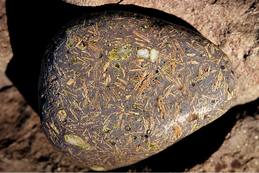
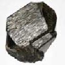
Porphyritic basalt cobble, High Rock Bay
Nice samples of porphyritic basalt can be found in the cobbles along the beach. The specimen to the left shows a dense pattern of feldspar phenocrysts and a few amygdules with epidote and quartz. The primary feldspars are plagioclase but after the lavas solidified, many pulses of hydrothermal activity brought about alterations to the feldspar and the basalt. Hydrothermal solutions with their alterations to existing minerals and their deposition of successive new minerals provide a very interesting study for the collector.
The two sections below show altered feldspar phenocrysts and, on the right, the brecciation of the amygdule wall including the chlorite rim and the adjoining feldspar phenocryst.

Feldspar phenocryst cluster in porphyritic basalt (FOV 13.0 mm) from beach cobble, High Rock Bay

Altered feldspar phenocryst in porphyritic basalt (FOV 13.0 mm) from beach cobble, High Rock Bay
Analcime in basalt (5.0 X 4.5 cm) from Lake Shore Traps, Keweenaw Point.
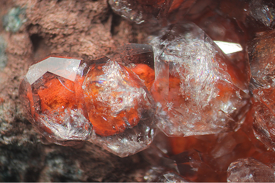
Phantom Analcime (FOV 5.2 mm) Lake Shore Traps, Keweenaw Point
Analcime crystals (FOV 13.0 mm) from Lake Shore Traps, Keweenaw Point.

Analcime in amygdule (FOV 9.0 mm) from Lake Shore Traps, Keweenaw Point.
Calcite with iron stained chlorite (FOV 4.5 mm) Lake Shore Traps, Keweenaw Point

A water clear calcite crystal (FOV 4.0 mm) from beach cobbles, Keweenaw Point.
The crystal is visible through a small hole in the top of a vesicle in he basalt.
The crystal is visible through a small hole in the top of a vesicle in he basalt.

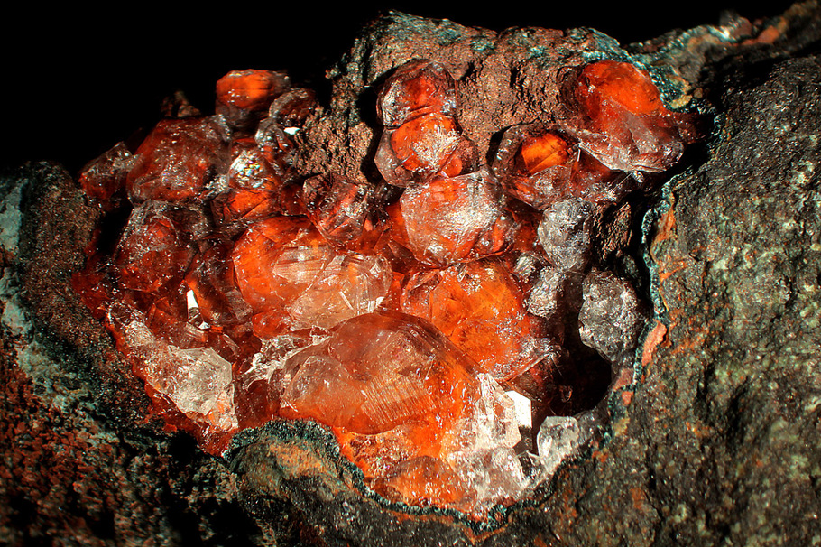
Analcime with chlorite rim (2.0 cm) from beach cobbles, Keweenaw Point

Analcime (2.0 cm) from beach cobbles, Keweenaw Point
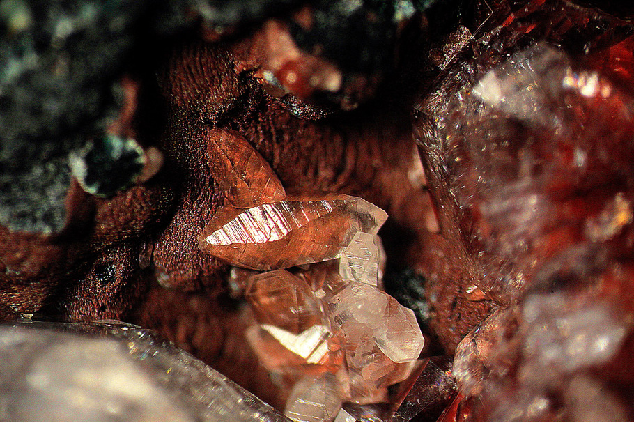
Calcite on natrolite (FOV 5.0 mm) from beach cobbles, Keweenaw Point
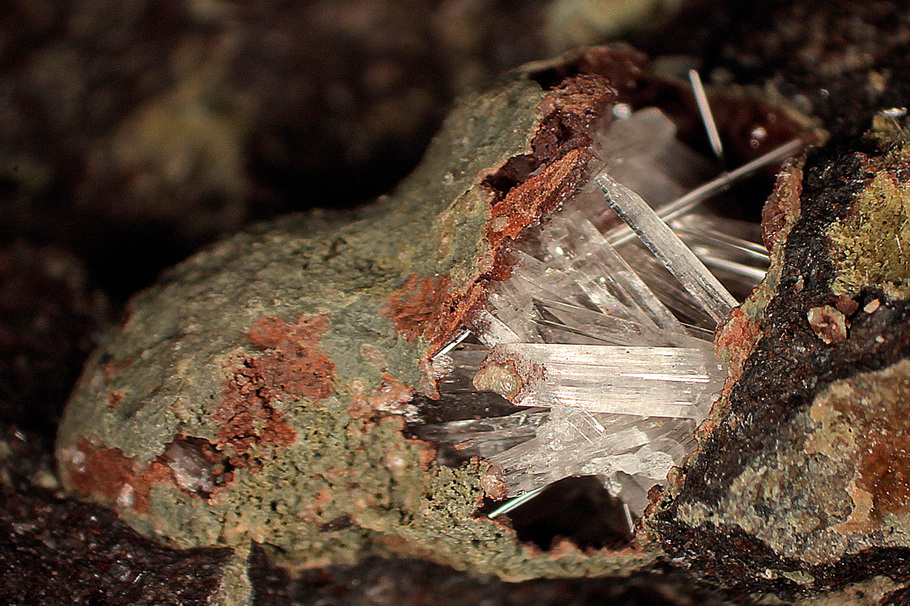
Natrolite (FOV 12.0 mm) from beach cobbles, Keweenaw Point

Natrolite (FOV 8.0 mm) from beach cobbles, Keweenaw Point

Natrolite (FOV 6.0 mm) from beach cobbles, Keweenaw Point

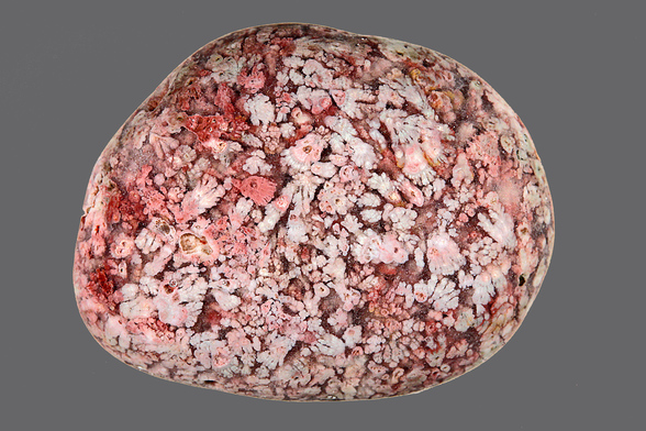
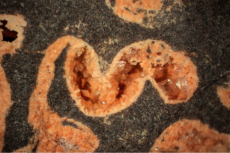
Amygdaloidal Basalt (6.5 x 4.0 cm) found near the Keweenaw Point Road about three miles from the end of the pavement.
It is also interesting because of its mineralogy. The vesicles appear to contain a variety of micro minerals. The open space in the vesicles is filled with calcite which protects the fragile crystals during blasting and the rough treatment that poor rock piles have experienced over the years. The photos below show the crystals after leaching with acid.
Figures 1 and 2 below show an unusual shape for a vesicle. It is apparent that as the tongue of lava flowed out over the landscape, some folding took place. This is sometimes visible in motion pictures of flowing lava. The folds appeared to have distorted the normal oval shape of the vesicle and sheared it into two miss matched haves.
(Figure 1) Distorted amygdule in basalt (FOV 9.0 mm)

(Figure 2) Distorted amygdule detail (FOV 9.0 mm) showing a shear plane and the opposing forces that resulted in the unusual shape.

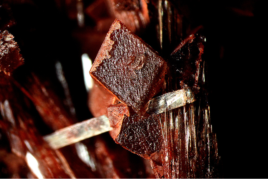
Microcline (FOV 7.0 mm)

Pumpellyite with epidote and quartz (FOV 5.0 mm)

Quartz with microcline (FOV 3.6 mm)

Quartz with microcline (FOV 4.1 mm)
Article has been viewed at least 21023 times.