 | | Book |
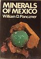
| anc MINERALS OF MEXICO 7 | : = Pras #0 AaprTTARE ; | MINERALS OF MEXICO William D. Panczner...1938Minerals of Mexico. Bibliography: p. 1. Mineralogy— Collectors and collecting— Mexico. 2. Mines and...and mineral resources— Mexico. I. Title. QE377.M6P36 1987 549.972 86-13325 ISBN 0-442-27285-5 This book...Boletin nuimeros 40 and 41 (Instituto Geoldgico de México, 1922, 1923), has an author been able...It is the hope and wish of the Sociedad Mexicana de Mineralogia, which promotes the study of Mexican |
| | Book |
| "'<' ~/ BOUNDARIES U A Mo<'« u~ o V :¾ MEXICO r - ·•-.. ·-··-··-··-·· < •• ....... V S TATES...org/details/mineralsofmexico0000panc MINERALS OF MEXICO • ERALS OF ~XICO M ______ William D. Panczner...1938Minerals of Mexico. Bibliography: p. 1. Mineralogy-Collectors and collecting-Mexico. 2. Mines and mineral...mineral resources-Mexico. I. Title. QE377.M6P36 1987 549.972 86-13325 ISBN 0-442-27285-5 This boo i...i.. is deJicated tu the people of Mexico and to the three people who directly affected me and this project |
 | | Report (volume) |
| Area Estado de Queretaro Mexico By KENNETH SEGERSTROM GEOLOGIC INVESTIGATIONS IN MEXICO GEOLOGICAL...with the Instituto Nacional para la Investigation de Recursos Minerales, under the auspices of the International...along the canyon of the Rio Ext6rax___-_ 22. Pena de Bernal_______________________________________ 23...INVESTIGATIONS IN MEXICO GEOLOGY OF THE BERNAL-JALPAN AREA, ESTADO DE QUERETARO, MEXICO By KENNETH SEGERSTROM...and Jalpan. The chief mining districts are Final de Amoles and Rio Blanco, which lie along a poorly defined |
 | | Report (issue) |
| SURVEY PRELIMINARY DEPOSIT-TYPE MAP OF NORTHWESTERN MEXICO By Kenneth R. Leonard U.S. Geological Survey...Figure 4. of Mineral Deposits in Northwestern Mexico Los Gavilanes Tungsten District El Antimonio District... Preliminary Deposit-Type Map of Northwestern Mexico Kenneth R. Leonard Introduction The following...California and the northern part of Chihuahua, Mexico. The area is important for the evaluation or mineral...prospects, and mineral occurrences in northwest Mexico. A record may refer to one deposit or to a group |
 | | Journal (issue) |
| O B Los Angeles Add postage and insurance Add Sales Tax ,n Cahlorma 4959 YORK BLVD. LOS ANGELES, CALIFORNIA...Jeanne Mager. Second Vice-President 13245 Rhoda Dr.. Los Altos Hills. CA 94022 Mrs. Keesa Stewart. Secretary...Andalusite Autunlte Orplment Wlllemlte Halite Azurite Skutterudlte Collophane Ilmenite Enarglte Dlatomite...AREAS CANADA The field trip to the Oka Colombium mine, as reported last month, had to b~ cancelled. The...3.110.579 & 3, 201.902. CANADA 705.675 (1965), MEXICO 74.399 (1963). BELGIUM 664.912 (1965) GEMS & MINERALS |
 | | Report (volume) |
| SERIALS EXAMINED Academia de ciencias medicas, fisicas y naturales de la Habana [Cuba], Anales vol...no. 1. Waltham, Mass. Ciencia vol. 6, nos. 7-12. Mexico, D. F. Civil Engineering vols. 16, 17. Easton,...Tallahassee, Fla. Gems and Gemology vol. 5, nos. 3-11. Los Angeles, Calif. Geographical Journal vols. 106, nos....Hidraulica en Mexico vol. 1, no.'l. (Name changed from Irrigacion en Mexico, Jan. 1947, which see) Mexico, D. P...Irrigacion en Mexico vols. 26 nos. 1, 3, 4; 27, nos. 1-4. (Name changed to Ingenieria Hidraulica en Mexico, Jan |
 | | Report (issue) |
| Jamaica__________________________________________________ Mexico--------------------------------------------------Aguascalientes...-------------------------------------------Estado de Mexico ---------------------------------Guanajuato__...55 55 Numerical listing of deposits-Continued Mexico-Continued San Luis Potos1 ------------------------------------...------------------------------------------ 58 Zacatecas ------------------------------------------- 58...Jersey----------------------------------------- 83 New Mexico ---------------------------------------- 83 New |
 | | Report (issue) |
| Jamaica_______________________________ JMJM ________ _ 26 Mexico--------------------------------------------------...Durango------------------------- MXDR _______ _ 32 Estado de Mexico _______________ MXEM _______ _ 34 Guanajuato_...deposits-Continued Mexico-Continued Vera Cruz ----------------------- MXVR ________ B42 Zacatecas------------------------...Jersey---------------------- USNJ _________ 61 New Mexico --------------------- USNM ________ 61 -New Yo...by subdivisions of the larger countries (Canada, Mexico, and the United States). Map numbers, major and |
 | | Report (issue) |
| Atlantic continental margin _____________ _ Gulf of Mexico and Caribbean Sea _______ _ Pacific continental...06 ppm), and chlorine ( 0.04 percent). Gold Acres mine, Nevada.-T. J. Armbrustmacher found anomalously...several metals in rocks from the Gold Acres open-pit mine, Lander County, north-central Nevada. Titanium,...inclusions, and local variations of elements within the mine, suggest the imprint of at least two sequences of...below the top of the ore zone at the Carlin gold mine, Eureka County, Nev., by T. E. Mullens and J. F |
 | | Journal (volume) |
| moantaiua. Its oatobment basin embraced about five de> greea of latitnde and three of loneitode, ooDtainlng...South is develsylvania. The General Custer is a gold mine developed oping in an industrial way very rapidly...extent or value. The district was formed in 1886 and de varieabout 20 miles, and is compoged of many ties...to the noted mine operators and Drew, who capitalists, Messrs. Osborne and opened the mine, proved its...1S86, on account of the burning of the mil), the mine was in bonaDz |
 | | Journal (volume) |
| — [Jan. I, 18J0 of Roseburg, has opened a coal mine, located fourteen miles west of this place, that...four feec or more in thickness. Not far from this mine is a spring haVing indi' cations of petroleum. The...great mesa and foothills of the *' Cordilleras de los Andes;" but the eyes do not rest here, for yon... The shaft of this Oct. 7, 1887. at $3 60 each. mine is down about 300 feet. The first 150 feet the country...made out of the above mine, I saw, myself, of which he is the sole owner. at this mine a block of native |
 | | Report (issue) |
| DAVENPORT HILL DAVIS DAM DAVIS DAM SE DAY SPRING DE MOTTE PARK DEAD MONKEY RIDGE DEADMANGAP DEAN PEAK...MILKWEED CANYON SW MILKY RANCH MILLER PEAK MILLER TANK MINE MOUNTAIN MINERAL MTN MINNEHAHA MITCHELLPEAK MITTEN...MOBILE NW MOCCASIN MOENAVE MOENAVESE MOENKOPI MOHAVE MINE MOHAVE PEAK MOHAVE SPRINGS MOHAWK MOHAWK MTS NE...LOW SOUTH SIERRA ARIDA SIERRA BONITA RANCH SIERRA DE LA LECHUGILLA (SIERRA LECHUGUILLA) SIGNAL SIGNAL...EAST SNAP CANYON WEST SNAP DRAW SNOWFLAKE SOCORRO MINE SOCORRO PEAK SOMBRERO PEAK SOMERTON SONOITA SONSELA |
 | | Report (issue) |
| region stretching from southern Canada to northern Mexico and from the foothills of the Rocky Mountains in...similar lithology from the Loveland type area into de- 18 DREESZEN posits of the glaciated area of...southernmost of the High Plains, in eastern New Mexico and western Texas. This event, named the Lubbock...feet at the northwest corner, near Tucumcari, New Mexico, to around 2700 feet along the southeastern edge...temperature is 10°F cooler than at Clovis, New Mexico. A depression of summer temperatures of at least |


