 | | Journal (article/letter/editorial) |
| WosUd AtewA o*i Mineral Qcculienceò, Items on new finds are desired. Please send them in. Abbreviations:...occurs in the Ashland schist as a belt extending through Clay, Coosa and Chilton Counties. The maximum...maximum width of the Ashland schist is about 4 miles extending N.E. to S.W. and the graphite occurs in lenses...lenses which are usually some distance apart. The schist is composed of quartz, muscovite or sericite, pyrite...One of the major operations was near Good Water, Coosa Co., Ala. ARIZONA — At Miami, Gila Co., Ariz. |
 | | Report (issue) |
| Manuscript dated January 1994 Published under the authority of the Minister for Mines 1995 \\,,\\\,1'\\"III"III...N. CRAMSIE, DIRECTOR GEOLOGICAL SURVEY OF NEW SOUTH WALES Cover photo: Photomicrograph of quartz-fibre...No 4 level stope in eastern lode, Mount Boppy gold mine. Quartz-filled net-vein fractures and brecciated...Collection negative 0108) Bottom Right: Mount Pleasant gold mine, Cobar (Cobar Collection negative 0083) Bibliographic...Survey of New South Wales, Sydney. Edited by: J.R. Stewart ISSN 0727 9418 © New South Wales Department |
 | Theodore, T.G., Murchey, B.L., Hanger, R.A., Strong, E.E., Ashinhurst, R.T. (1994) To accompany the preliminary geologic map of the Snow Gulch Quadrangle, Humboldt and Lander counties, Nevada. Open-File Report Vol. 1994 (94-436) US Geological Survey doi:10.3133/ofr94436 | Report (issue) |
| DEPARTMENT OF THE INTERIOR U.S. GEOLOGICAL SURVEY To accompany the Preliminary Geologic Map of the Snow Gulch...Ted G. Theodore1 with a section on Radiolarians in the Ordovician Valmy Formation and Devonian Scott Canyon...section on Helicoprion sp. from the Pennsylvanian and Permian Antler Peak Limestone, Lander County, Nevada...S. Geological Survey editorial standards or with the North American Stratigraphic Code. Any use of trade...purposes only and does not imply endorsement by the U.S. Government. llVfenlo Park, CA 94025 ^Department |
 | | Report (issue) |
| 1879. QUEENSLAND. REPORT ON THE -GEOLOGY AND MINERAL RESOUltCES OF THE DISTRICT BETWEEN CHARTERS TOWERS...TOWERS GOLDFIELDS AND THE COAST. BY ROBERT L. J·AcK, F.G.S., F.R.<3-.S., GEOLOGICAL SURVEYOR, NORTHERN...STUEE1', . 1879. RIWORT ON THE GEOLOGY AND MINERAL RESOURCES OF THE DISTRICT BgTWEEN CHARTERS .TOW...l';Rs GOLDFIELI> AND THE COAST. Townsville, 14th May, 18'78. * Sr:a, . I have the honour to forward...Report on the Geology And Mineral resources of the District·between Charters Towers Goldfield and the 0011 |
 | | Journal (article/letter/editorial) |
| descriptive of the Gold Belt, concluding with a generalized section of the formations of the Gold Belt, four...four pages of text descriptive of the Jackson area, signed by H. W. Turner, geologist, and G. F. Becker...charge; a topographic map of the Jackson tract (scale I: 125000), a sheet showing the areal geology, and a third...structure sections. The area covered by the folio embraces a portion of the foothills of the Sierra Nevada... chiefly in the counties of Amador and Calaveras, California. The area is drained by the Mokelumne and |
 | | Book |
| 1968 Second edition 1973 Wholly set up in Australia by the editors. Cover design by Stuart Crluth, Education...collated and bound in Australia by Hollyoak Manufacturing Company, Melbourne, for the School of Geology...dealing for the purpose of private study, research criticism, or review, as perrnitted under the Copyright...may be reproduced in any manner whatsoever without the written perrnission of theeditors. This book is...Registered in Australia for transrnission by post as a book. ISBN 0 9599061 O X Available from the School |
 | | Report (volume) |
| DEPARTMENT OF THE INTERIOR UNITED STATES GEOLOGICAL SURVEY GEORGE OTIS SMITH, DIRECTOR GUIDEBOOK OF THE WESTERN...WESTERN UNITED STATES PART D. THE SHASTA ROUTE AND ' COAST LINE BY J. S. D1LLER AND OTHERS WASHINGTON...especially those related to the nautilus (cephalopods). Rise and culmination of the marine animals sometimes...mollusk-like brachiopods, abundant. Culmination of the bugliko marine crustaceans known as trilobites. First...rocks. No fossils found. 17 to 25. * 50+. a The geologic record consists mainly of sedimentary beds |
 | | Report (issue) |
| Slate Creek is the best known of a number of productive goldbearing placer streams on the headwaters of...River, on the south side of the Alaska Range, in the upper Copper River basin. The other gold-bearing streams...GEOLOGY. CARBONIFEROUS ROCKS. . r The oldest rocks of the region are the Chisna and Mankomen formations...described, the Chisna formation, the older, consists of tuffs, quartzites, and conglomerates; the Mankomen...CONGLOMERATE. '.^ X \ r Unconformably overlying the Mankomen rocks is a conglomerate composed essentially |
 | | Report (volume) |
| Placer Gold Deposits of Utah___________ IIT 9 r 3 GEOLOGICAL SURVEY BULLETIN 1357 Placer Gold...with lists of annotated references pertaining to the placer districts UNITED STATES GOVERNMENT PRINTING...WASHINGTON : 1973 UNITED STATES DEPARTMENT OF THE INTERIOR ROGERS C. B. MORTON, Secretary GEOLOGICAL...Congress catalog-card No. 72-600159 For sale by the Superintendent of Documents, U.S. Government Printing...5. House Range placers (Sawtooth district, Notch Peak placers)......... 1 1 1 3 4 4 5 6 6 7 9 9 Salt |
 | | Journal (issue) |
| 5 The Mineral Collector's Newsletter $6.00 May 2019 A New Occurrence of Allophane From the Laochang...Laochang Mine, Gejiu City, Yunnan, China Tony Nikischer Excalibur Mineral Corporation A recent acquisition...acquisition of exceptional allophane specimens from the Laochang Mine (see figure I) came as a complete surprise..."gibbsite", and selected only the most colorful specimens for hand-carrying back to the U.S. Knowing there has...has been much controversy regarding the presence of gibbsite {Al(OH)3) and/or evansite (Al3(PO4)(OH)6 • |
 | | Report (volume) |
| UNITED STATES DEPARTMENT OF THE INTERIOR J. A. Krug, Secretary GEOLOGICAL SURVEY W. E. W rather, Director...Director Bulletin 956 GEOLOGY AND ORE DEPOSITS OF THE LIBBY QUADRANGLE, MONTANA BY RUSSELL GIBSON WITH...____-___-_-_-._-.-__--___----..---__-.-.___._ 2 Purpose of the investigation....___-_.___.______--_____-_-___._...Lithology _____ _--_-_-_-_-__--__---__--_-_--_-. Striped Peak formation___________________________ Distribution..._---______l_^_-_ 35 .... Autometamorphic alteration in the stocks. ^__- :_^-__._ 35 Relation of Dry Creek stock |
 | | Report (issue) |
| MINING DEVELOPMENTS IN THE MATANUSKA COAL FIELD. By THEODORE CHAPIN. INTRODUCTION. The following report is...times during the summer and fall of 1918 and includes developments up to the end of 1918. The Matanuska...coal fields are in the valley of Matanuska Eiver, a tributary of Cook Inlet from the Talkeetna and Chugach...This region has a special interest on account of the control and operation of two coal mines at Eska and...developed by the Department of the Interior through the Alaskan Engineering Commission. The coal mines |
 | | Report (volume) |
| Deposits of the Eagle Mountains Trans-Pecos Texas GEOLOGICAL SURVEY BULLETIN 987 A study of the geology...geology and fluorspar deposits of the Eagle Mountains Hudspeth County, Texas OHIO GEOLOGICAL SURVEY -j UNITED...WASHINGTON : 1953 5" UNITED STATES DEPARTMENT OF THE INTERIOR Douglas McKay, Secretary GEOLOGICAL SURVEY...SURVEY W. E. Wrather, Director For sale by the Superintendent of Documents, U. S. Government Printing...__--_____________-_ 4 Field work and purpose of the investigations._____________________ 6 Acknowledgments |
 | | Report (issue) |
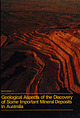
| MONOGRAPH 17 of Somepats oe ilar ce| + in Australia mail iii DOOO38J0754 oA., eet OF ROME prhge...ASPECTS OF THE DISCOVERY OF SOME IMPORTANT MINERAL DEPOSITS IN AUSTRALIA Cover Picture—The Argyle Diamond...Diamond mine Photo by courtesy of Ashton Mines Limited GEOLOGICAL ASPECTS OF THE DISCOVERY OF SOME IMPORTANT...IMPORTANT MINERAL DEPOSITS IN AUSTRALIA Editors K. R. GLASSON J. H. RATTIGAN INCORPORATED BY ROYAL...ROYAL CHARTER 1955 Monograph Series No. 17 THE Published by AUSTRALASIAN INSTITUTE OF MINING AND METALLURGY |
 | | Journal (issue) |
| Texas Bill Birch Museum of Victoria Melbourne, Australia Michael P. Cooper Nottingham, England Anthony...circulation manager for rates.) •Individuals (outside the U.S.): $51 for one year, $98 for two years. (Airmail...Jr., R. Peter Richards & D. G. Howard The Pezinok antimony mine, Male Karpaty Mountains, Slovakia.......by P. Uher, S. Michal & J. Vitdlos The minerals of Alum Cave Bluff, Great Smoky Mountains, T ennessee... Columns Abstracts of the 21st annual FM-TGMS-MSA Mineralogical Symposium: The Minerals of B ra zil. |
 | | Journal (volume) |
| THE MINING MAGAZINE : DEVOTED TO Mines, Mining Operations, Metallurgy, &c., dc. EDITED AND OONDUOTED... VOLUME THREE. FROM JULY TO DECEMBER , 1854. New York : PUBLISHED AT 98 BROADWAY . John F. Trow...ns er ,.. PAGE Boston Mining Fluctuatio Adventure Mine 66 , for Octob 550 “ November, Alabama, Mineral...Wealth of ................ 96 Bowden Copper Mine .. Algomah Mine.... with Cumberla 73 Brick Burning 66 66...Coal....... 66 552 Algomah Mine, Alkali Trade. Connec Bristol Coppe Mine, 351 ticut.......... r Altitudes |
 | | Report (volume) |
| 225 Series A, Economic Geology, 33 DEPARTMENT OF THE INTERIOR UNITED STATES GEOLOGICAL SURVEY CHARLES...NONMETALLIFEROUS ECONOMIC MINERALS, BY 0. W. HAYES.. GOLD AND SILVER ........................................-'.................. Alaska: 18 25 28 The Juneau gold belt, by Arthur C. Spencer .....................'.. The Porcupine placer mining district, by Charles M. 'Wright........ Gold placers of the Fairbanks...district, by L. M. Prindle ............ The Kotzebue placer gold field of Seward Peninsula, by Fred H. |
 | | Report (volume) |
| Parts of tHe Southern PelonclHo Mountains, Arizona and New Mexico Volcanic Geology in Parts of the Southern...Arizona and New Mexico By D. H. MciNTYRE U.S. GEOLOGICAL SURVEY BULLETIN 1671 DEPARTMENT OF THE INTERIOR...STATES GOVERNMENT PRINTING OFFICE: 1988 For sale by the Books and Open-File Reports Section U.S. Geological...Geological Survey Federal Center, Box 25425 Denver, CO 80225 Any use of trade names is for descriptive purposes...purposes only and does not imply endorsement by the U.S. Geological Survey. Library of Congress Cataloging-in-Publication |
 | | Report (issue) |
| FUELS. ILSEMANNITE AT OURAY, UTAH. By FRANK L. HESS. THE DEPOSIT AT OURAY. LOCATION AND GEOLOGIC CONDITIONS...published by the United States Geological Survey in 1920,1 but no chemical or other study of the material...has since been made by the Geological Survey, and further publication on the deposit therefore seems...Ouray is a small settlement and trading post on the north side of Duchesne River at its junction with...miles to the southeast, the station at the end of a narrow-gage railroad connecting with the Denver & |
 | | Journal (article/letter/editorial) |
| ennessee covers an area of 41,220 square miles in the southeastern United States. It a 500-mile-long state...and bounded on the west by the Mississippi River and on the east by high ridges of the Appalachian Mountains...from the Mississippi River the collector encounters relatively undeformed Cenozoic sediments of the Mississippi...Gulf Coastal Plain in the western part of the state. Just prior to crossing the Tennessee River and continuing...continuing through the middle of the state are weakly deformed Paleozoic sediments of the Highland Rim, Central |
 | | Journal (issue) |
| Representative(s) will speak about the geologic considerations of building the Southern Delivery System Refreshments...Refreshments provided by the Micromount Group Inside this Issue: CSMS Calendar Pg 2 CSMS Undergraduate...Only—Lapidary Group, Sharon Holte, 719 217-5683 The Senior Center is located at 1514 North Hancock in...Colorado Springs. For more information on any of the sub-groups, meetings, and other CSMS valuable information...Friday, Feb. 19 is the Denver Metro Regional Science & Engineering Fair, to be held on the Auraria Campus |
 | | Report (issue) |
| Geology of the Buckingham Stockwork Molybdenum Deposit and Surrounding Area, Lander County, Nevada U...up background. View northwestward. Geology of the Buckingham Stockwork Molybdenum Deposit and Surrounding...40Ar/ 39Ar GEOCHRONOLOGY OF SELECTED PLUTONS IN THE BUCKINGHAM AREA By EDWIN H. McKEE and a section...M. HAMMARSTROM GEOCHEMISTRY OF THE PORPHYRY COPPER ENVIRONMENT IN THE BATTLE MOUNTAIN MINING DISTRICT... GEOLOGICAL SURVEY PROFESSIONAL PAPER 798-D The Buckingham stockwork molybdenum deposit, a Late Cretaceous |
 | | Journal (article/letter/editorial) |
| locations, iind interesting mineral occurrences in the state of Wyoming. Five publications were used extensively...compiling it: For general information on some of the localities, readers may wish to consult Hausel (...01 June 2016 Figure 2. Postcard view of the Tenderfoot mine (about 19131, Esterbrook copper district...and inexpensive map for finding the localities can be obtained from the Deiorme Company, which sells a...of 1 inch equals 4 miles) of the entire state of Wyoming in book form. The Wwming Atlas and Gazetteer can |
 | | Report (volume) |
| on behalf of the U. S. Atomic Energy Commission and is published with the permission of the Commission...E. SOISTER and DORA R. CONKLIN CONTRIBUTIONS TO THE GEOLOGY OF URANIUM GEOLOGICAL SURVEY BULLETIN...on behalf of the U. S. Atomic Energy Commission and is published with the permission of the Commission...WASHINGTON : 1959 UNITED STATES DEPARTMENT OF THE INTERIOR FRED A. SEATON, Secretary GEOLOGICAL SURVEY...SURVEY THOMAS B. NOLAN, Director For sale by the Superintendent of Documents, U. S. Government Printing |
 | | Report (issue) |
| DEPARTMENT OF THE INTERIOR t5-NIT~D STATES GEOLOGICAL SURVEY GEORGE OTIS SMITH, DIRECTOR OF THE SIERRA... WALDEMAR - LINDGREN OFFICE j DEPARTMENT OF THE INTERIOR UNITED STATES GEOLOGICAL SURVEY GEORGE...PROFESSIONAL PAPER 73 rrHE .TERTIAR Y GRAVELS OF .THE SIE~ RRA NEVADA OF CALIJTORNIA BY WALDEMAR LINDGREN...::~.:: ·coNTENTS. Page. I. General features of the province ........... .. .. ____ . ______ .. _. ____________...: ... ·.. . Outline of later geologic history of the Sierra Nevada ..... ___ __ _____ __ ________ ~ ___ |


