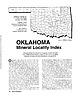
 | | Journal (article/letter/editorial) | | Houston, Texas 77036 ROBERT 0. FAY Oklahoma Geological Survey Norman, Oklahoma 73019 Downloaded by [The Aga...713 15th Street NW Ardmore, Oklahoma 73401 OKLAHOMA Figure 1. Oklahoma counties. Mineral Locality...known for its gypsum crystals and barite roses, Oklahoma also boasts a variety of other species, including...unaware of the variety of minerals available from Oklahoma and think primarily of the prolific gypsum crystals...hundred years, extends into the northeast corner of Oklahoma and has produced notable specimens. Unfortunately |  | | Book | | ROCKHOUND'S GUIDE TO THE GEMS & MINERALS OF OKLAHOMA © E.L.GILMORE 1992 No part of this book may...rockhounds to know where to look for minerals in Oklahoma. who would like This data has been drawn from...from many sources: The publications of the Oklahoma Geological Survey; Scientific publications; the observations...from the author’s own experience in rockhounding Oklahoma for the past 30 years. Some parts of this book...desire of the author to list all minerals found in Oklahoma. The work on this book has covered a period of |  | | Book (volume) | | ASHTABULA COUNTY CONNEAUT, area pits, quarries, rd. cuts, etc.⎯cone-in-cone Calcite. CLERMONT COUNTY MILFORD...CLINTON COUNTY WILMINGTON, area of Todd’s Ford, a mineral deposit⎯Hematite. COSHOCTON COUNTY AREA, townships...CUYAHOGA COUNTY CHAGRIN FALLS (on Geauga Co. line), area quarries⎯oilstone. DELAWARE COUNTY DELAWARE...nodules⎯Pyrite (crystals sharply cubic). FRANKLIN COUNTY COLUMBUS, area countywide exposures of blue clay...HIGHLAND COUNTY SINKING SPRING, area ore deposit (most important in Ohio) ⎯Hematite. HOCKING COUNTY AREA |  | | Book (volume) | | ASHTABULA COUNTY CONNEAUT, area pits, quarries, rd. cuts, etc.⎯cone-in-cone Calcite. CLERMONT COUNTY MILFORD...CLINTON COUNTY WILMINGTON, area of Todd’s Ford, a mineral deposit⎯Hematite. COSHOCTON COUNTY AREA, townships...CUYAHOGA COUNTY CHAGRIN FALLS (on Geauga Co. line), area quarries⎯oilstone. DELAWARE COUNTY DELAWARE...nodules⎯Pyrite (crystals sharply cubic). FRANKLIN COUNTY COLUMBUS, area countywide exposures of blue clay...HIGHLAND COUNTY SINKING SPRING, area ore deposit (most important in Ohio) ⎯Hematite. HOCKING COUNTY AREA |  | | Book (volume) | | chalcedony, jasper and gem petrified wood. BUFFALO COUNTY KEARNEY, area gravel bars and pits along the Platte...townagate, chalcedony, jasper, petrified wood. CASS COUNTY WEEPING WATER, SE, on rd. to Nehawka, in the Snyderville...chalcedony, jasper, fossils. CHERRY COUNTY VALENTINE, in the Sandhills county along the Niobrara R. and Minnechaduza...gem qualityagatized and opalized wood. DAWES COUNTY CHADRON, in N part of Co. and as far W as Crawford... in breaks of the White R. reached by numerous ranch rds., choiceFairburn agates; all regional Federal |  | | Report (volume) | | district, Calhoun County: 2, 65, 102, 118. 2. r Beaver Creek Valley, St. Clair County and Greens Valley...Valley, Etowah County: 2, 102, 118. 3. r Leeds, Jefferson County: 2, 102. 4. r Longview-Saginaw district...district, Shelby County: 2, 102. 5. r Sinks district, Bibb County: 2, 28, 54, 67, 74, 102, 118, 143. 6. v Southeastern...Southeastern corner, Cherokee County: 1, 2, 54, 74, 102. 7. v Southern Cleburne County: 1, 2, 54, 74, 102. 8...Vincent-Harpersville-Wilsonville district, Shelby County: 2, 54, 102. ARIZONA General: 4, 8, 13, 43, 85 |  | | Book | | commercial ores and secondary minerals by state, county, township, and geologic range. For easy identification...cities, and many of today’s prosperous western county seats began as mining-boom camps. trating sand...Whether you such as those listed alphabetically by county, township, and range in Part II of this book. Where...etc. Iron ore precipitates: Ferrous carbonate (siderite), greensand, hematite, bog iron ore Phosphatic...will help you prospect and explore any state and county. etc., for mineral deposits in Finding Suitable |  | | Book | | Mexico New York North Carolina North Dakota Ohio Oklahoma Oregon Pennsylvania Rhode Island South Carolina...listed by county and community, range and distance. Whenever the collector crosses a county line, he will...of the county he is entering posted alongside the highway. By looking up the state and county, the user...guide can determine the collecting sites in that county by range and distance from the major cities and...information to reach a specific spot within a particular county. Many old localities listed here have, literally |  | | Report (volume) | | Bulletin 618 GEOLOGY AND UNDERGROUND WATER OF LUNA COUNTY, NEW MEXICO BY N. H. DARTON WASHINGTON GOVERNMENT... ILLUSTRATIONS. PLATE I. Geologic map of Luna County, N. Mex....................... In pocket. II. A...showing grade of underground water surface in Luna County, N.Mex...........................................well east of Deming, N. Mex.; B, Well on Young ranch southwest of Deming, N. Mex........................................ 130 XI. A, Ditch at Solignac ranch; B, Irrigation ditch 6 miles south of Deming, N |
|


